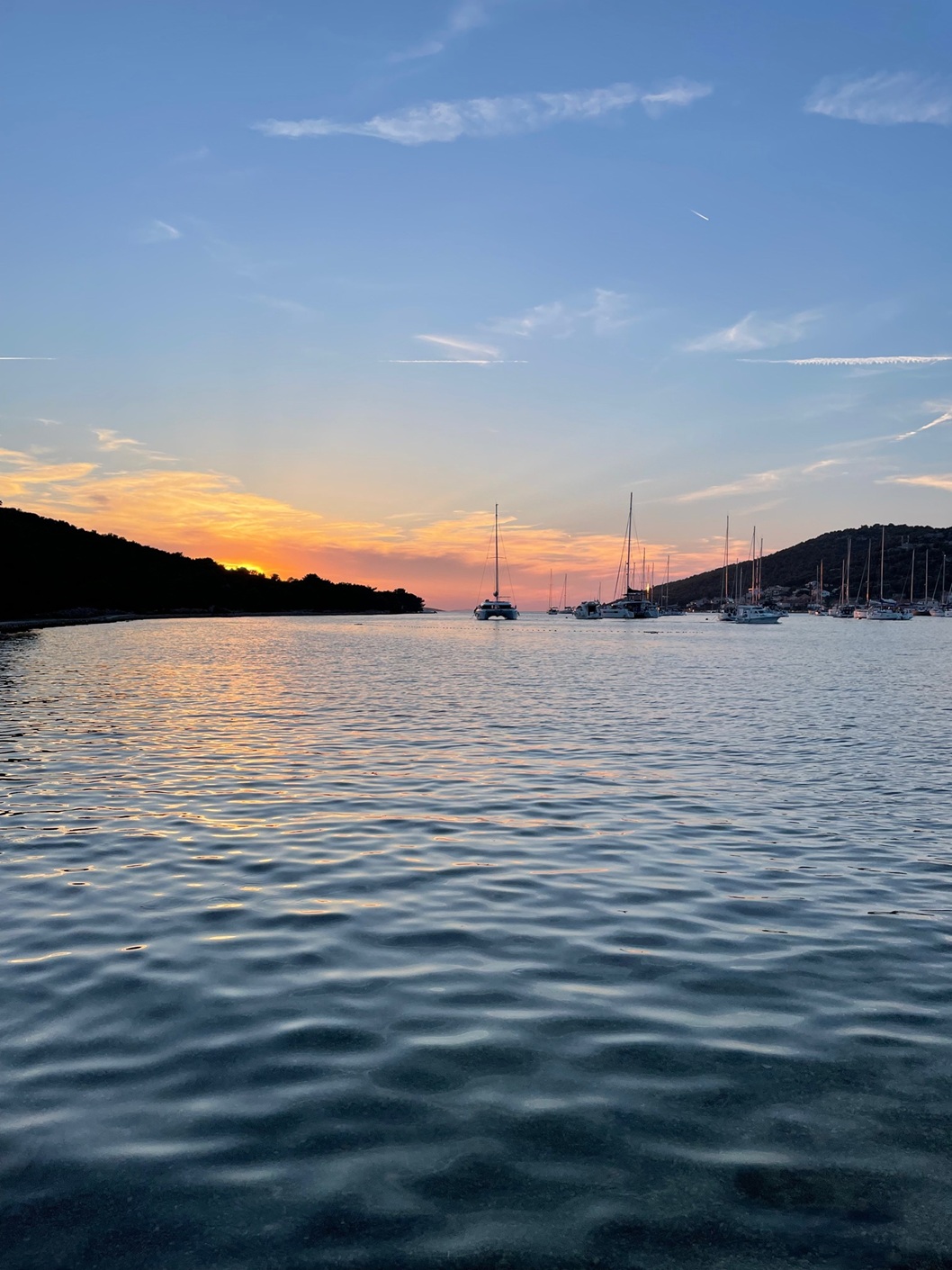
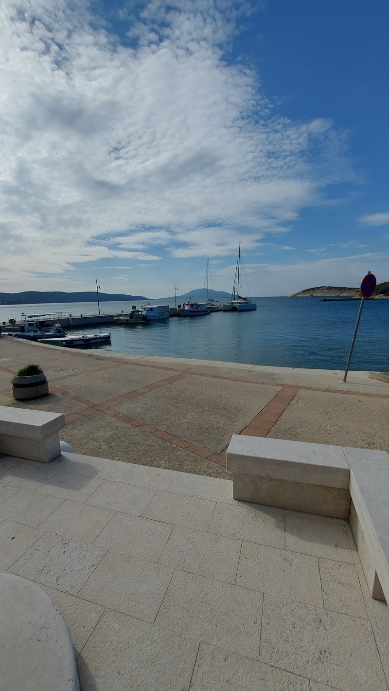
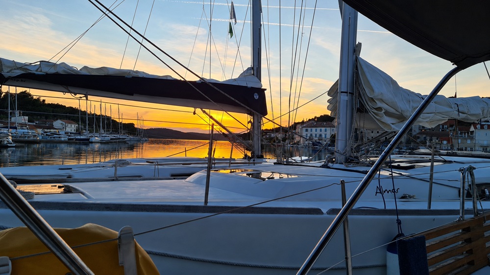
Harbours
Working harbours, town quays, improvised overnights and the occasional questionable docking decision. Less polished than marinas — often more interesting.
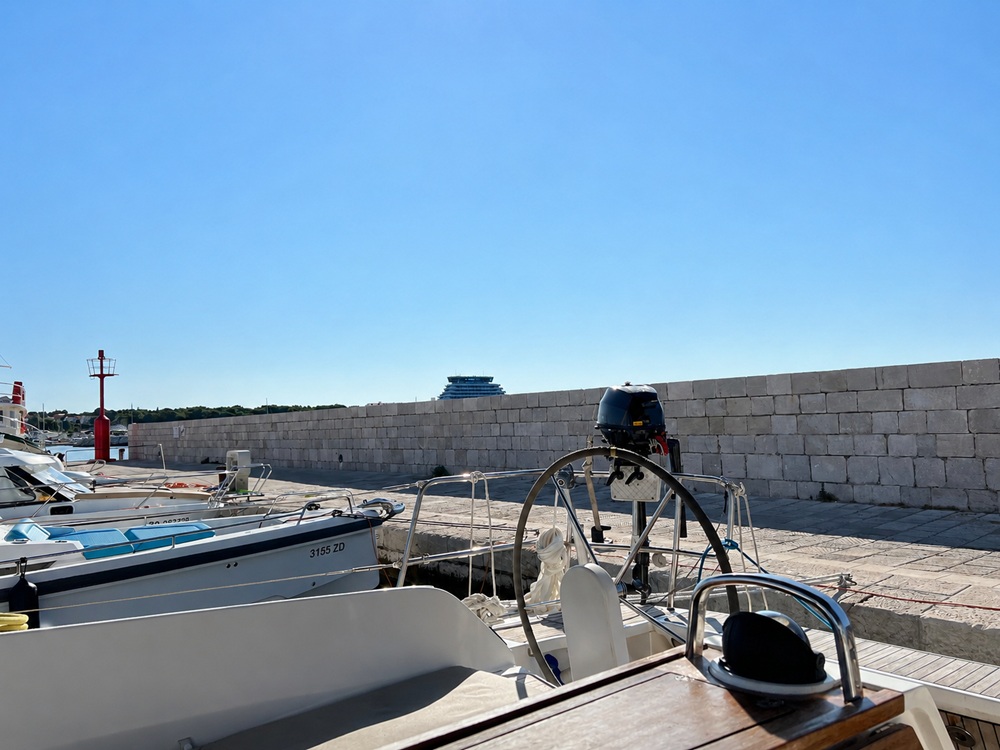
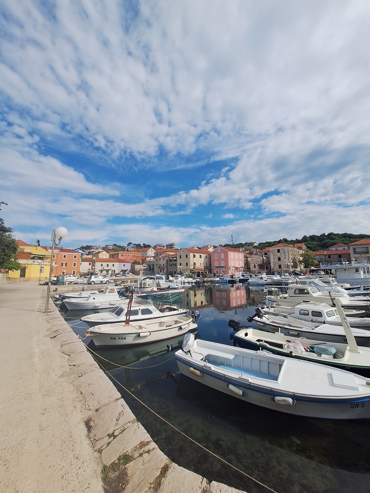
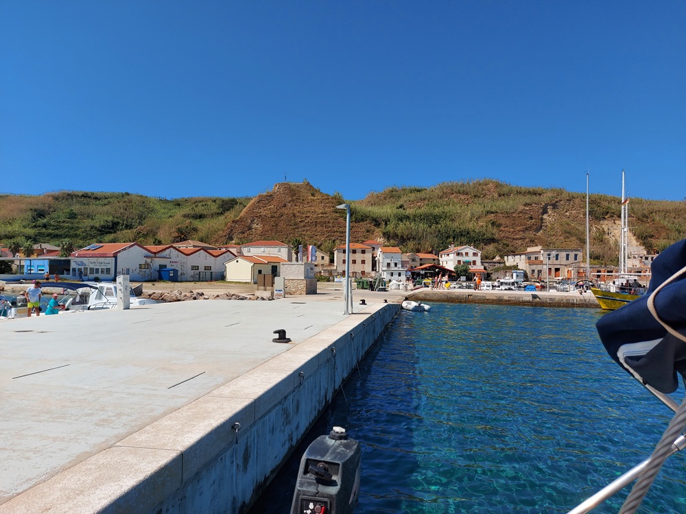
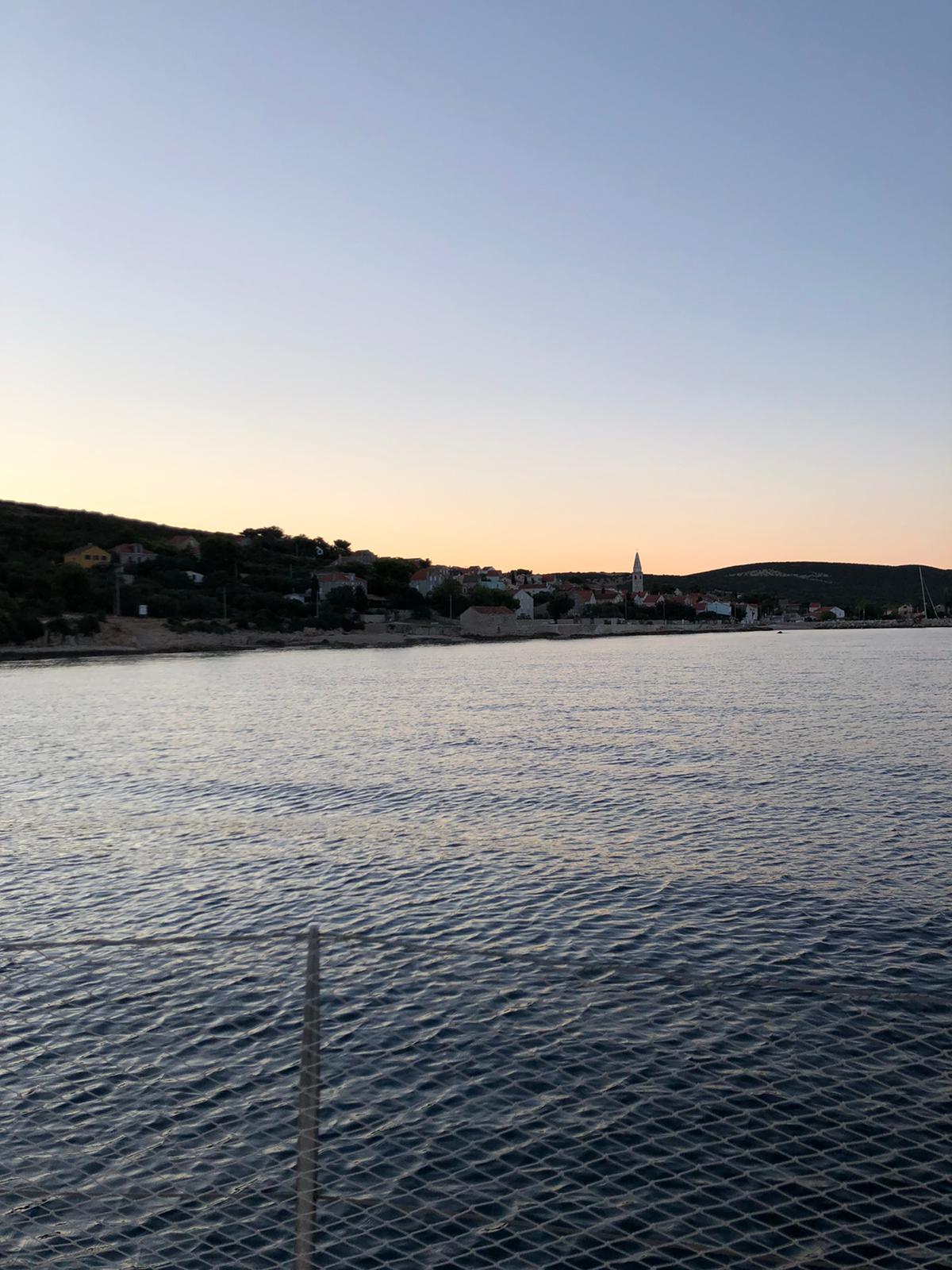
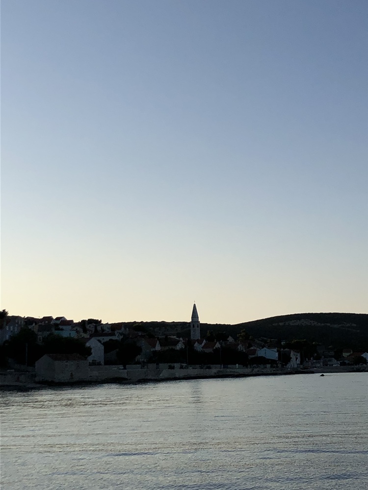
Izola

A pleasant town quay / outer pontoon stop just outside the marina area. We moored alongside at the head of the pier and spent a calm, comfortable night there. The inner, southern side of the pier is very well sheltered and feels noticeably more protected.
- Shelter: very good on the inner / southern side of the pier
- Berthing: alongside at the pier head; mooring berths available
- Depth / draft: no exact depth noted; suitable at our berth, but check locally
- Facilities: harbour / town infrastructure nearby; marina facilities close by
- Nice to know: charming fishing town with good restaurants within easy walking distance
- Watch out for: outside positions may be less sheltered; berth choice matters
Impressions
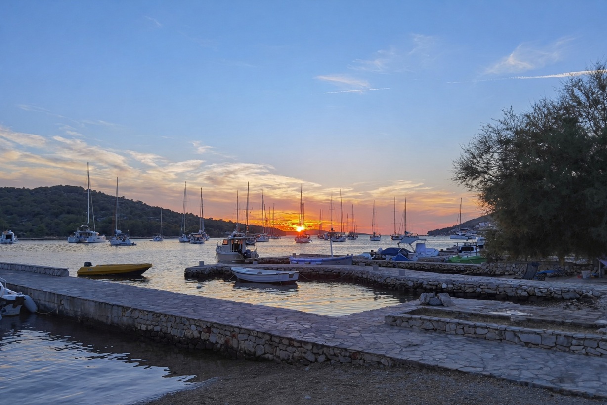
Kaprije
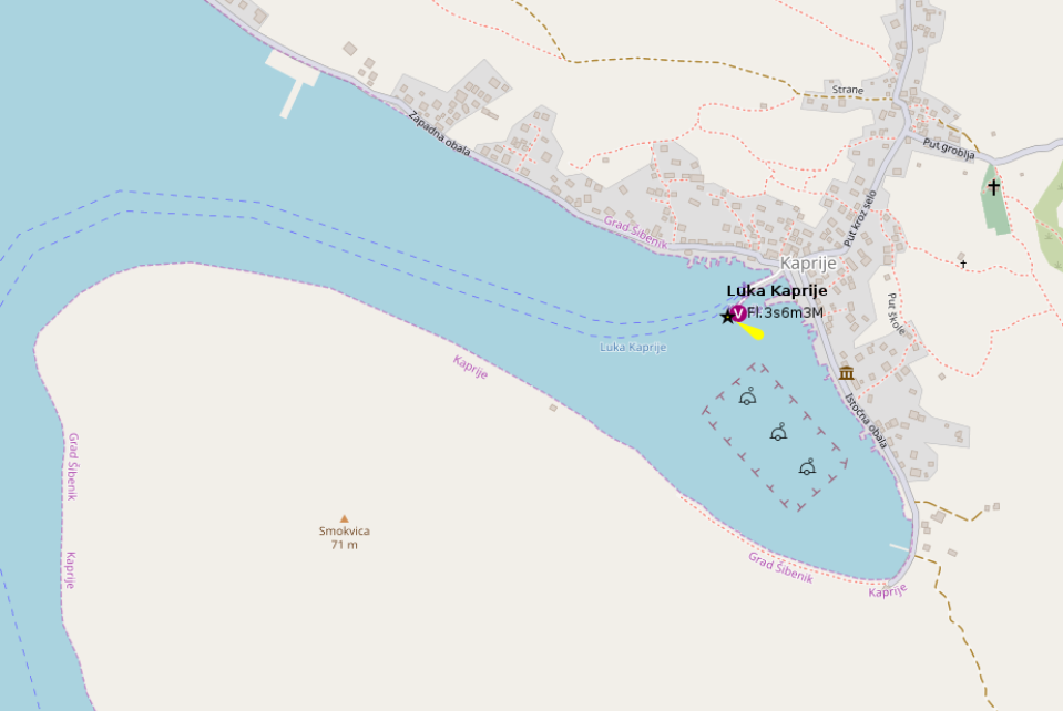
Kaprije became an unplanned stop for us after one of the crew got seasick — and for that purpose it worked very well. The bay is extremely well sheltered from almost all directions, especially behind the breakwater, where the berth feels safe and settled. It is not a glamorous marina stop, but a very useful, protected harbour with a quiet island atmosphere.
- Shelter: excellent inside the bay; best protection behind the breakwater
- Berthing: about 12 stern-to berths with mooring lines behind the breakwater; additional berths south of the ferry pier
- Depth / draft: generally suitable at the main harbour berths; private restaurant berths may be critical for sailing yachts
- Facilities: limited water available; only the south side of the ferry pier can be used
- Nice to know: quiet island harbour, useful as a safe and sheltered stop; buoy field available in the bay
- Watch out for: anchoring prohibited in the bay; 5 kn speed limit and occasional controls reported; strong gusts possible during bora and jugo
Impressions
Koper
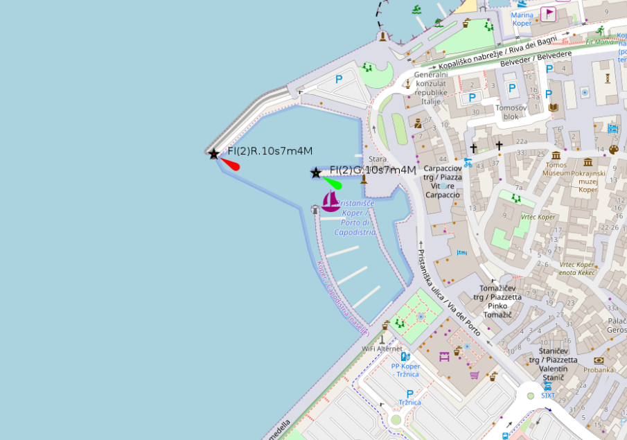
Koper is primarily an industrial and commercial port rather than a classic cruising stop. We only entered the historic harbour basin as part of training and approach practice, not as an overnight berth. The port infrastructure is impressive in its own right — cranes, quays, traffic, working-harbour atmosphere — but for visiting yachts the usable options inside the old basin are very limited.
- Shelter: sheltered inside the harbour basin, but not primarily intended for visiting yachts
- Berthing: mainly clearance berths and local boats in the historic basin; small marina nearby
- Depth / draft: harbour depths generally not the issue; availability and permission are the limiting factors
- Facilities: major commercial port infrastructure nearby; tiny marina close to the historic harbour area
- Nice to know: impressive working-port atmosphere and useful for harbour approach / training manoeuvres
- Watch out for: not a relaxed town-quay stop; expect commercial traffic, restrictions, and limited yacht berthing options
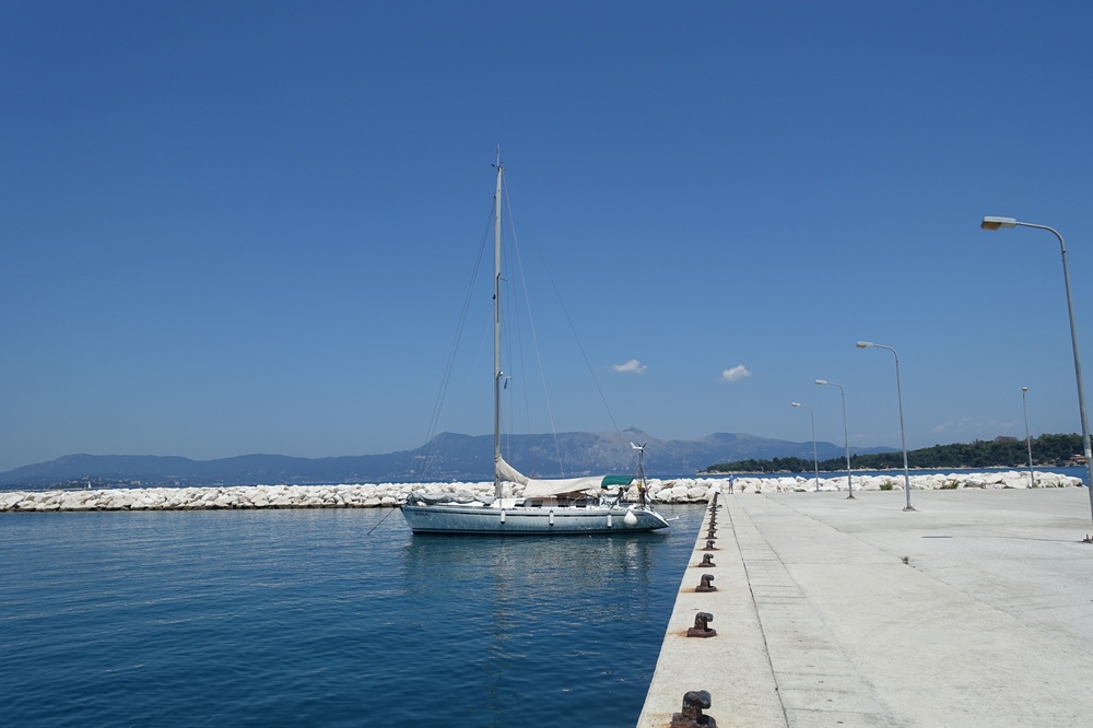
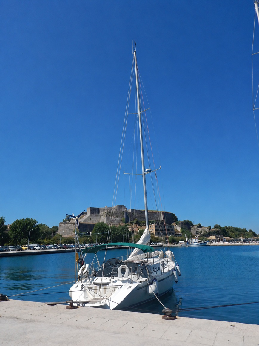
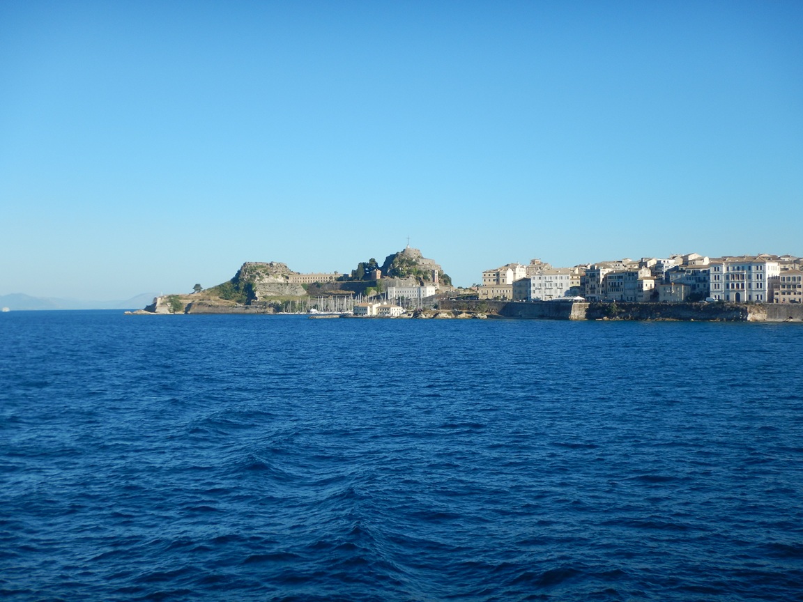
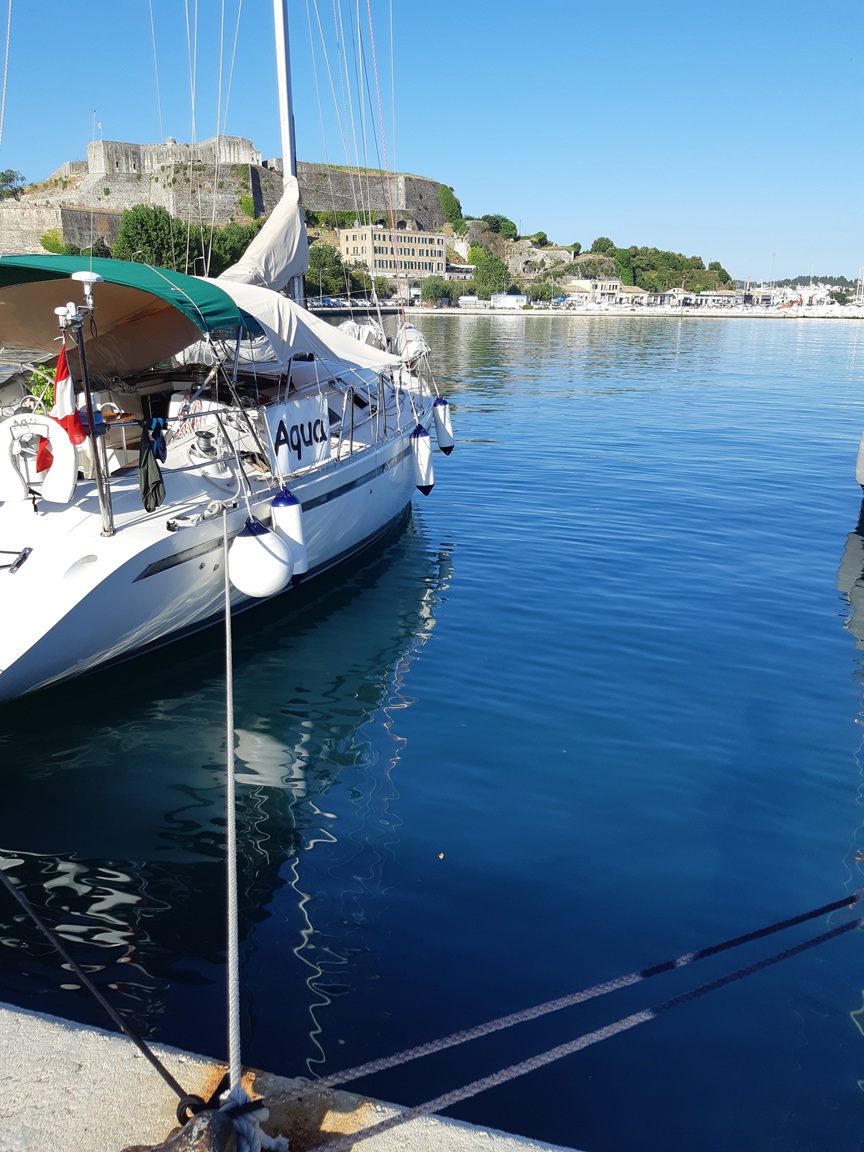
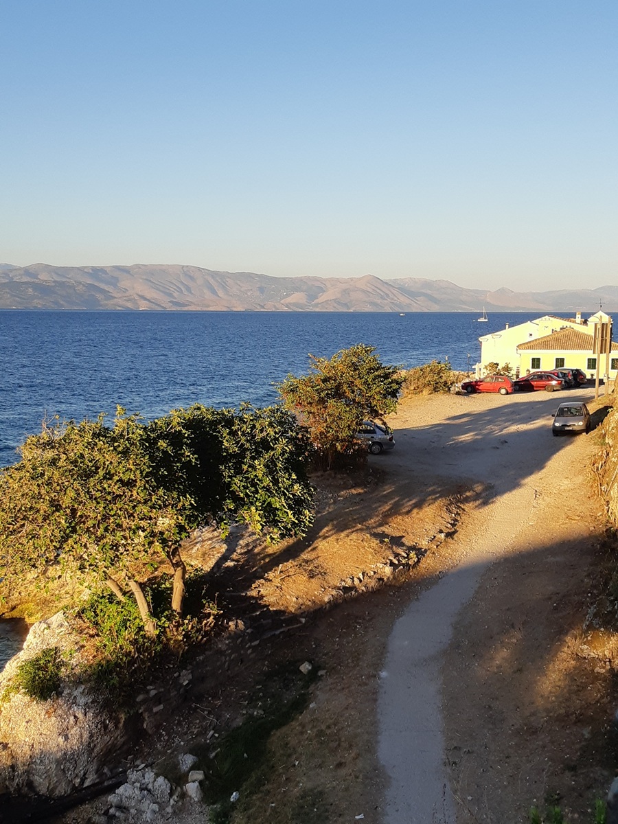
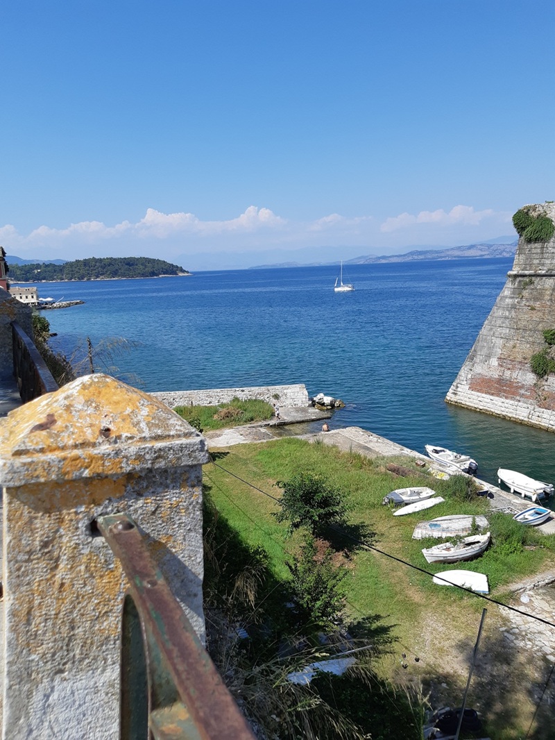
Korfu
Corfu’s old harbour basin is one of those berths where the setting does half the storytelling. We moored stern-to with anchor and stern line in the historic basin, surrounded by views of the old fortifications. The anchor held very well in sand, and the basin itself felt calm and well protected.
- Shelter: good protection inside the old harbour basin
- Berthing: stern-to with own anchor and stern line
- Depth / draft: suitable at our berth; check exact position locally
- Facilities: small tavern / bar directly at the pier
- Nice to know: beautiful historic setting with views of the surrounding fortress walls
- Watch out for: make sure the anchor is well set before going stern-to; manoeuvring space may depend on harbour traffic
Impressions

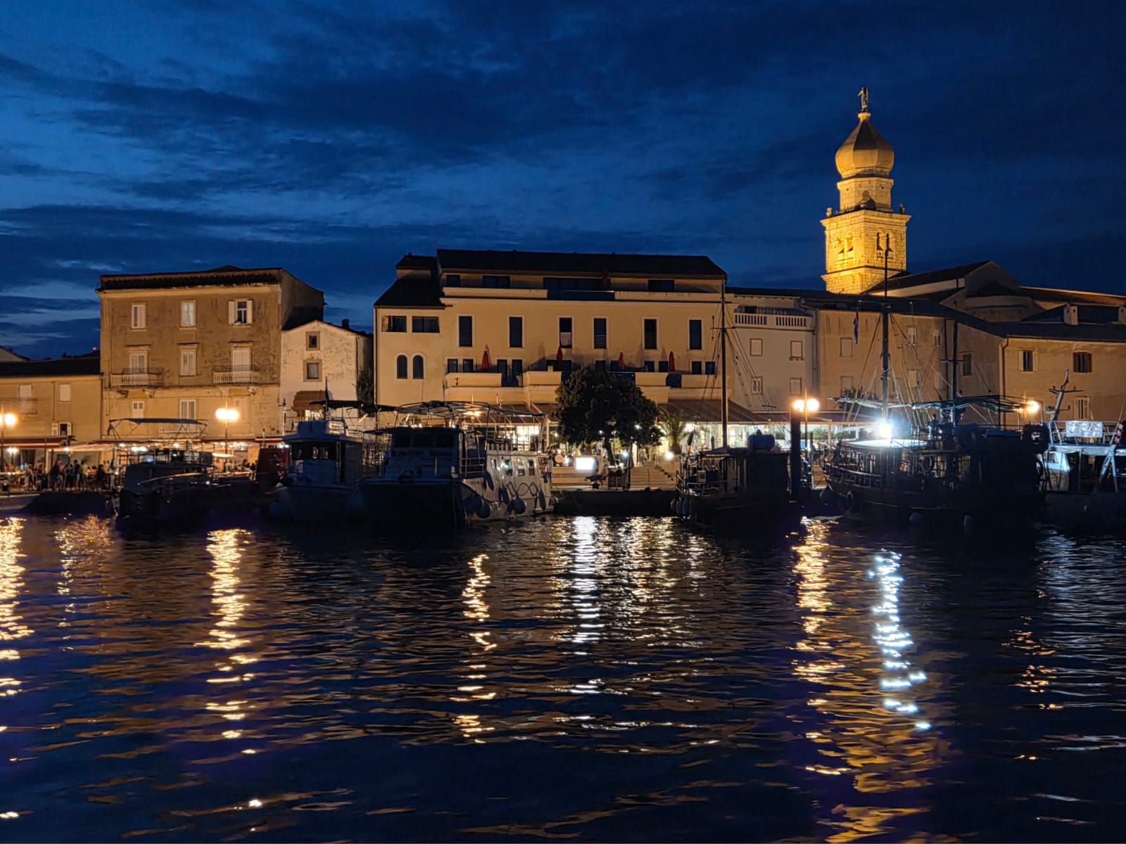
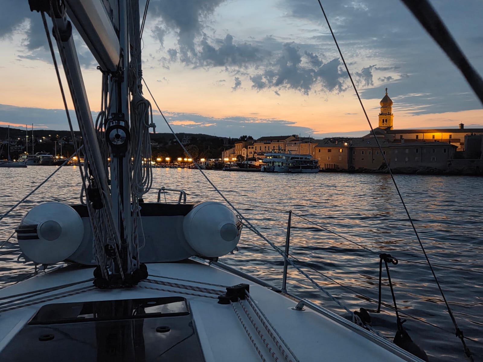
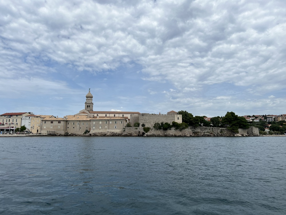
Krk
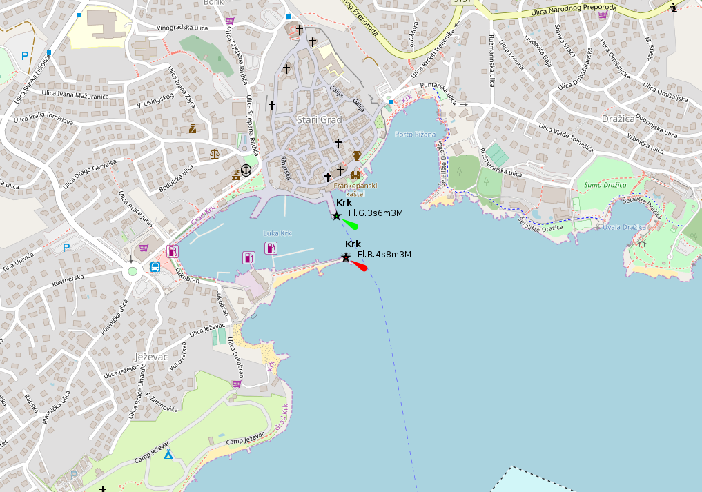
Krk is a busy island capital and a very popular holiday stop — lively, picturesque, and framed by historic buildings around the harbour. We found it attractive but not entirely effortless: there are several berthing options on the piers, but wind direction, harbour traffic and depths deserve attention. In sirocco / jugo conditions the harbour can become noticeably uncomfortable.
- Shelter: decent harbour shelter, but vulnerable in sirocco / jugo
- Berthing: alongside at pier heads or stern-to with mooring lines on several piers
- Depth / draft: mostly workable for sailing yachts, but check locally; depths near the inner fuel station can be critical
- Facilities: two fuel stations; the floating fuel station is straightforward, the inner one at the end of the basin is trickier
- Nice to know: beautiful historic town atmosphere with many restaurants at the harbour and in the surrounding streets
- Watch out for: busy harbour, tourist traffic, gusty or uncomfortable conditions with sirocco, and tight manoeuvring near the inner basin
Impressions
Kukljica (Ugljan)
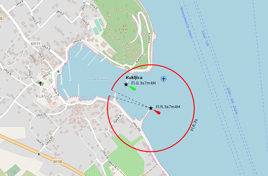
Kukljica is a pleasant small harbour town on Ugljan, useful both for provisioning and as an overnight stop. We lay on the inner breakwater: once briefly for shopping, and once overnight. For provisioning, it is better to berth further inside the harbour, since the walk to the supermarket can be surprisingly long from the outer positions. As an overnight berth, the southern side of the breakwater was not ideal for us, with a small waste area nearby and old fishing nets and harbour gear stored on the mole.
- Shelter: good inside the harbour; can become uncomfortable in jugo, but still workable
- Berthing: inner harbour mostly with mooring lines; inner breakwater usable, berth choice matters
- Depth / draft: suitable at our berth; check locally, especially further inside and close to quay structures
- Facilities: water and electricity available at many inner-harbour mooring berths; supermarket within walking distance
- Nice to know: charming village harbour and the first settlement close to the well-known Pašman–Ugljan bridge
- Watch out for: southern breakwater side less pleasant for overnighting; longer walk to provisions from outer berths; jugo can make the harbour restless; check current bridge restrictions and clearance before attempting passage
With our 33 ft yacht we passed under the Pašman–Ugljan bridge without difficulty — though not entirely without a raised pulse. Current restrictions and clearance should always be checked before attempting the passage.
Impressions
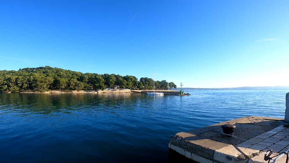
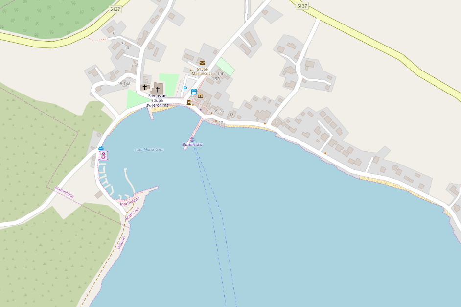
Martinšćica (Cres)
Martinšćica is a small, picturesque harbour village on Cres, surrounded by a wide, quiet landscape that feels much wilder than the size of the place suggests. For us, it became more than just a stop: twice it was the safe harbour when bora conditions caught us harder than expected. We lay alongside on the harbour mole both times, once because the inner side with mooring lines was already full, and once after arriving in the middle of the night after a demanding bora passage, when the crew was tired enough that a mooring manoeuvre would have been pure theatre without artistic value.
- Shelter: good protection inside the harbour; a very welcome refuge in bora conditions
- Berthing: alongside on the outer side of the main mole; mooring lines available on the inner side
- Depth / draft: suitable at our berth; check locally, especially when choosing between inner and outer side
- Facilities: inexpensive berthing; excellent restaurant directly at the pier; sanitary facilities farther away and fairly basic, but usable
- Nice to know: quiet, atmospheric village with beautiful untouched nature nearby — perfect for walking if weather keeps you in harbour
- Watch out for: outer mole may be needed by excursion or ferry traffic; we were once rather abruptly moved on by a vessel entering with horn signals; inner side can fill up quickly
Harbour expansion has reportedly been planned, but during our visits there were no visible signs of major construction yet.
Impressions
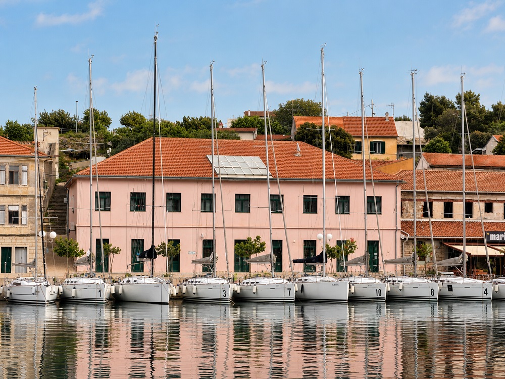
Milna (Brač)
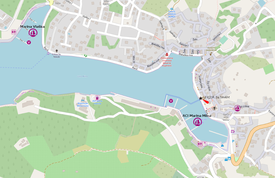
Milna on Brač is an extremely picturesque harbour town, set deep inside a broad and sheltered inlet, with an almost disproportionate number of marina options for such a small place. We spent the night in the ACI Marina, stern-to with mooring line, and found the sanitary facilities excellent. Space inside the marina felt somewhat limited, with rather narrow fairways, but the setting in the large harbour basin is very attractive.
- Shelter: very good inside the long harbour inlet; well protected and comfortable in normal conditions
- Berthing: several marina options; ACI Marina stern-to with mooring lines; alongside berthing in a raft may also be possible at the harbour mole
- Depth / draft: suitable at our marina berth; check locally when using quay or mole positions outside the marinas
- Facilities: three marinas in the harbour area; excellent sanitary facilities in the ACI Marina; town services and restaurants nearby
- Nice to know: beautiful island harbour town with a sheltered, spacious basin and a very atmospheric waterfront
- Watch out for: marina fairways can feel tight; occasional reports of polluted water in the harbour, though we did not notice it during our stay; large yachts anchoring in the basin may create early-morning disturbance
Impressions
Piran
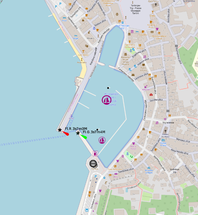
Piran is a beautiful medieval coastal town and one of the most atmospheric harbour stops in this part of the Adriatic. The town itself is absolutely worth visiting, with its dense old streets, historic waterfront and unmistakable Venetian character. The harbour, however, is relatively expensive and often fills up early, especially in high season, so arriving late without a plan can quickly turn from charming to educational.
- Shelter: sheltered inside the harbour, but berth availability is the real limiting factor
- Berthing: harbour berths can be scarce and expensive; in an emergency, berthing at the customs quay may be possible, but should be checked locally
- Depth / draft: generally workable for sailing yachts, but concrete blocks on the bottom and dolphins can complicate manoeuvring
- Facilities: town harbour infrastructure; restaurants, cafés and the historic centre directly nearby
- Nice to know: extremely worthwhile medieval coastal town and one of the most memorable places to go ashore
- Watch out for: often full early in high season; relatively expensive; concrete blocks and dolphins make berthing more demanding, especially at night
Rogoznica
Rogoznica is both an old fishing village and a lively holiday town, with a large marina inside the harbour area. We stayed outside the main season and chose not to use the marina, instead lying rafted alongside at the long mole on the eastern side of the harbour bay. It worked well for us, with a few pleasant cafés nearby and a more direct, less polished harbour atmosphere.
- Shelter: good protection inside the broad harbour bay; berth comfort depends on exact position and traffic
- Berthing: large marina available; outside the marina, alongside / rafted berthing may be possible at the long eastern mole
- Depth / draft: suitable at our berth; check locally when using mole positions or buoys outside the marina
- Facilities: large marina infrastructure nearby; cafés and town services within walking distance
- Nice to know: lively but still characterful harbour town, combining fishing-village roots with holiday-town convenience
- Watch out for: 3 kn speed limit throughout the harbour bay; buoy field present; anchoring prohibited in some areas, so check local restrictions carefully
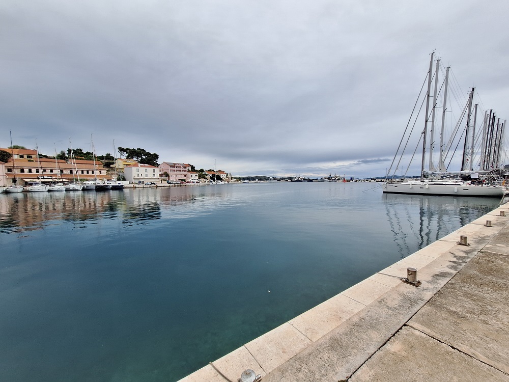
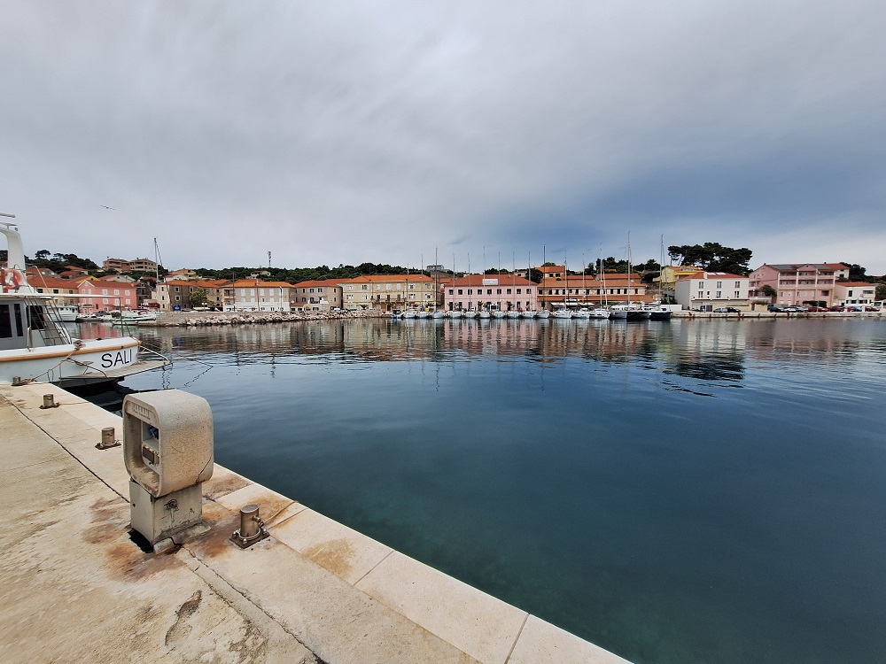
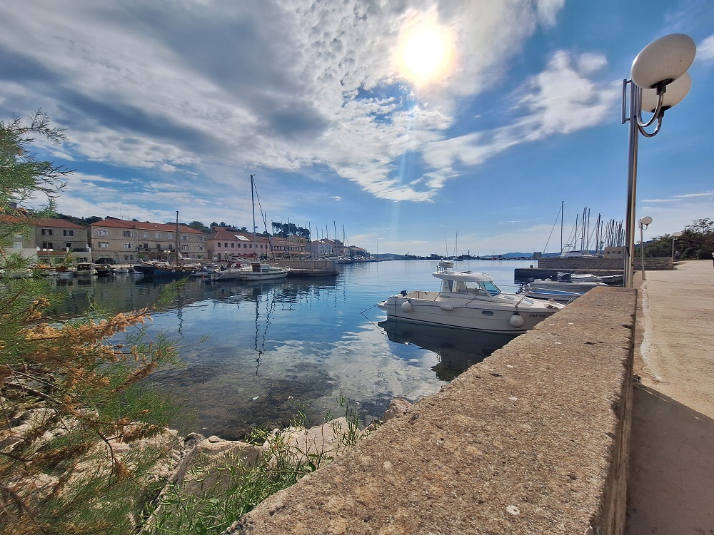
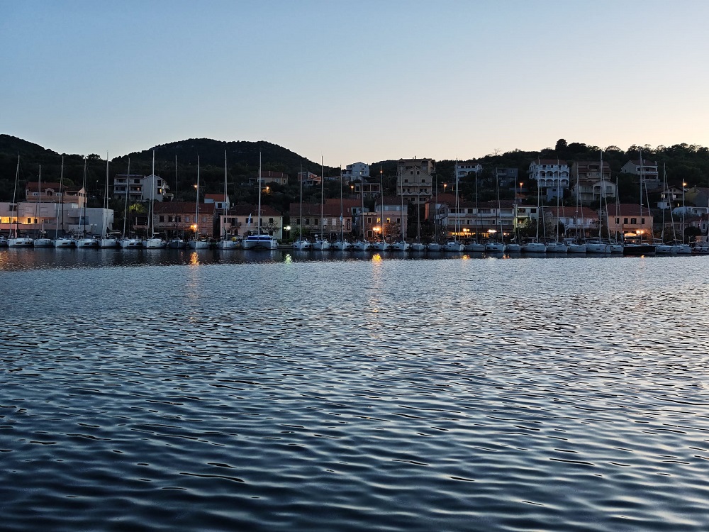
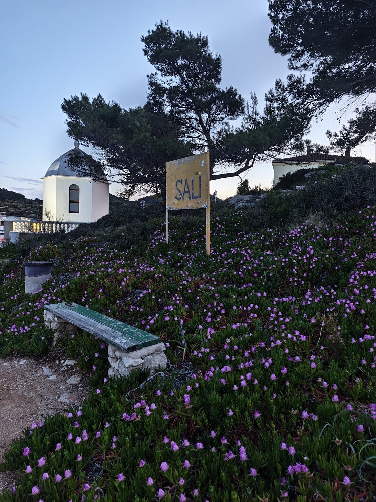
Sali (Dugi Otok)
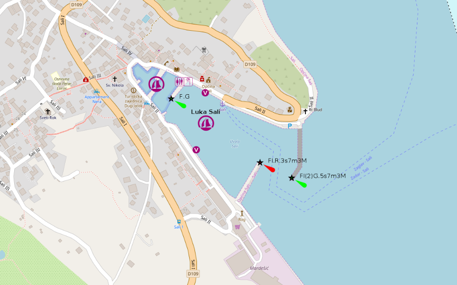
Sali is one of those harbour towns I discovered far too late. Its position in the long channel between Dugi Otok and Ugljan / Pašman is not especially convenient for a one-week cruise, because reaching it often means committing to the whole channel passage and living with that “long corridor” feeling for quite a while. Still, the town itself is genuinely beautiful: a charming village wrapped around a large harbour basin, with plenty of space and a wonderfully relaxed island atmosphere.
- Shelter: very good inside the large harbour basin; improved swell protection thanks to the second breakwater
- Berthing: spacious harbour with a southwest quay and a northeast quay, useful for different wind and weather situations
- Depth / draft: generally suitable for sailing yachts; check exact quay position locally
- Facilities: town harbour infrastructure; restaurants and village services around the harbour
- Nice to know: beautiful and surprisingly spacious island harbour; highly recommended, especially for yachts able to pass under the Pašman–Ugljan bridge
- Watch out for: route planning matters; the position deep in the Dugi Otok / Ugljan-Pašman channel can be inconvenient on a tight one-week itinerary
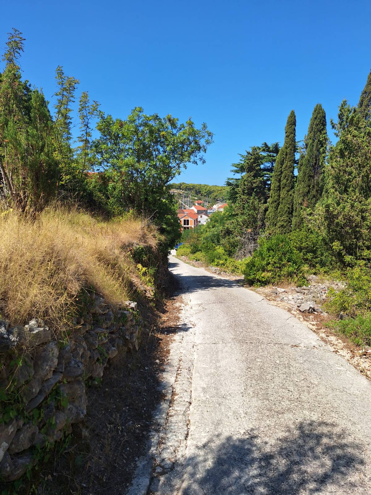
Impressions
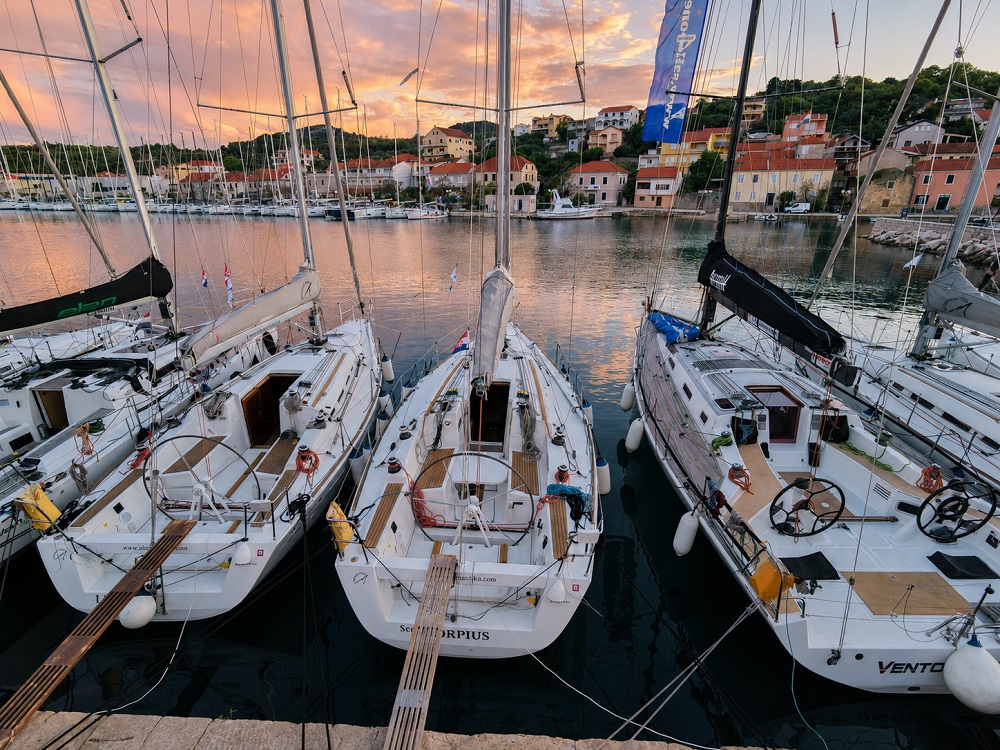
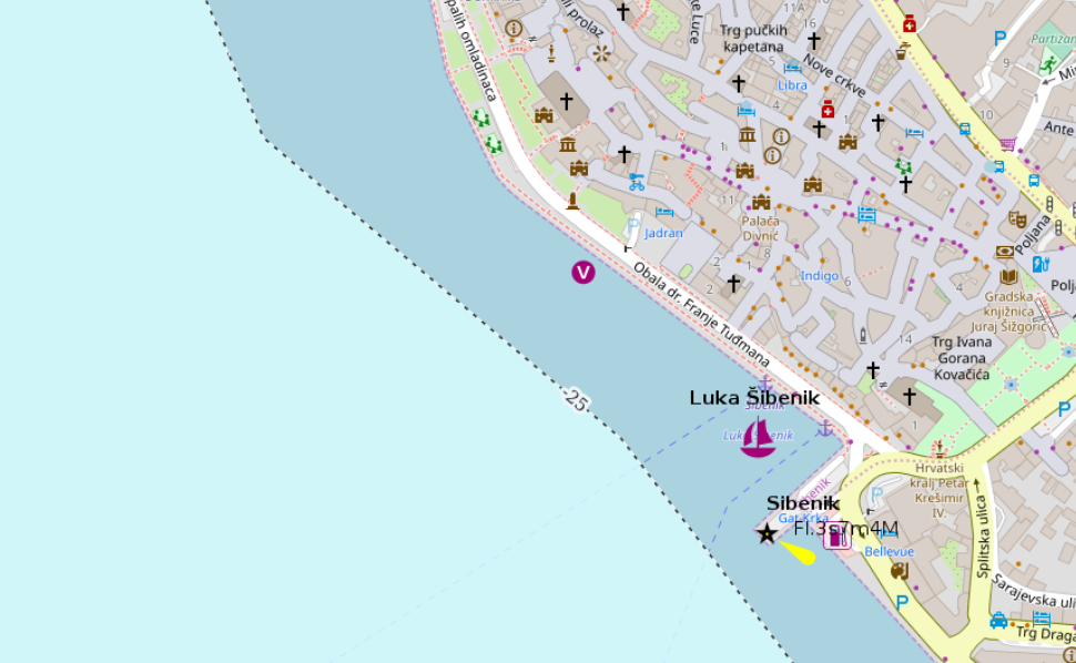
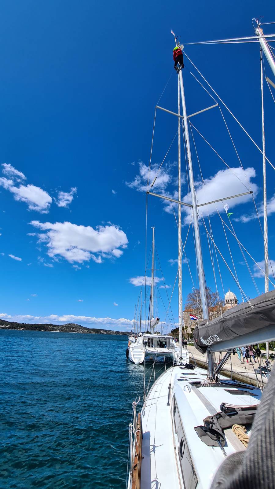
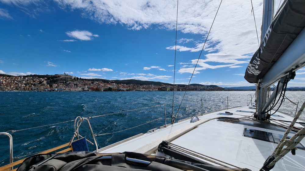
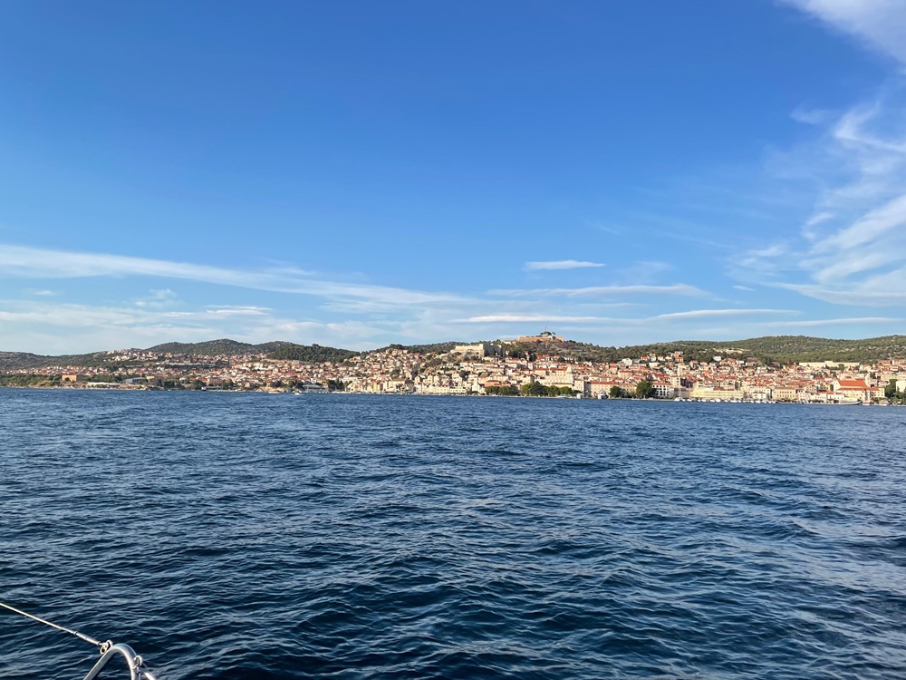
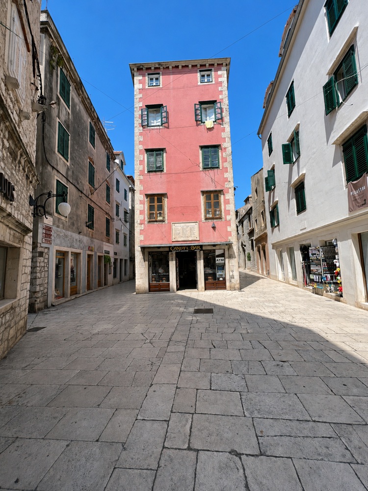
Šibenik
Šibenik does not make the softest first impression from the sea: from a distance, the town appears grey, industrial and heavy with concrete. The old town, however, is much more attractive once ashore and has clearly been restored with care. The approach itself is one of the most interesting parts, leading through a narrow entrance past early modern fortifications into the enormous harbour basin.
- Shelter: very well sheltered inside the large harbour basin
- Berthing: long harbour mole available; the main mole is genuinely long, roughly 200 m, with ferry traffic nearby
- Depth / draft: generally suitable in the harbour basin, but check exact berth and quay position locally
- Facilities: urban harbour infrastructure; ferry quay nearby; old town within reach; onward route possible up the Krka
- Nice to know: impressive entrance through the narrow channel past historic fortifications; the restored old town is far more charming than the industrial approach suggests
- Watch out for: possible current in the narrow entrance; commercial and ferry traffic; the outer impression is rather industrial, so do not judge the town too early
Impressions
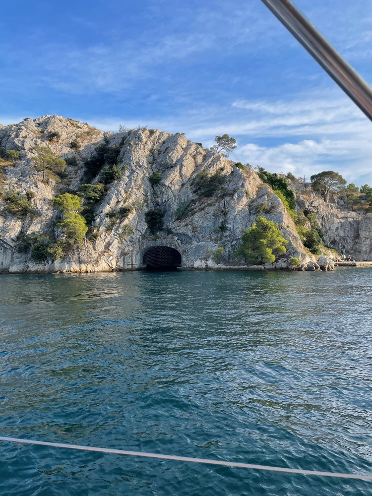
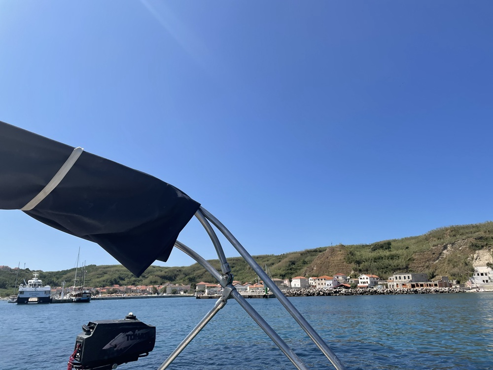
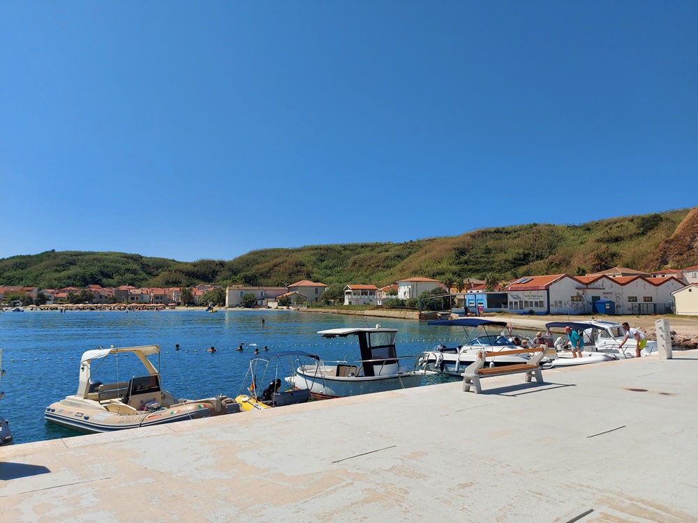
Susak
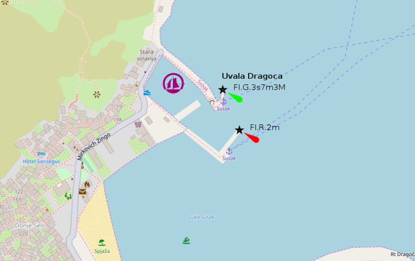
Susak is one of the most unusual islands in Croatia: a fascinating sandy island in an otherwise mostly rocky cruising area. The island consists of a roughly 100 m thick layer of loess blown onto a rocky base, which gives it its distinctive soft landscape and makes it especially rewarding to explore on foot. The harbour itself is small and requires attention. Berths are assigned by the harbourmaster, and both depth and available space can make manoeuvring more demanding than the peaceful island atmosphere suggests.
- Shelter: inner and outer harbour available; in bora, only the inner harbour offers proper protection
- Berthing: berths assigned by the harbourmaster; excursion boats may occupy the outer harbour during the day
- Depth / draft: watch depths carefully; silting can occasionally reduce available water depth
- Facilities: several restaurants in the village; bathing beach about 150 m southwest of the harbour, with WC nearby
- Nice to know: unique sandy island, beautiful to explore, and very different from the usual rocky Croatian coast
- Watch out for: strong ferry swell at the new L-shaped mole; keep mooring lines clear and leave generous distance from the wall; limited manoeuvring space and possible silting require patience rather than heroics
Impressions
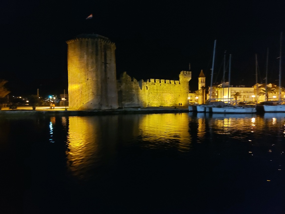
Trogir
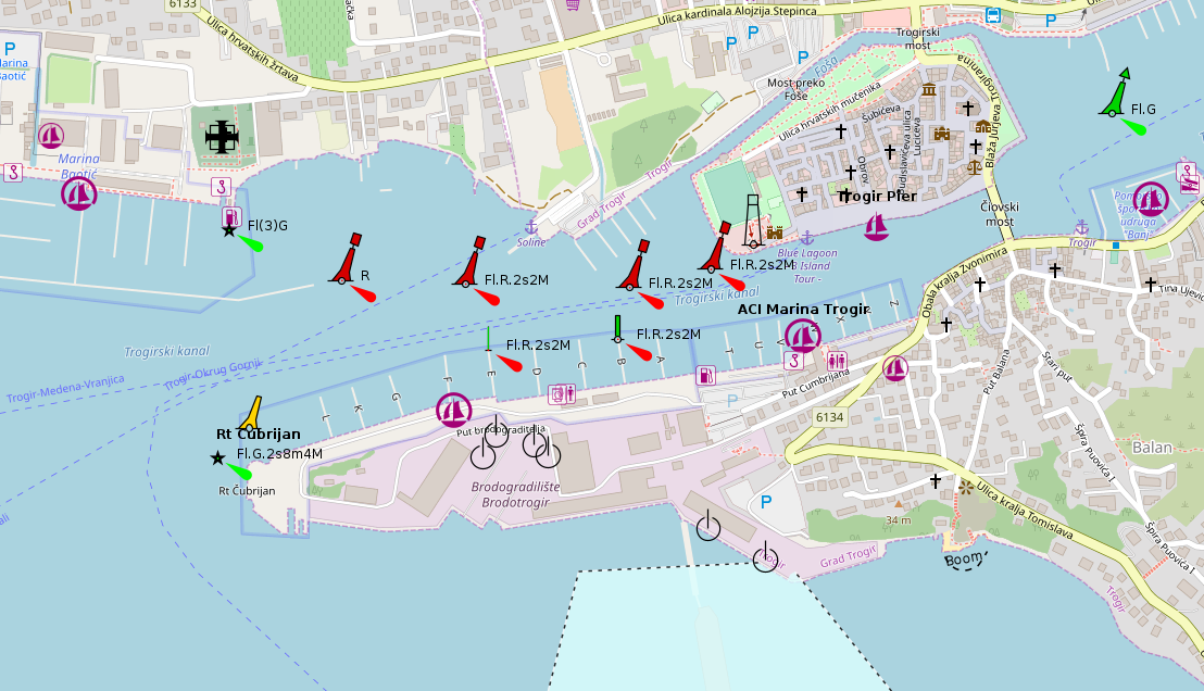
Trogir is one of the most striking historic harbour towns in this area, with the old town and fortress giving the whole basin a very memorable backdrop. We did not stay overnight, but anchored in the harbour basin for a while and enjoyed the surroundings and the view towards the fortress. The town quay itself is attractive but not straightforward: tourist boats and megayachts tend to have priority there, and without mooring lines it is not a berth to treat casually.
- Shelter: generally sheltered inside the harbour area, but swell can build in the channel with strong westerly winds and also during bora, especially near the eastern part of the ACI Marina
- Berthing: old town quay has no mooring lines and is often occupied by tourist boats or large yachts; ACI Marina, SCT / Marina Trogir and Baotić Marina are nearby alternatives
- Depth / draft: suitable harbour area for sailing yachts, but check exact berth, quay and anchoring position locally; current in the channel can complicate manoeuvring
- Facilities: several marina options, fuel station, technical services, restaurants and strong charter infrastructure nearby
- Nice to know: beautiful historic setting with old town, fortress views and a memorable harbour atmosphere; anchoring for a short daytime stop in the basin worked well for us
- Watch out for: current up to around 3 kn may affect manoeuvres; the town quay can occasionally flood in strong westerly conditions; fuel berth is tight and Fridays can bring long queues from returning charter yachts; Friday to Saturday is busy due to crew change; Trogir lies under the Split airport approach path
Impressions
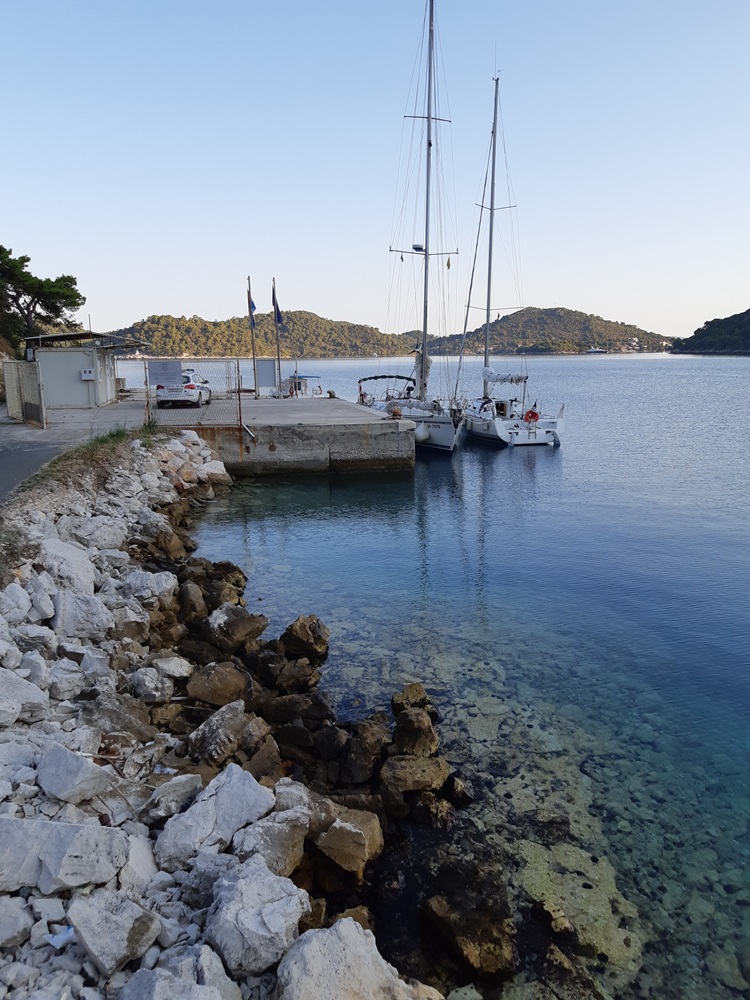
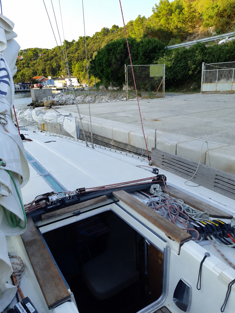
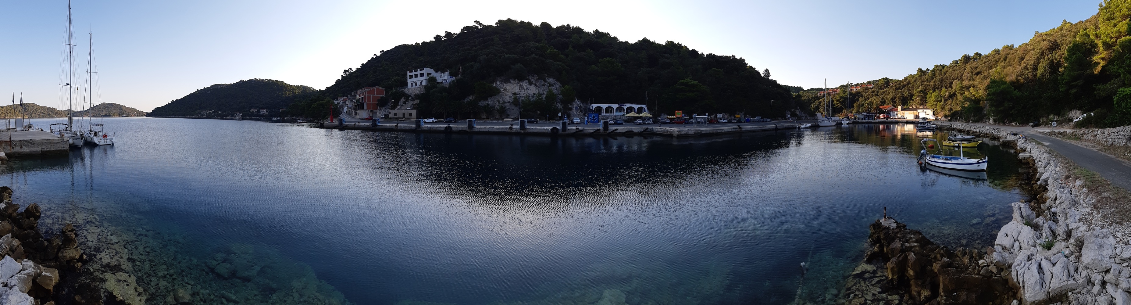
Ubli (Lastovo)
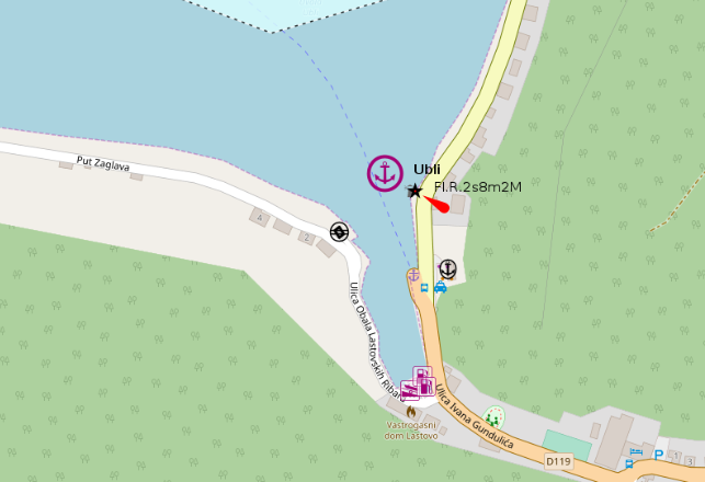
Ubli is a practical harbour on Lastovo rather than a picturesque cruising highlight. We stopped here at the customs quay when arriving from Greece on the way towards Italy, as we had to clear into Croatian territorial waters. The harbour serves as an important ferry and local transport point, with basic services nearby and connections further across the island.
- Shelter: usable harbour shelter, but ferry movements can create strong swell
- Berthing: customs quay available for clearance; ferry traffic has priority and may also use the area south of the ferry berth
- Depth / draft: suitable at the customs quay for our stop; check exact berth and ferry manoeuvring space locally
- Facilities: water sometimes available at the quay, usually in the morning around 10–11; small shop nearby; minibus connection to Lastovo
- Nice to know: useful clearance stop when entering Croatian waters; practical access point for the island of Lastovo
- Watch out for: strong ferry swell possible; ferry berthing movements can affect available space; do not treat the quay as a quiet long-stay berth
Impressions
Umag
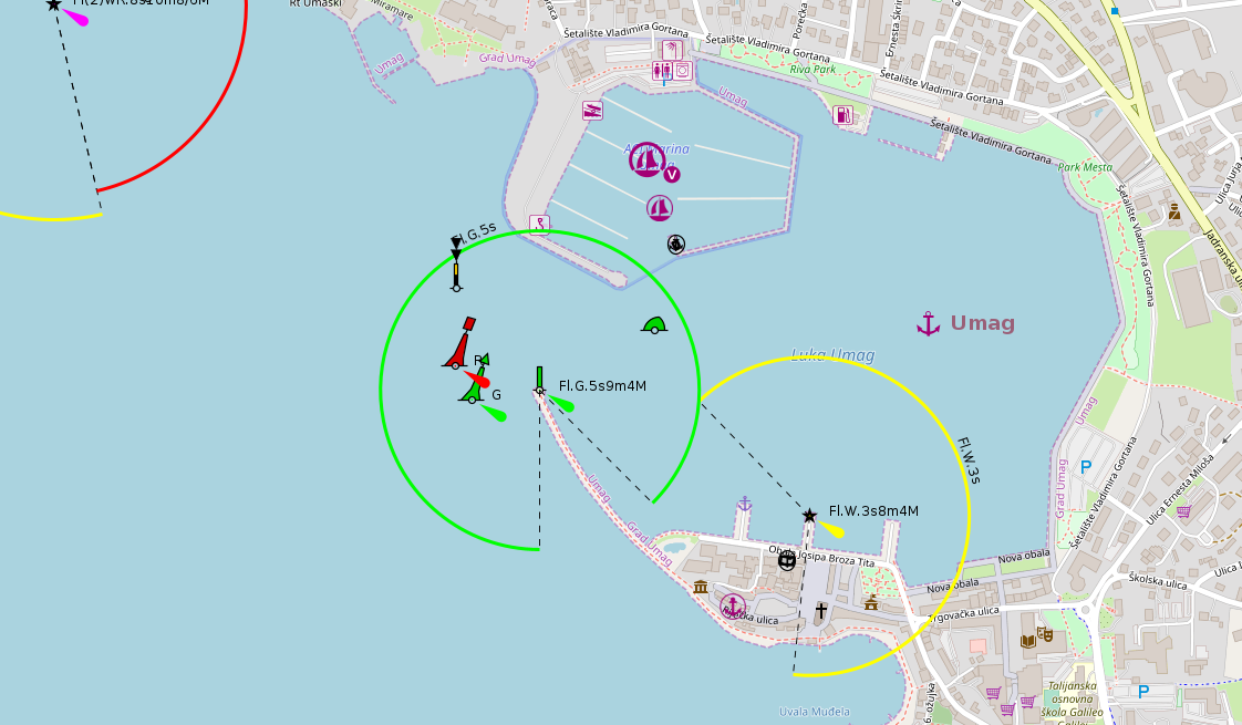
Umag is a lively holiday town and a long-established year-round port of entry. We only used the customs quay here, staying overnight before crossing towards Italy, because at the time we still had to formally clear out of Croatian waters. Today, with Croatia inside the Schengen Area, this kind of clearance is generally no longer the normal reason for stopping here when sailing directly between Croatia and Italy, but current rules should always be checked before departure.
- Shelter: usable harbour shelter, but strong northerly winds can create uncomfortable and tricky swell in the town harbour
- Berthing: customs quay available; some mooring berths in the town harbour; guest mooring buoys in the harbour bay
- Depth / draft: generally workable for sailing yachts, but check exact berth and buoy positions locally
- Facilities: town harbour infrastructure, clearance facilities, restaurants and holiday-town services nearby
- Nice to know: practical northern Adriatic stop before or after an Italy crossing; lively town atmosphere
- Watch out for: harbour lights can be hard to distinguish at night against the town background; fishing and excursion boats often lie east of the customs quay; northerly winds may create deceptive swell
Unije
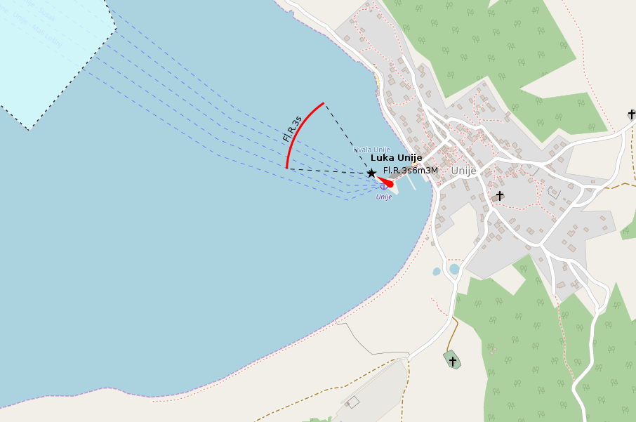
Unije is a small, quiet island settlement with only a handful of services, but a very distinct character. For me it still belongs more to the harbour category than to the anchorage category, even though we ended up anchoring northwest of the small harbour. During our 2021 visit, the mole was being enlarged, which meant we could not use it as originally hoped. The place itself is modest and remote, with only one or two restaurants and a small shop — exactly the kind of island stop where simplicity is part of the appeal.
- Shelter: small harbour setting; protection and comfort depend strongly on berth availability and current harbour works
- Berthing: harbour mole available in principle, but check current status; during our visit construction works prevented us from using it
- Depth / draft: check locally; reduced depths and construction changes may affect approach and berthing
- Facilities: very limited village infrastructure; one or two restaurants and a small shop
- Nice to know: quiet, remote island village with a very different rhythm from the busier Adriatic harbour towns
- Watch out for: anchoring prohibited west of the mole; poor holding reported off the southern shore of the harbour bay due to rock slabs; many anchored boats may only be held by chain weight rather than a properly set anchor
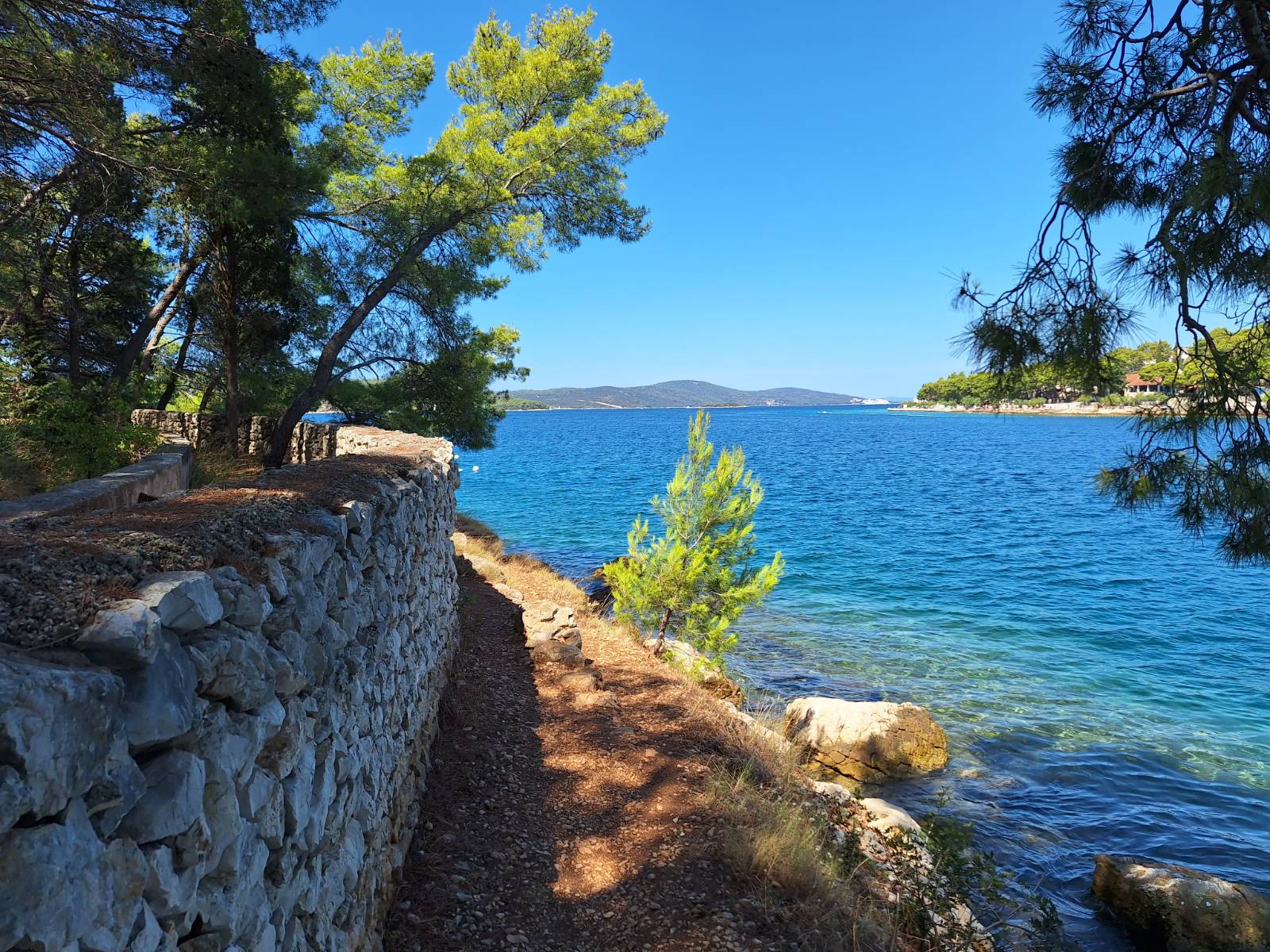
Impressions
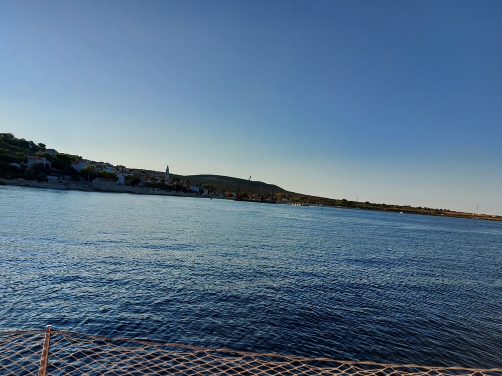
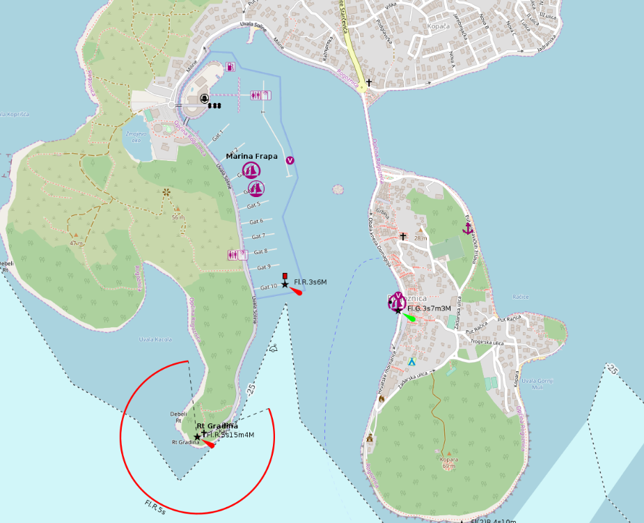
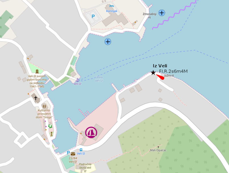
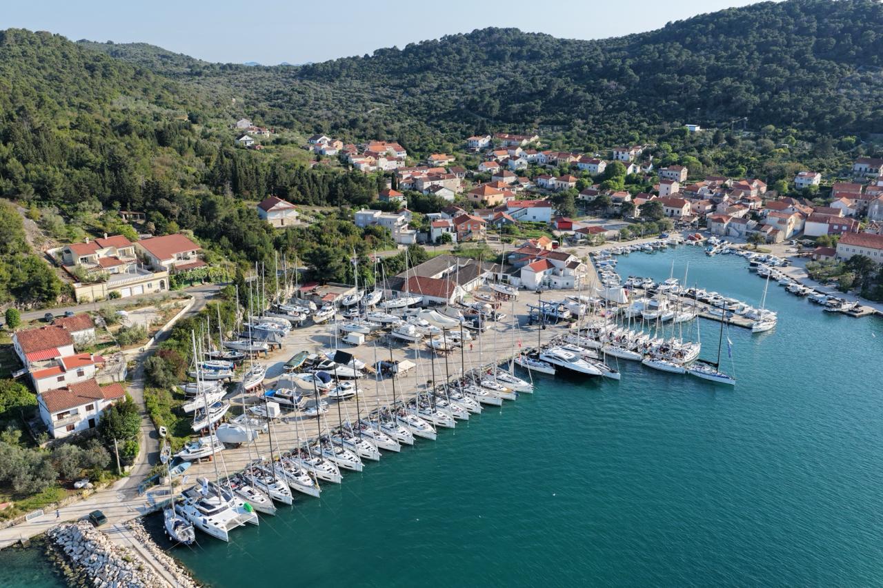
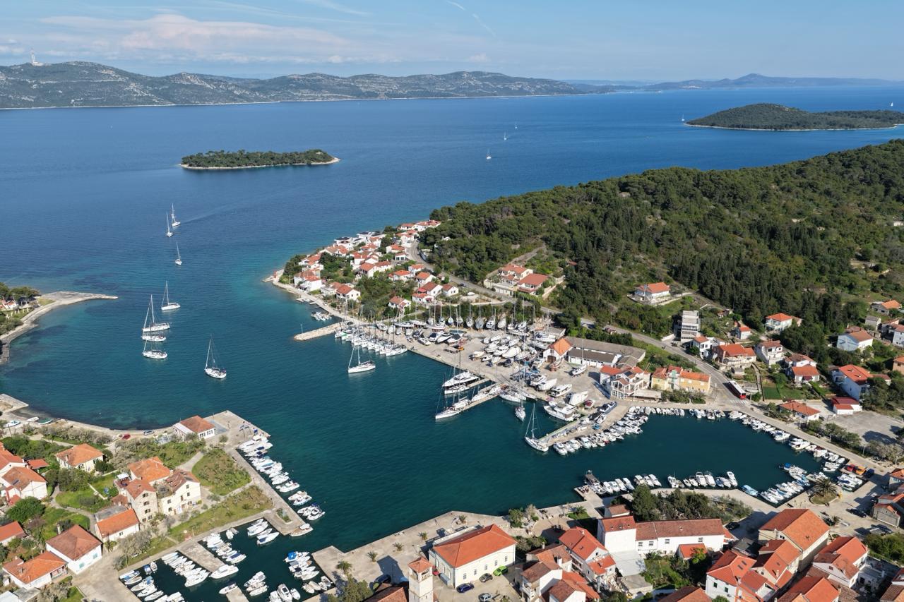
Veli Iž
Veli Iž is a small harbour village and a real jewel in a quiet, natural setting. The place feels far removed from the louder holiday harbours, with a calm island rhythm, a small village centre and just enough infrastructure to make a stay comfortable. Its position in the long channel between Dugi Otok and Ugljan / Pašman is not ideal for every one-week route, but it is especially attractive for yachts that can pass under the Pašman–Ugljan bridge and use the area more flexibly.
- Shelter: good harbour shelter, but berth choice and available depth should be checked carefully
- Berthing: small marina with limited berths; some additional berths at the west quay, possibly bow-to depending on local instructions
- Depth / draft: watch depths carefully, as the harbour is prone to silting; contact the marina before relying on deeper berths, especially near the travellift
- Facilities: small marina infrastructure, technical service, supermarket, bakery and restaurants in the village
- Nice to know: quiet, beautiful island stop in largely unspoiled surroundings; very rewarding if the route through the channel fits your itinerary
- Watch out for: very limited berthing capacity, especially in high season; possible silting and reduced depths; fast ferry traffic to Zadar several times a day; route planning matters due to the channel location
Impressions
Vis
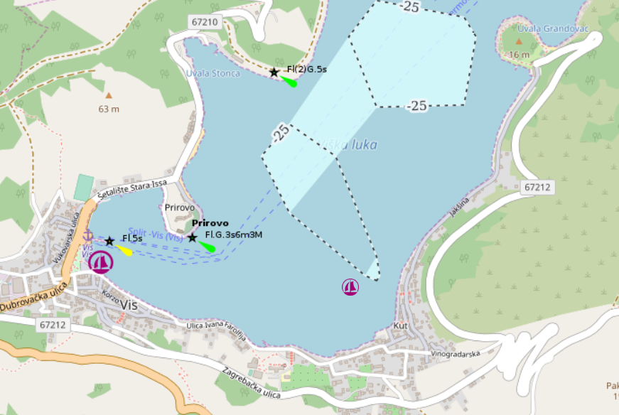
Vis is a lively holiday town, ferry harbour and seasonal port of entry, with plenty of restaurants, a supermarket close to the harbour and a beautiful island-town atmosphere. The berths, however, are not as harmless as the waterfront may suggest. At the town quay there are many mooring berths with electricity and water, but it can be noisy and exposed, especially in bora and jugo conditions. A somewhat quieter alternative can be found farther southeast in Kut.
- Shelter: limited in bora and jugo; jugo can blow very gusty from the east inside the harbour bay, and sudden tramontana before a bora change can make even Kut uncomfortable
- Berthing: many stern-to mooring berths at the town quay with electricity and water; quieter mooring berths also in Kut
- Depth / draft: generally suitable for sailing yachts at the usual berths, but check the exact berth and keep ferry manoeuvring areas clear
- Facilities: water and electricity at the quay; small sanitary facilities near the town quay and in Kut; fuel berth available, but only one yacht can usually berth at a time
- Nice to know: lively island town with many restaurants, supermarket nearby and strong harbour atmosphere; Kut is usually the calmer choice
- Watch out for: ferry swell can be nasty; protect stern and gangway carefully and keep rigs clear of neighbouring boats; fuel berth access can be restricted and busy; Friday-style charter pressure may create waiting times; harbour water quality can be poor in summer; handle mooring lines carefully and watch the propeller
Impressions

Vodice
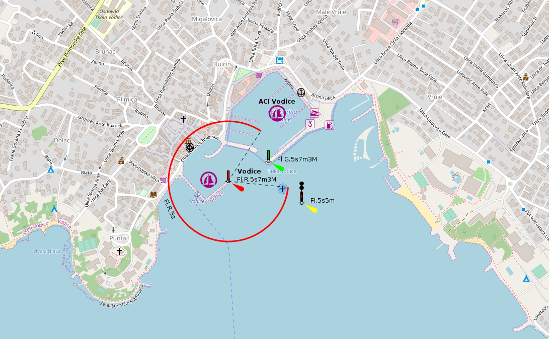
Vodice is a very lively seaside town and holiday resort, with plenty of activity around the harbour. It is a practical stop with good services, but not necessarily a quiet one: in the harbour area, loud music can continue well into the early morning. The town harbour offers some mooring berths with electricity and water, though protection becomes insufficient in strong jugo conditions.
- Shelter: generally usable in settled conditions, but poor protection in the town harbour during strong jugo
- Berthing: mooring berths with electricity and water available in the town harbour; ACI Marina nearby
- Depth / draft: suitable at regular yacht berths; small harbour north of the ACI Marina is only for boats up to about 5 m
- Facilities: ACI Marina, town harbour services, fuel station, small-boat harbour with 3 t crane, restaurants and resort infrastructure nearby
- Nice to know: lively holiday town with plenty of services, useful for provisioning, restaurants and a more urban harbour stop
- Watch out for: strong jugo makes the town harbour uncomfortable and may make berthing at the fuel station impossible; expect nightlife noise in the harbour area until early morning
Impressions