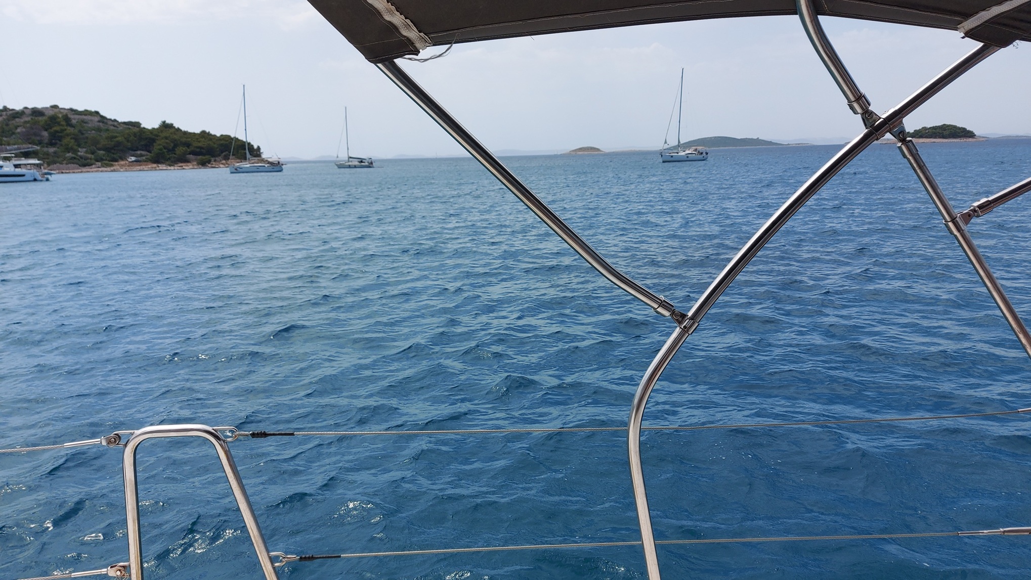
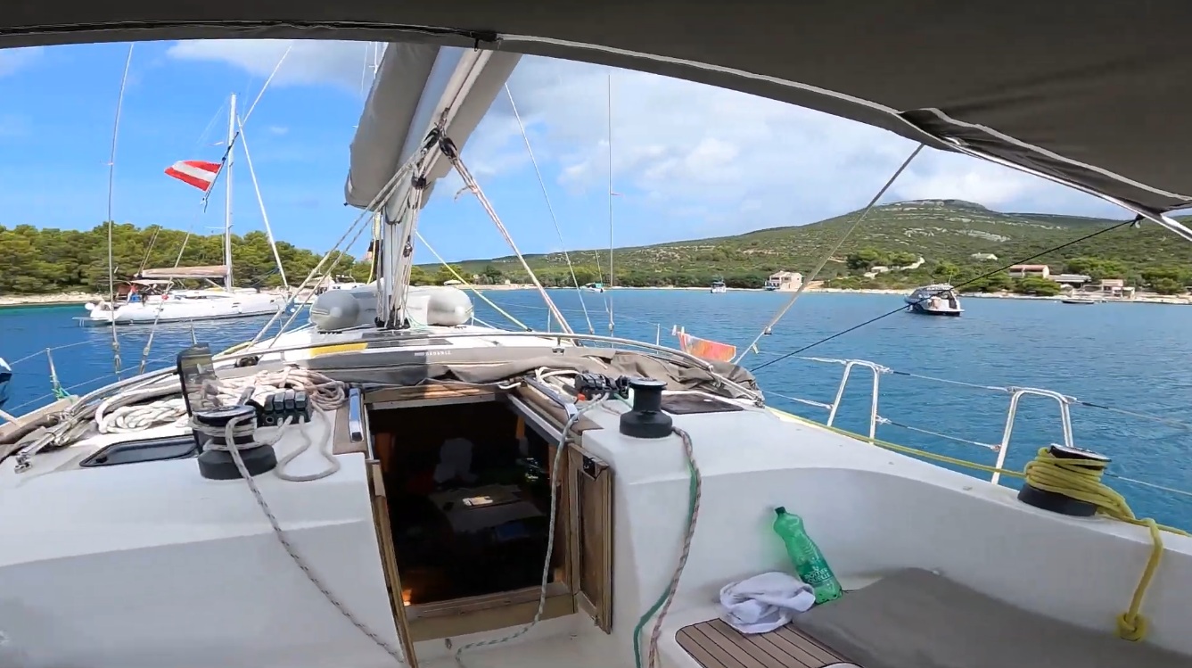
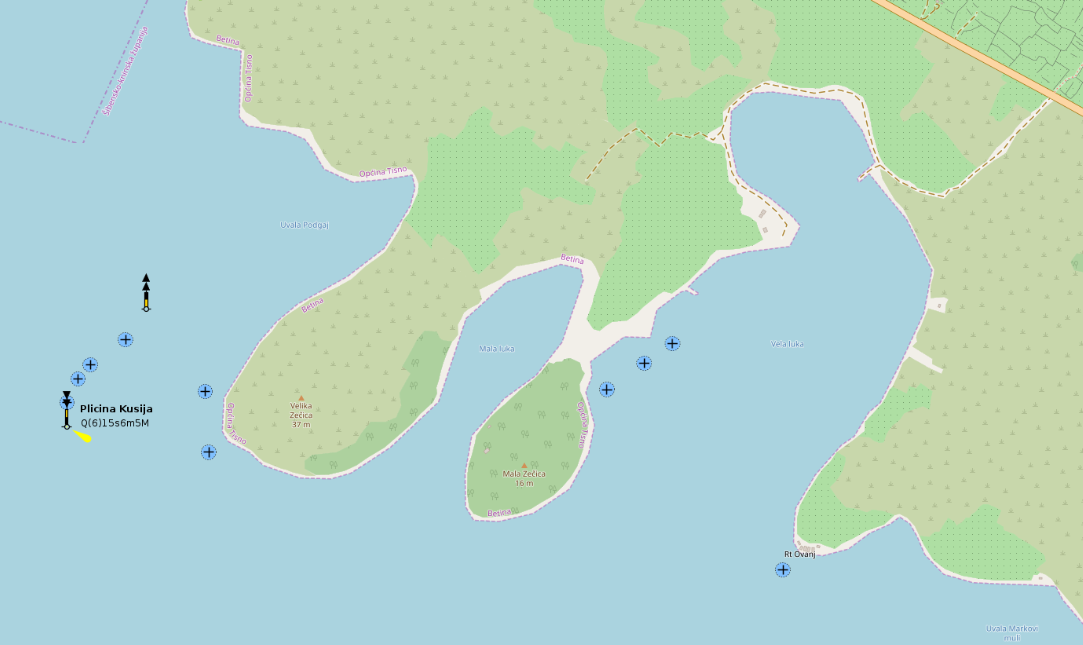
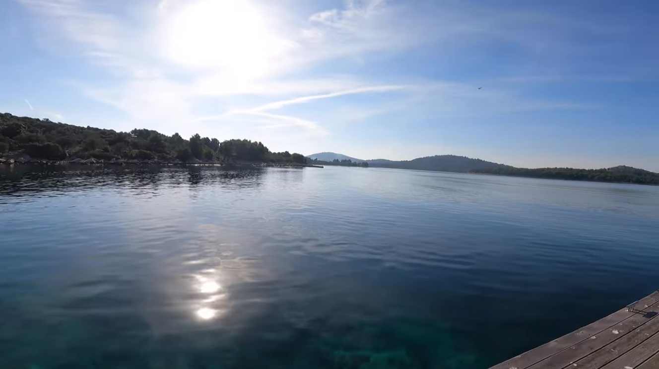
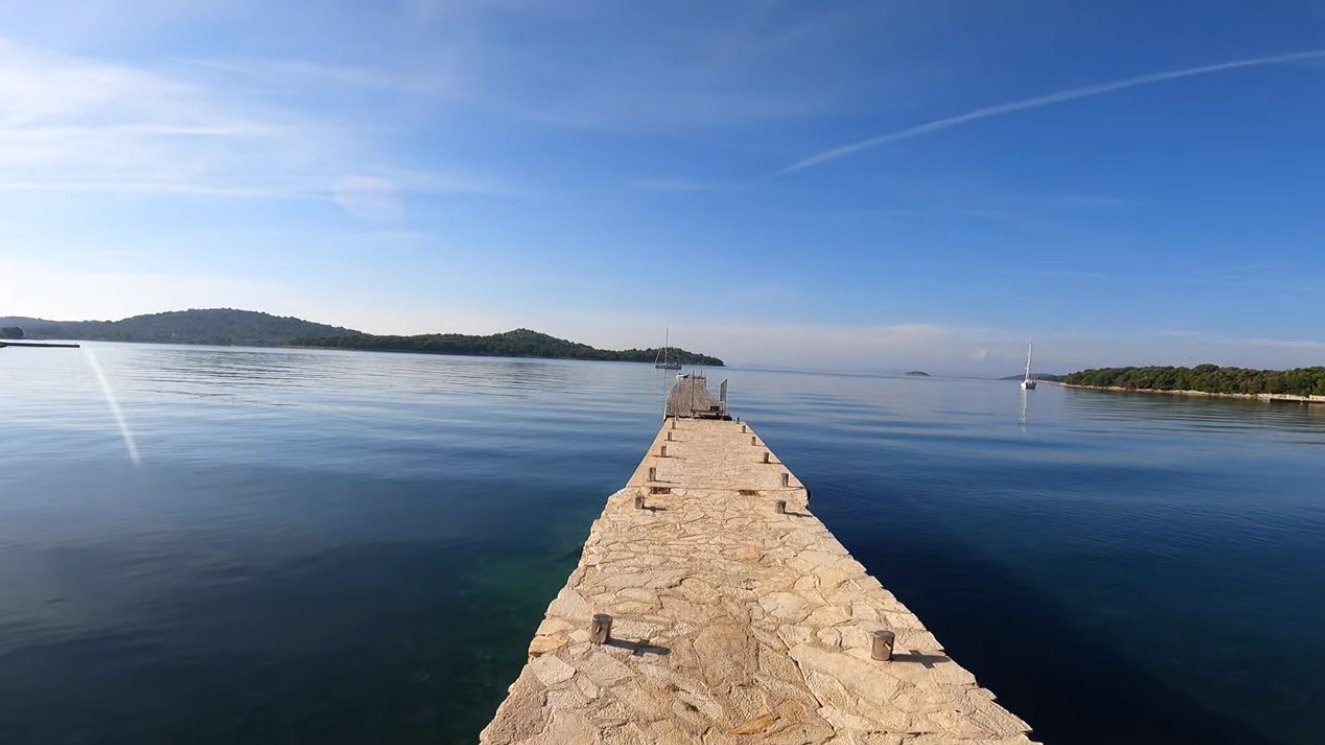
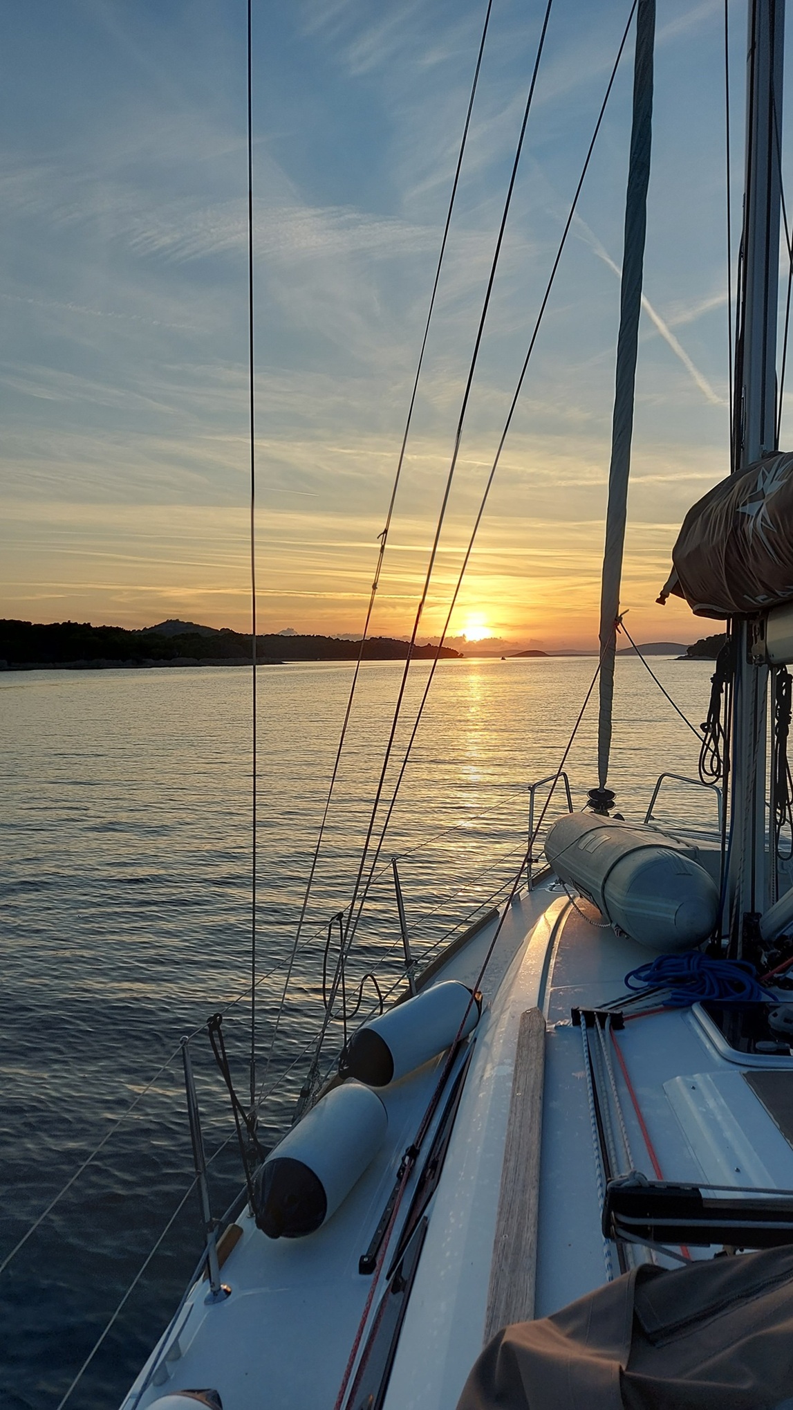
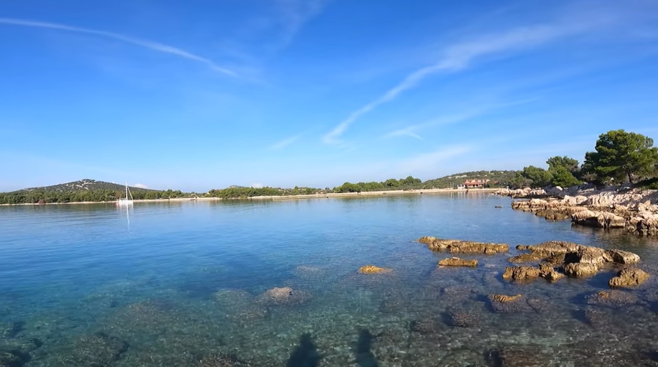
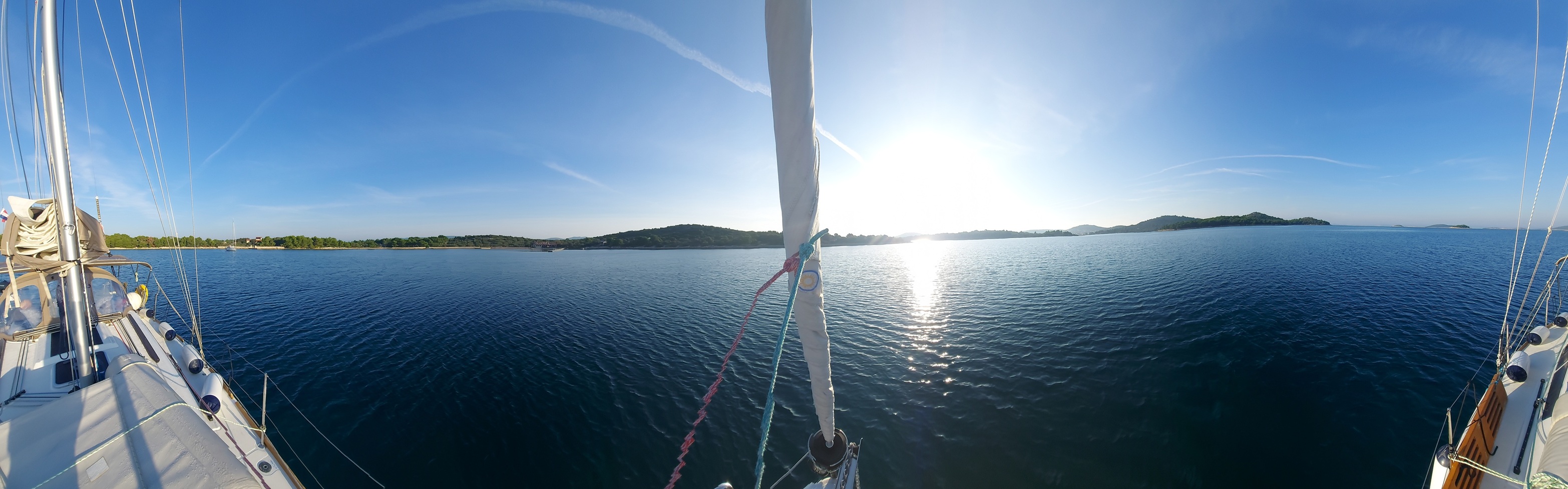
Bays, Coves & Anchorages
This section is a curated logbook of where to go—and why you’d bother. Browse below, or wander as curiosity and weather permit.
- Ankaran
- Bizikovica (Žut)
- Blaca (Brač)
- Ilovik (Lošinj)
- Lagdimor (Krk)
- Lamjana Mala (Ugljan)
- Lovišće (Šćedro)
- Luka Pod Sv. Križ
- Natprisliga (Kakan)
- Nečujam (Šolta)
- Obinuš/Binjuš
- Partljug (Ugljan)
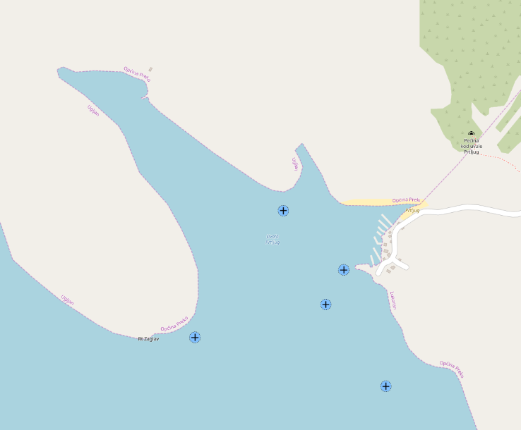
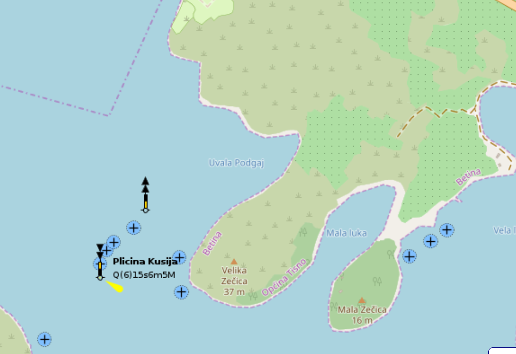
- Podgaj
- Podgarbe/Zagračina (Molat)
- Rogačić (Vis)
- Sabuni (Žut)
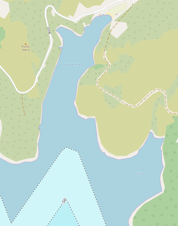
- Smrka (Brač)
- Sobra (Mljet)
- Soline (Pašman)
- Strunjan
- Sunfarni (Lošinj)
- Supetarska Draga (Rab)
- Sveti Grgur (Main Bay)
- Vela Luka
- Vrulje (Kornat)
- Zmajan
- Zminjak (Murter)
Ankaran
A quiet, practical overnight stop with easy approach, shallow water, and little drama — exactly the sort of place one appreciates more after sunset than from the chart alone.
- Shelter: not perfect, but fair in calm weather
- Bottom: sand
- Depth impression: rather shallow
- Nice to know: Swimming area; 2 basic berths along the breakwaters
- Watch out for: NW: Protected area – navigation prohibited
Bizikovica (Žut)
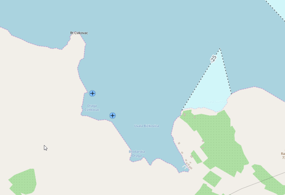
A modest, quietly tucked-away anchorage near Bizikovica — shallow, straightforward, and best appreciated for its calm simplicity rather than spectacle. The kind of place that works when the weather behaves and one keeps expectations grounded.
- Shelter: acceptable in settled conditions; open to some directions
- Bottom: sand, holding generally fair but not uniform
- Depth impression: around 7 m, with shallower patches
- Nice to know: quiet surroundings; occasional use for swimming; limited space near breakwaters
- Watch out for: uneven ground
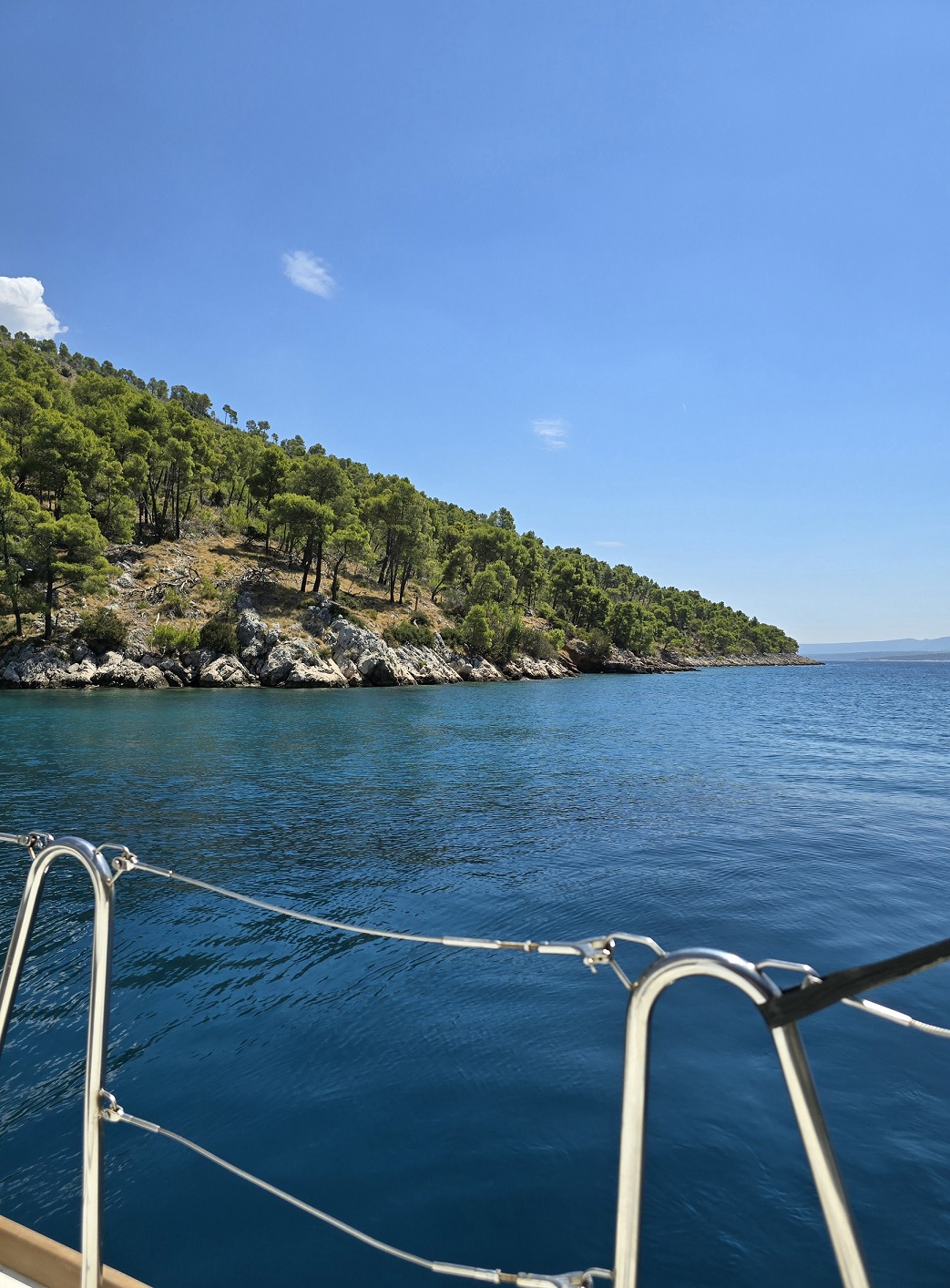
Blaca (Brač)
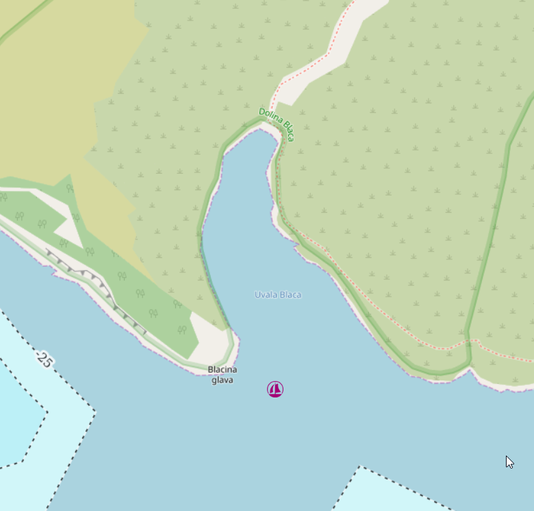
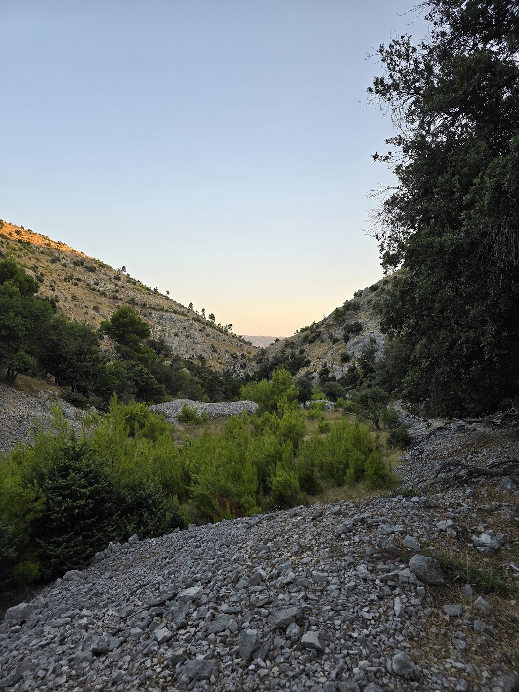
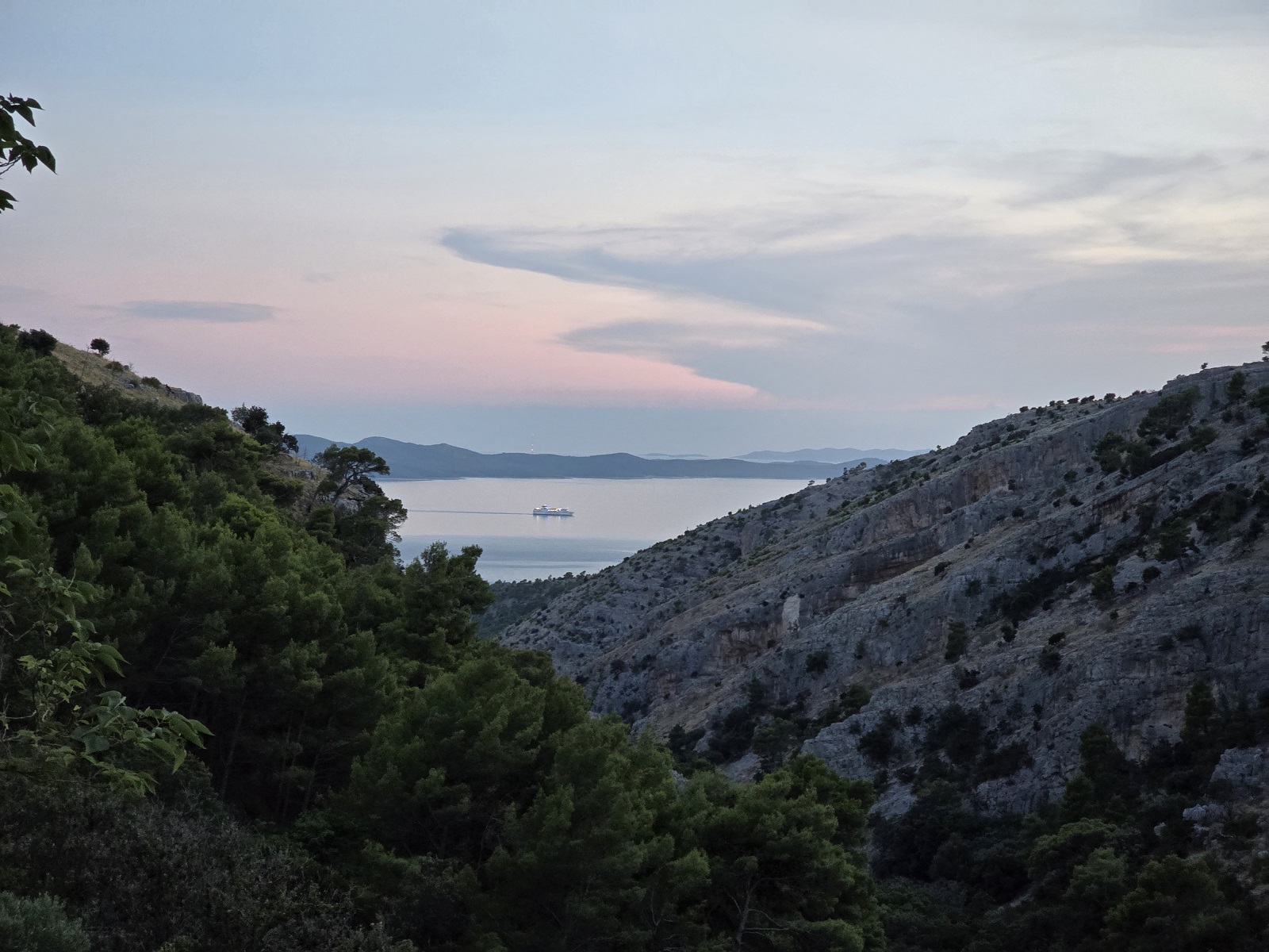
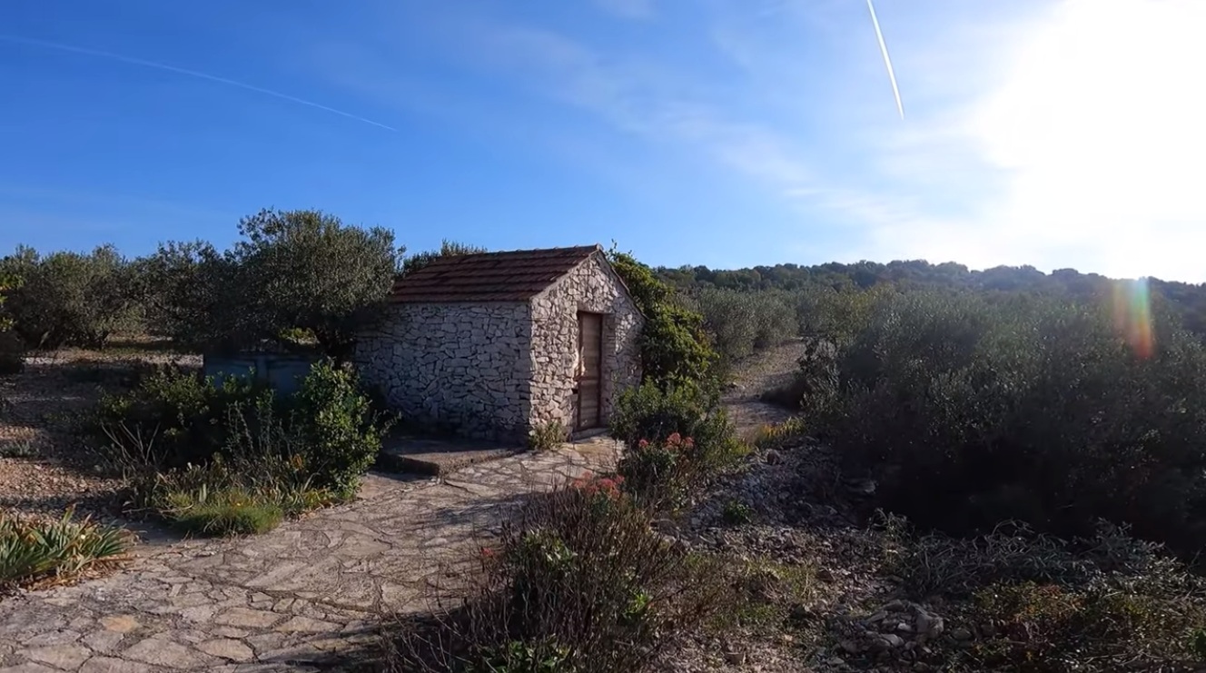
A striking, almost theatrical inlet on the southern coast of Brač — steep slopes, clear water, and a sense of quiet isolation once the day boats leave. Space is limited and often shared, making stern lines less a choice than a necessity. The real reward lies ashore: a rugged, memorable hike up to the Blaca hermitage, where the landscape turns austere and unexpectedly contemplative.
- Shelter: good in calm conditions; enclosed but not fully protected
- Bottom: mixed sand and rock; unreliable in some places
- Depth impression: moderate, quickly deepening towards the center
- Nice to know: scenic anchorage; access to hike leading to the Blaca monastery (~45 min inland)
- Watch out for: limited swinging room; other yachts; anchor may require a second attempt
Impressions
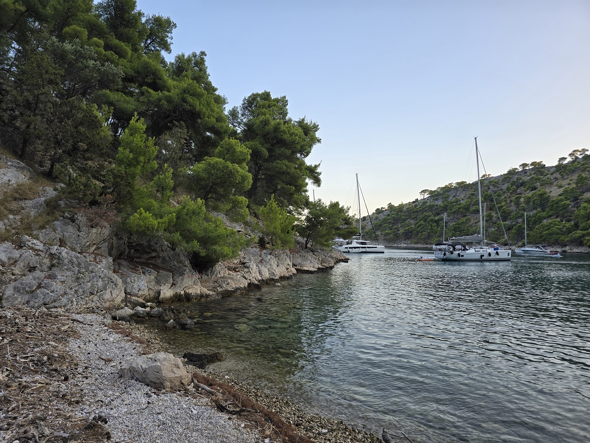
Ilovik (Lošinj)
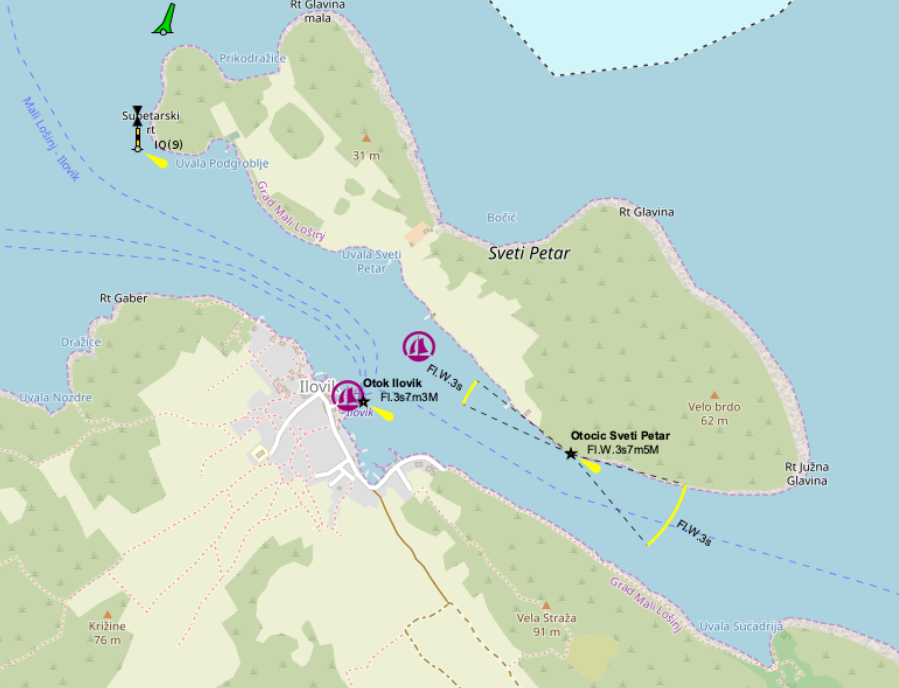
A functional but reliable refuge between Ilovik and Sveti Petar — more a place of purpose than romance. In strong bora conditions, the channel offered us a surprisingly calm and controlled environment, despite being open at both ends. In our case, what is usually a crowded mooring field turned into a quiet, almost solitary stop.
- Shelter: open to two directions, but generally well protected within the channel
- Bottom: mixed; anchoring secondary due to extensive mooring field
- Depth impression: moderate, consistent through the channel
- Nice to know: large buoy field; lively in season, surprisingly quiet off-season
- Watch out for: ferry traffic; designated fairway; anchoring restrictions near the harbor and channel
Lagdimor (Krk)

A small, rather technical bay just west of Sveti Juraj — less inviting at first glance, but ultimately the more workable option. After aborting our initial attempt in the neighbouring double bay, where rapidly shoaling rock near the shore made a stern line approach feel questionable, we relocated here to continue anchoring practice under more predictable conditions.
The anchor set immediately — a welcome contrast — but the seabed drops off quickly, leaving little margin for error in positioning. We anchored stern-to into the bay, exposing ourselves to wind and light swell, while the opposite direction offered poor prospects for holding due to the steep gradient.
- Shelter: limited; some protection from northerlies depending on position
- Bottom: mixed; holding acceptable, but depth increases rapidly
- Depth impression: steeply shelving — careful positioning required
- Nice to know: suitable for anchoring practice; clearer conditions at nearby Sveti Juraj
- Watch out for: steep drop-offs; limited holding area; exposed when stern-to; consider a stern line to shore for longer stays
For anything beyond a short stop, this is not an ideal overnight anchorage — the neighbouring Sveti Juraj remains the more suitable choice, despite its own challenges.
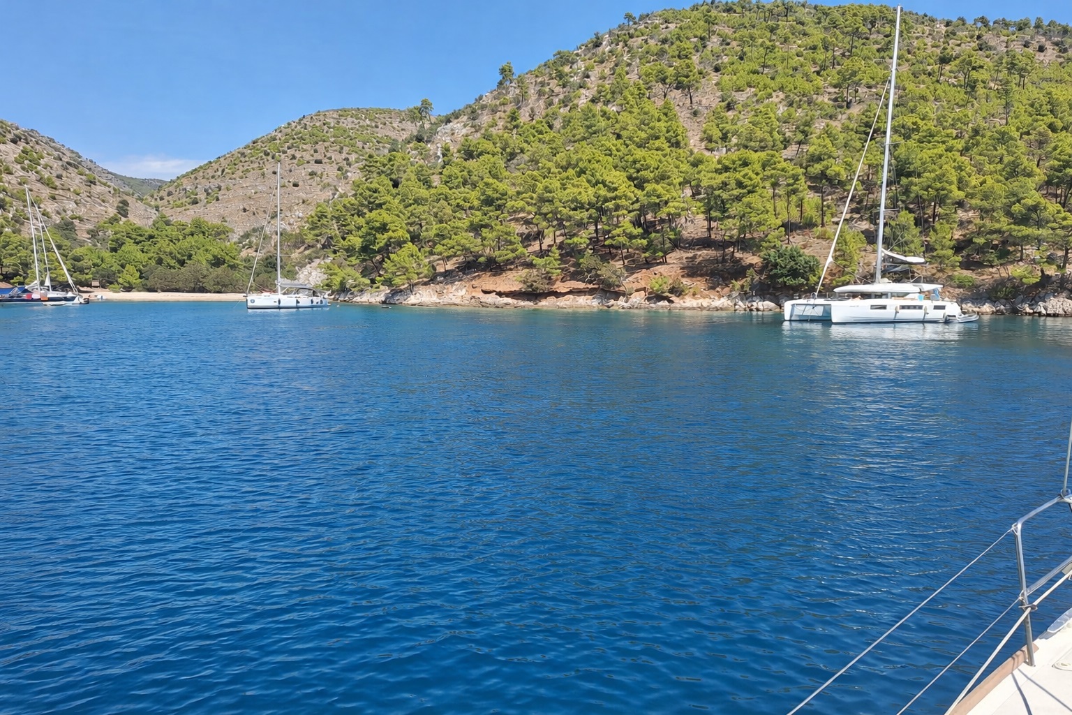
Lamjana Mala (Ugljan)
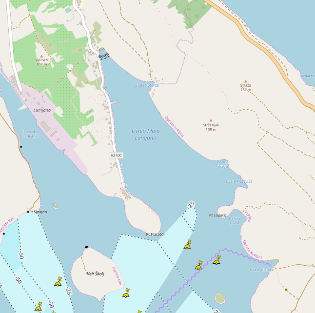
A remarkably well-protected bay on the eastern side of Ugljan — calm, enclosed, and almost unnervingly still. The kind of place that feels less like an anchorage and more like a pause in time.
Even with its established mooring field, the bay can feel entirely empty out of season. During our stay, we had the place to ourselves — no movement, no noise, just a flat sea reflecting sky and shoreline with quiet precision. It is, quite simply, what one imagines sailing to be.
- Shelter: excellent in almost all conditions; very well enclosed
- Bottom: not assessed (mooring used)
- Depth impression: moderate and even within the bay
- Nice to know: mooring field available; anchoring possible
- Watch out for: slight exposure to southerly and south-easterly winds, though rarely problematic
Impressions
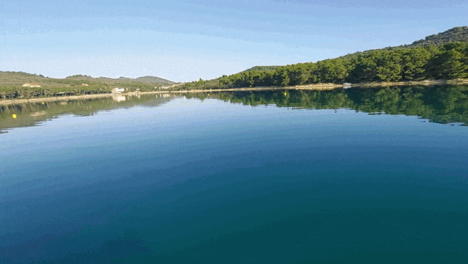
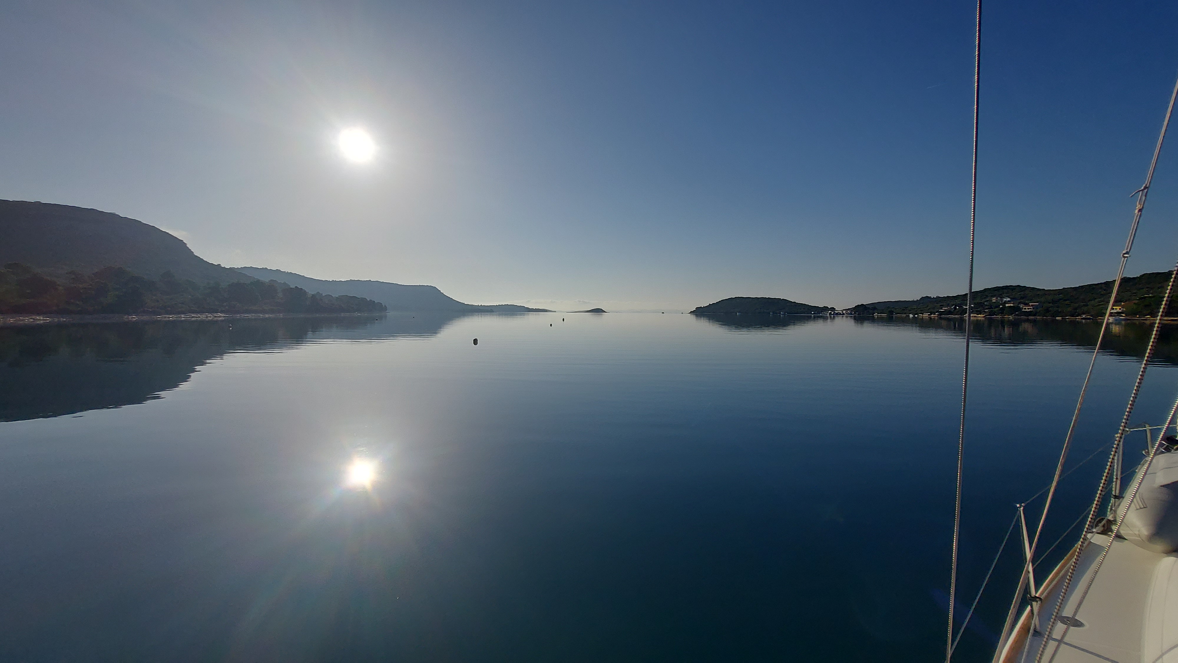
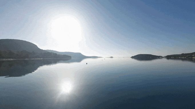
Lovišće (Šćedro)
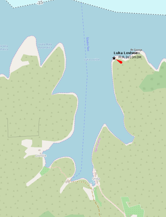
A deeply indented bay on Šćedro, structured almost entirely around its mooring field — practical, well-organised, and after a long and demanding night at sea, exactly what was needed: a controlled arrival and a quiet rest.
The buoy we picked up proved entirely reliable and held without issue. In early season, the bay was calm and sparsely occupied, though it is known to be considerably busier in summer. Anchoring is effectively not an option here, as the usable depths are occupied by buoys and anchoring within buoy fields is prohibited.
- Shelter: good overall; some exposure depending on wind direction (bora, jugo, and westerlies can create gusts)
- Bottom: not relevant; buoy field dominates anchoring area
- Depth impression: deeper central basin (~20–30 m), shallower towards the edges
- Nice to know: organised buoy system (bow/stern lines); several small konobas along the shore
- Watch out for: gusty winds in certain conditions; tight spacing between boats; submerged lines between buoys
A curious footnote: there are reports of rats making their way onto boats at night. We neither invited nor encountered any — but it is the sort of detail one files away nonetheless.
Luka Pod Sv. Križ
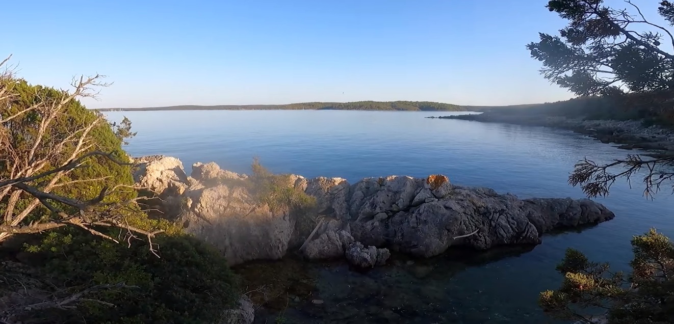
Tucked beneath the slopes of Cres, Luka Pod Sv. Križ feels less like a destination and more like a quiet pause along the coastline — a place where the sea settles, cliffs hold the wind at bay, and time softens around the boat. Sheltered in parts yet exposed in others, it rewards careful anchoring with a rare sense of stillness, broken only by distant swell and the muted rhythm of water against stone.
South (Melici / Kolorat)
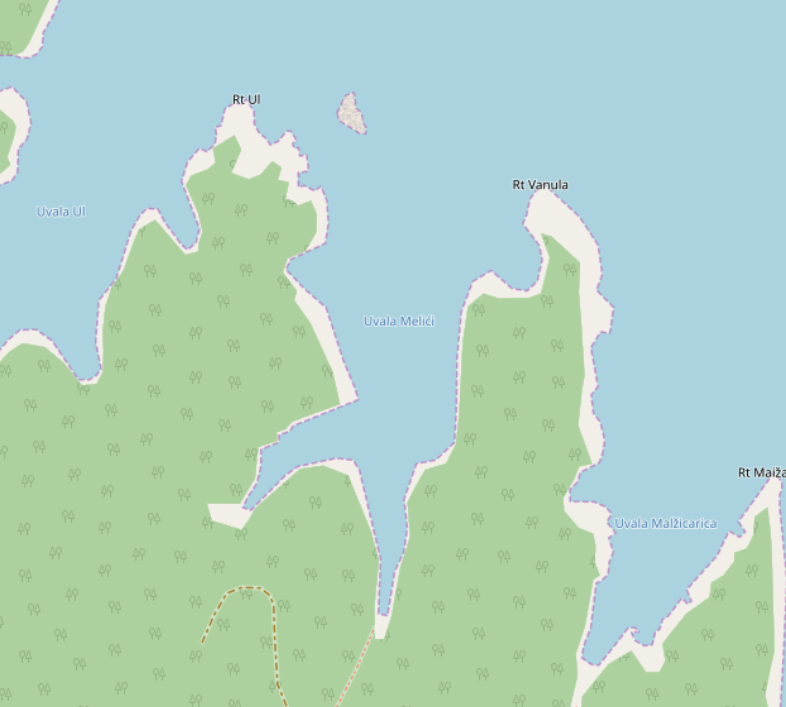
The southern arms of Luka Pod Sv. Križ form a wide, forgiving anchorage area — flexible, spacious, and almost always offering a workable option. When the buoy field at Kolorat filled up early in the afternoon, we simply moved deeper into the system and found better conditions.
In Uvala Melici, the anchor set immediately and held without issue. Plenty of room to swing, even with other boats around. The bay tolerates multiple setups — deeper draft yachts outside, shallower boats pushing further into side arms.
However, the protection is not absolute: once the wind shifted northerly, a noticeable swell built up. Not dangerous — but uncomfortable enough to leave. This bay rewards attention to wind shifts.
- Shelter: very good overall; choose sub-bay depending on wind
- Bottom: good holding; anchor sets reliably
- Depth impression: moderate; shallower further inside
- Nice to know: large area with multiple fallback options; buoy field fills early
- Watch out for: swell when wind shifts to north; limited comfort despite apparent shelter
In calmer conditions — especially in autumn — the bay becomes almost unnaturally still. One of those rare places where anchoring feels effortless.
Impressions
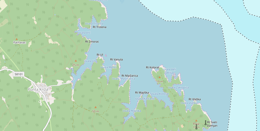
North (Trstena)
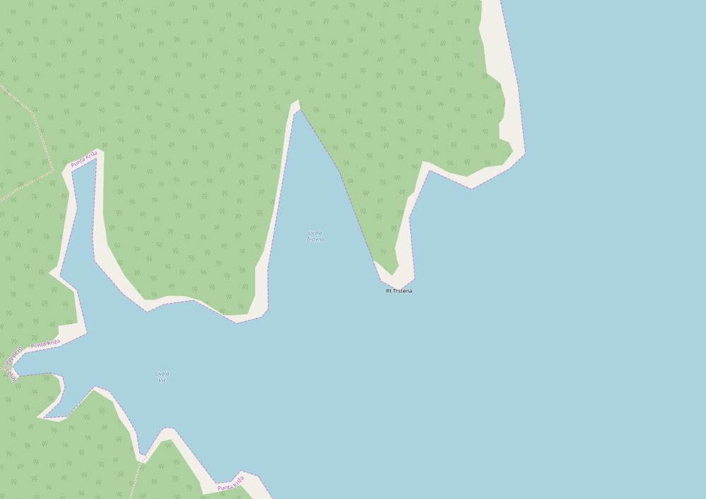
The northern end of the bay is a different beast: tighter, more technical, and far less forgiving. With limited space and increasing depth, anchoring becomes a matter of precision rather than routine.
Our anchor refused to hold on the first attempts — depth, scattered weed, and position working against us. The solution: stern-to with a line ashore. Improvised, slightly chaotic, but ultimately effective.
Once secured, the night was calm and quiet — though waves hitting the stern made their presence known. A classic trade-off: security versus comfort.
- Shelter: very good once secured; exposed stern-to depending on setup
- Bottom: mixed with weed; unreliable for pure anchoring
- Depth impression: quickly increasing; limited anchoring zone
- Nice to know: ideal for practicing stern line manoeuvres
- Watch out for: submerged rocks and razor-sharp shallows on approach; tricky holding conditions
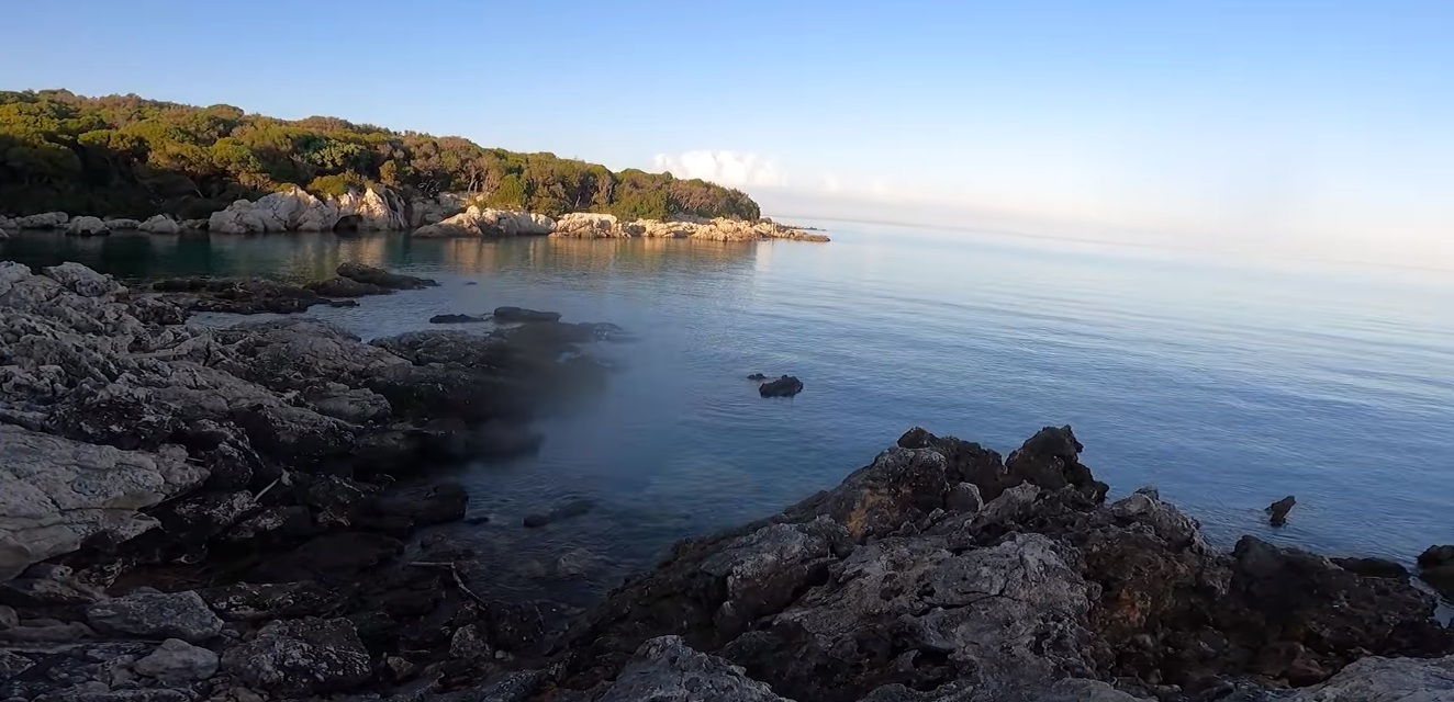
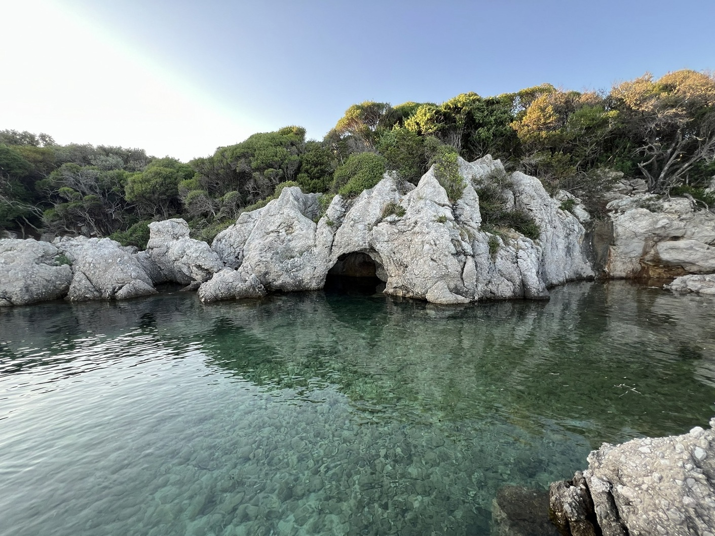
The surrounding landscape adds a quieter layer: dense vegetation, wildlife (red deer reported), and hidden coastal features — including a small sea cave that invites curiosity, but not necessarily entry.
Impressions

Impressions (little exploration walk)
Natprisliga (Kakan)
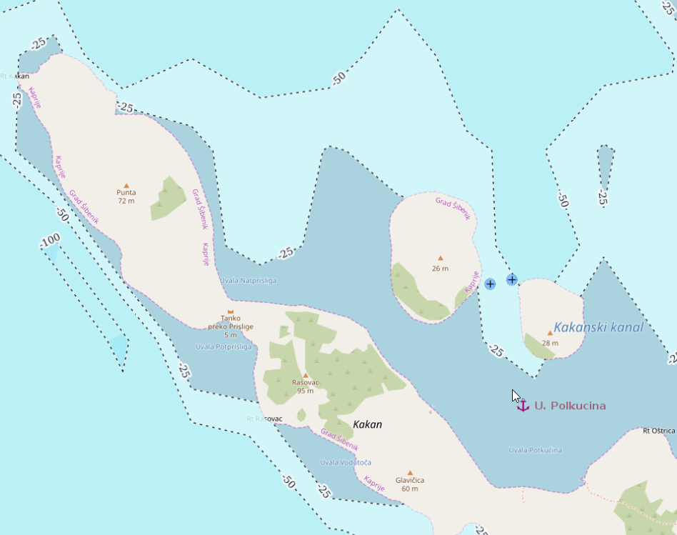
A low, unassuming inlet on the northern side of Kakan — less a destination than a temporary refuge. After building sea and an increasingly uncomfortable crew situation, it offered just enough relief to pause, regroup, and let things settle. Not a place to linger, but useful when conditions demand a break.
- Shelter: noticeably calmer than outside; partial protection from open sea
- Bottom: mixed with poor holding; anchor unreliable
- Depth impression: moderate, fairly even
- Nice to know: good as a quick stop to recover from swell or seasickness
- Watch out for: anchor dragging; limited trust in holding; not suited for longer stays
Impressions
Nečujam (Šolta)

A wide, forgiving bay that looks almost too easy — and mostly is. Nečujam offers a whole collection of small side coves, each with decent anchoring conditions, making it a convenient playground for maneuvers or a relaxed daytime stop. We used it twice: once in April 2021 for training and a quick stop, and again in August 2024 for what it does best — swimming, drifting, and doing absolutely nothing of consequence. That said: in summer, the place fills up quickly, and spatial awareness becomes a social skill. At one point, another boat dropped anchor almost directly above ours — harmless in calm conditions, but mildly nerve-wracking if you actually plan to leave.
- Shelter: generally well protected inside; open towards the entrance of the bay
- Bottom: mostly sand, patches of seagrass; holding generally reliable
- Depth impression: gently sloping, plenty of room in most areas
- Nice to know: multiple side coves with good anchoring options; ideal for training or short stops
- Watch out for: heavy traffic in high season; boats anchoring too close; limited swing room when crowded
April had teeth — cold water, empty bay, and the kind of quiet that makes you jump in anyway just to prove a point. August, by contrast, was all blue water and leisure. Same place, entirely different mood.
Impressions
Obinuš/Binjuš
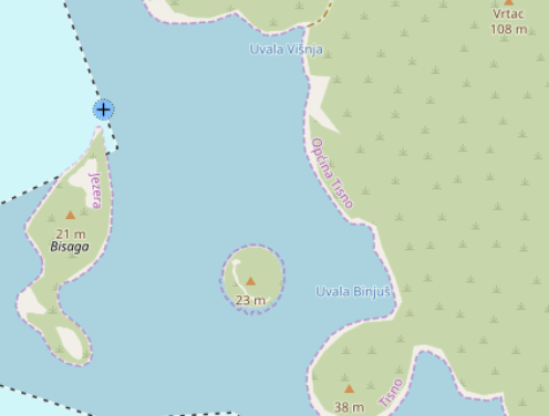
Not a place you’d circle in red on the chart — but one you quietly remember. Obinuš is a straightforward anchorage that does exactly what it promises: it holds. No theatrics, no hidden charm — just a solid overnight option when you need one. During our stay in June 2023, the anchor set immediately and stayed put without any drama. Conditions were calm, and the bay delivered a restful, uneventful night — sometimes the highest compliment you can give.
- Shelter: good protection from most directions; exposed to NW and SW
- Bottom: sand / mixed; reliable holding
- Depth impression: moderate, easy to read
- Nice to know: uncomplicated anchoring; suitable as a fallback or transit stop
- Watch out for: swell building with NW or SW winds
No drama, no story to tell — which, at sea, is often exactly what you were hoping for.
Partljug (Ugljan)
A deceptively attractive bay — Partljug looks inviting at first glance, and to be fair, it delivers: good holding, calm water, and a certain quiet charm. But geometry is destiny here. The bay is long, narrow, and tight. With depths of roughly 4–8 meters, a proper swinging circle quickly exceeds what the bay can comfortably offer. The textbook five-times-depth rule becomes… aspirational.
We stopped here in October 2024 for a short break — and, notably, executed our first successful anchoring under sail alone. It worked beautifully — but the limited space makes precision less of a virtue and more of a necessity.
- Shelter: visually sheltered, but limited real wind protection due to low terrain and sparse vegetation
- Bottom: good holding; anchor sets reliably
- Depth impression: 4–8 m, fairly even
- Nice to know: excellent for a controlled anchoring practice or short stop
- Watch out for: restricted swinging room; bay width often < 50 m — keep your swing radius in check
A good bay — as long as you don’t ask too much of it. For lunch: perfect. For the night: only if you enjoy doing geometry in your sleep.
Podgaj
A bay that looks more promising than it actually is. Podgaj offers only limited protection — mainly from NW through S — and even that feels half-hearted due to the low, sparsely vegetated terrain. Wind has little to slow it down here.
The real issue, however, lies below: a thin layer of sand over rock plates. Despite several attempts, our anchor simply refused to set properly. In completely calm conditions, hanging on chain weight alone might suffice — but with a forecast of wind shifting from E to S/SW, this quickly crossed from “imperfect” into “unacceptable”. We decided to leave.
- Shelter: limited; partial protection NW–S, exposed otherwise
- Bottom: rock with thin sand cover; unreliable holding
- Depth impression: moderate
- Nice to know: could work in flat calm for a very short stop
- Watch out for: poor holding; shifting winds; shallow patches and rocks beyond marked areas
Not every bay wants you to stay — and this one makes that clear rather quickly.
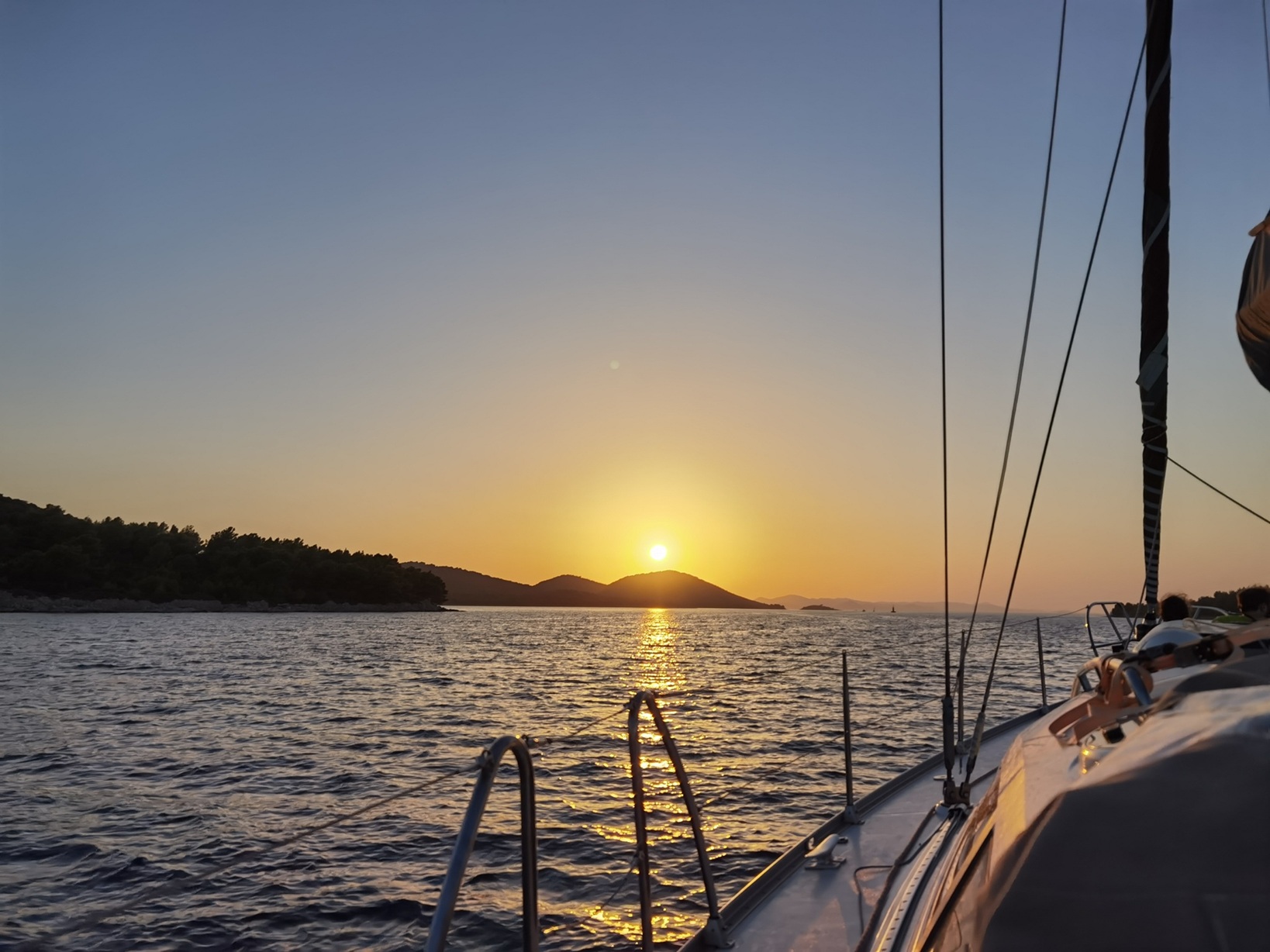
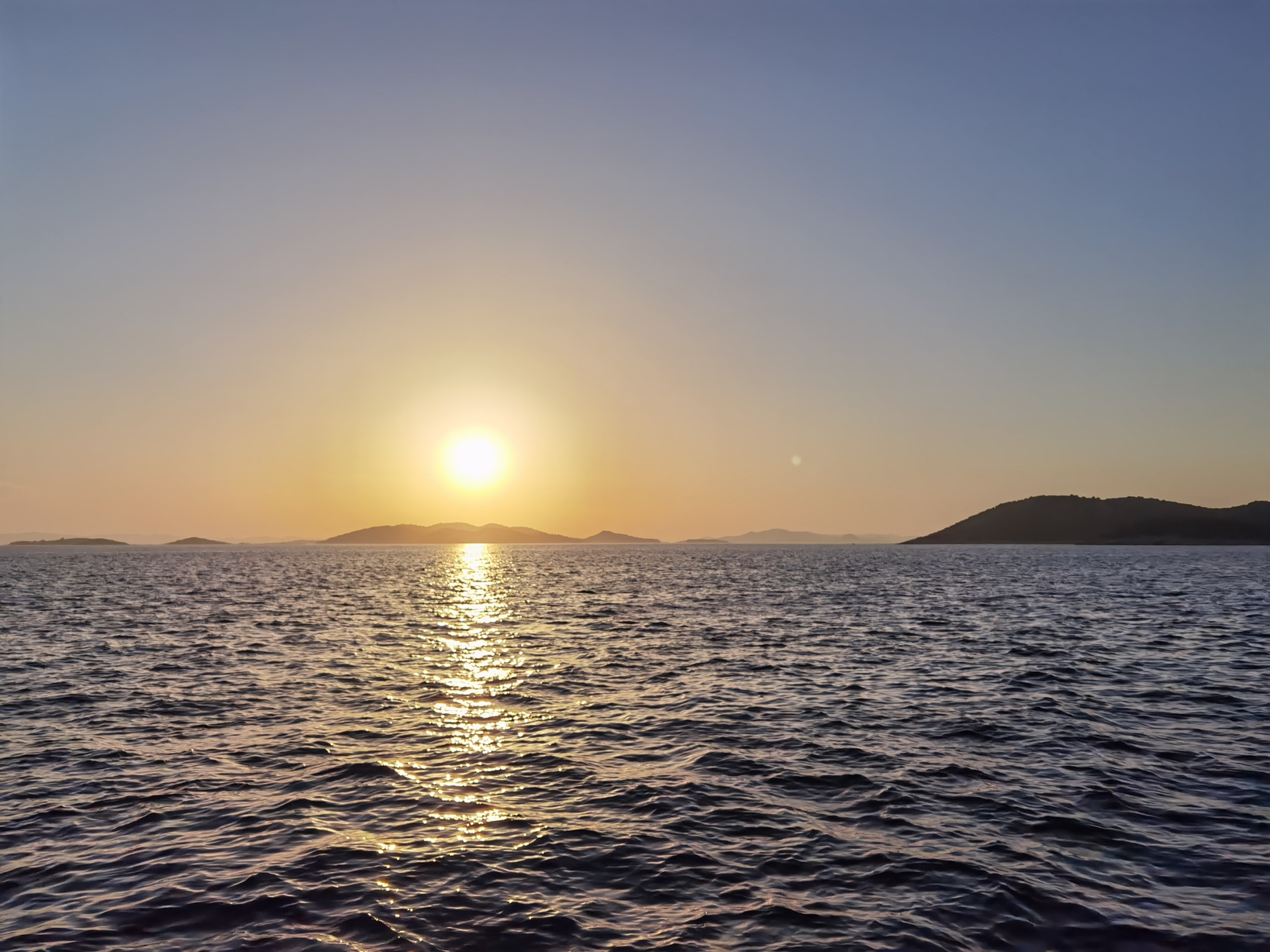
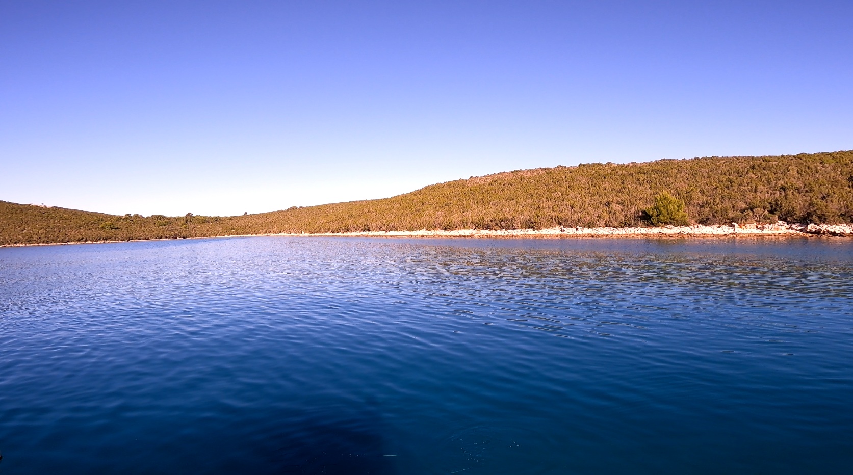
Podgarbe/Zagračina (Molat)
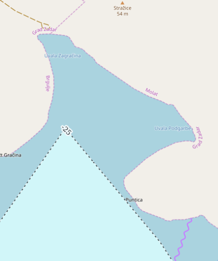
Podgarbe looks generous at first glance: a broad, quiet bay with enough room to breathe and apparently decent depths for anchoring. In practice, however, it proved far more stubborn than welcoming.
The main issue was not space in the abstract, but getting the anchor to hold on a predominantly rocky bottom. We struggled repeatedly. First we tried the eastern end of the bay, without success. Later, fresh attempts in the northern part finally bit — but there the presence of another yacht made the setup too tight, and we ended up feeling uncomfortably close to shore.
So back east we went, once again. By then it was already dark, and as every sailor learns sooner or later, distance estimates to shore at night are treacherous little liars. The seabed profile did not help either: it shelves gently at first, then falls away more decisively, making it annoyingly difficult to find the right compromise between depth, swing circle, and peace of mind — especially with a wind shift forecast for the night.
In the end, we did stay overnight, but this was not one of those effortless anchorages. It was the sort of place where the boat may rest, yet the skipper’s mind continues pacing the deck long after dark.
- Shelter: visually open and spacious; comfort depends heavily on exact position and wind development
- Bottom: mostly rock slabs; difficult holding
- Depth impression: initially moderate, then dropping away more quickly
- Nice to know: broad bay with several possible anchoring zones
- Watch out for: deceptive night distances to shore, limited confidence in holding, swing-circle planning becomes important fast
A bay with room, yes — but not with generosity. Here, the real challenge is persuading stone to behave like ground tackle.
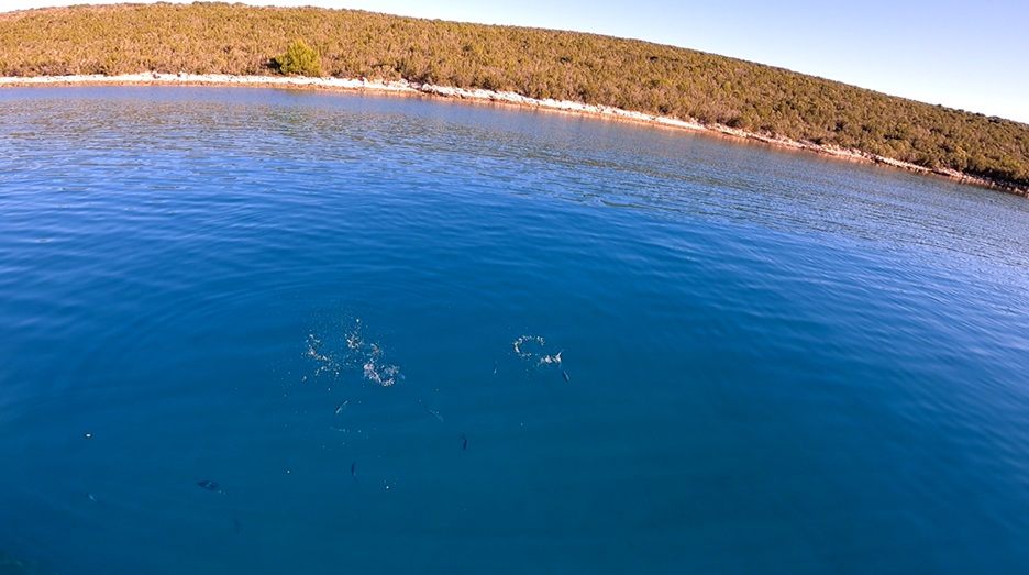
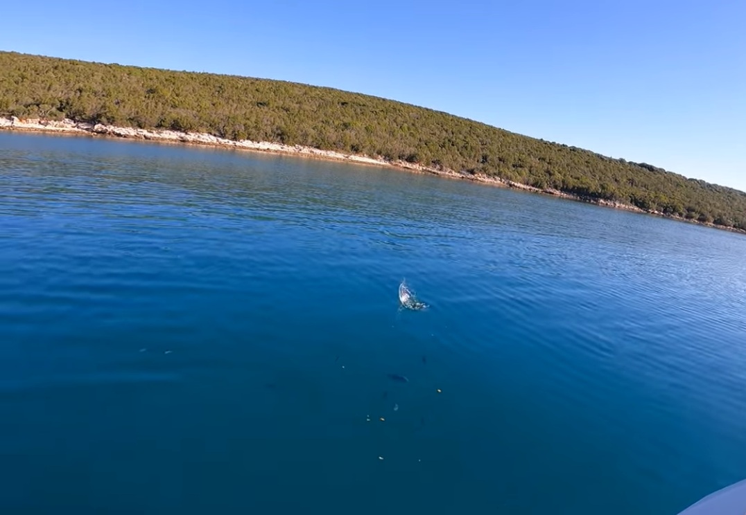
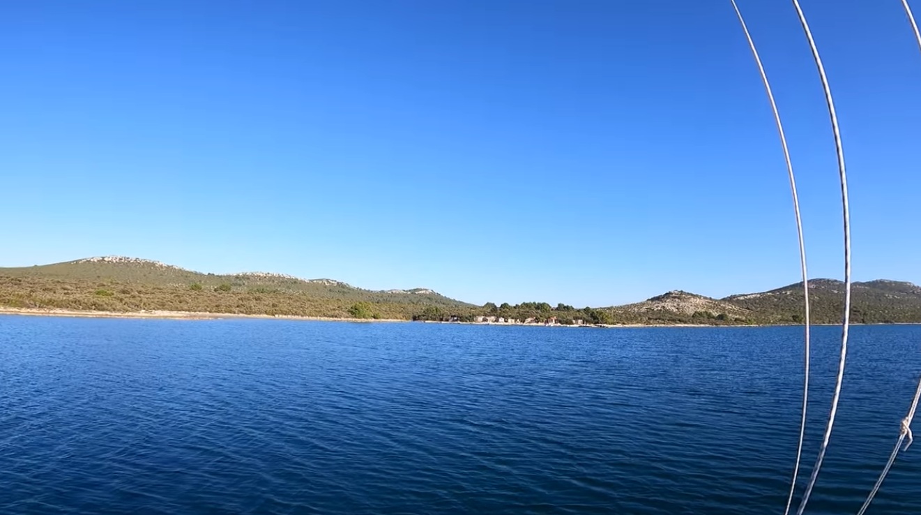
Rogačić (Vis)
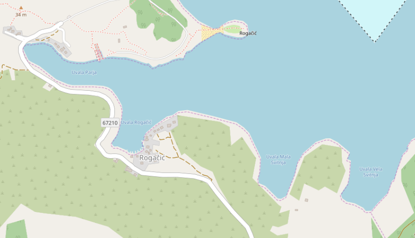
A place of quiet charm — if you arrive early enough. Rogačić is a deeply indented bay with several narrow inlets, offering a naturally sheltered feel. But that same geography quickly turns into a limitation: tight spaces and awkward depths leave little room for maneuver once boats start filling in.
We came here as a fallback after Vis town was completely full. Arrival was late in the day, and with light westerly winds forecast, continuing to Komiža no longer felt like a prudent option. Unfortunately, Rogačić had already reached its practical capacity — the better spots were taken, and what remained felt more like compromise than seamanship.
According to the pilot, mooring at the bunker entrance is not advised. Setting a proper landline would have been the logical alternative, but at dusk, without prior experience, that was a line we chose not to cross.
The seabed itself appears reasonably reliable (sand / gravel), and in less crowded conditions this could well be a beautiful and calm anchorage. For us, however, it was a case of “almost” — and almost is rarely enough at anchor.
- Shelter: good overall, especially in the inner inlets
- Bottom: sand / gravel; generally good holding
- Depth impression: uneven; narrow areas with limited swinging room
- Nice to know: scenic, quiet outside peak times; bunker tunnel as a notable landmark
- Watch out for: congestion in high season; restricted space; no mooring at bunker; landlines often required
Come early, or not at all — Rogačić rewards timing more than persistence.
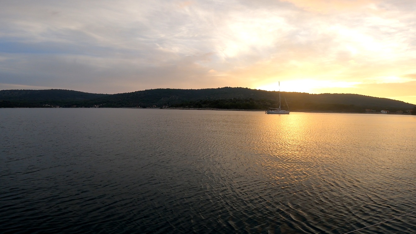
Sabuni (Žut)
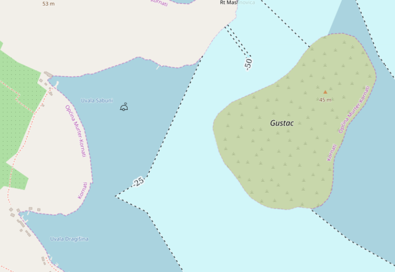
One of those anchorages where everything simply falls into place. We dropped the hook — and it set immediately. The holding was excellent, depths comfortable, and the overall setup inspired confidence from the very first moment.
Sabuni offers protection from almost all directions, with land wrapping around the bay in a way that keeps both wind and swell remarkably well at bay. The only caveat: a gap to the northwest where terrain opens up. In certain conditions, this could create a funneling effect with locally increased wind — something to keep in mind rather than fear.
The evening invited exploration: we climbed the small island Gustac (approx. 45 m) opposite the anchorage — a short ascent rewarded with a wide, quiet view over the Kornati landscape. Add a cool drink, and the day completes itself.
The night that followed was as calm as one could wish for. No movement, no second thoughts — just that rare, complete sense of being exactly where you should be.
- Shelter: excellent in most directions; minor exposure NW (possible funneling)
- Bottom: sand / mixed; very good holding
- Depth impression: comfortable anchoring depths
- Nice to know: climb Gustac for panoramic views; great swimming spot
- Watch out for: potential gusts from NW through terrain gap
Even in October, someone still jumped in for a swim — which says more about the place than any pilot ever could.
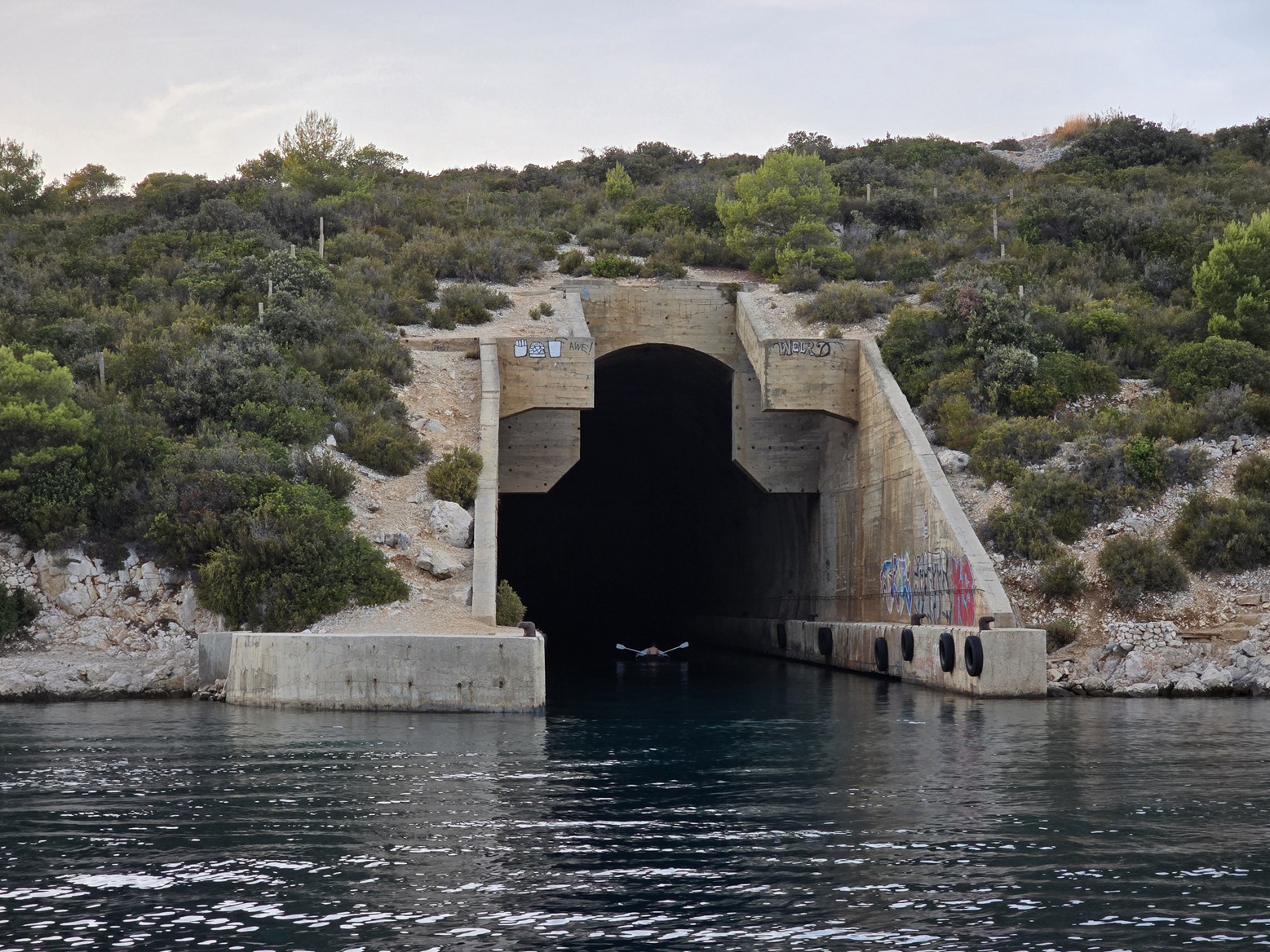
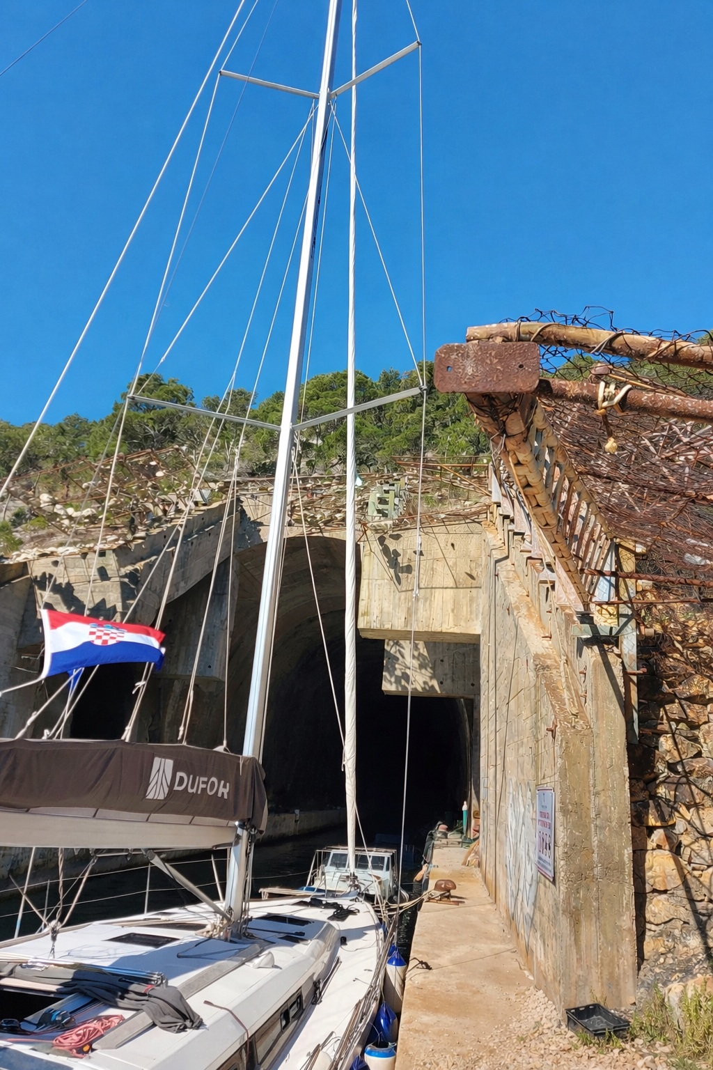
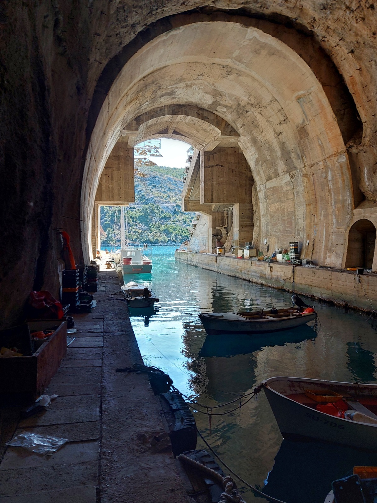
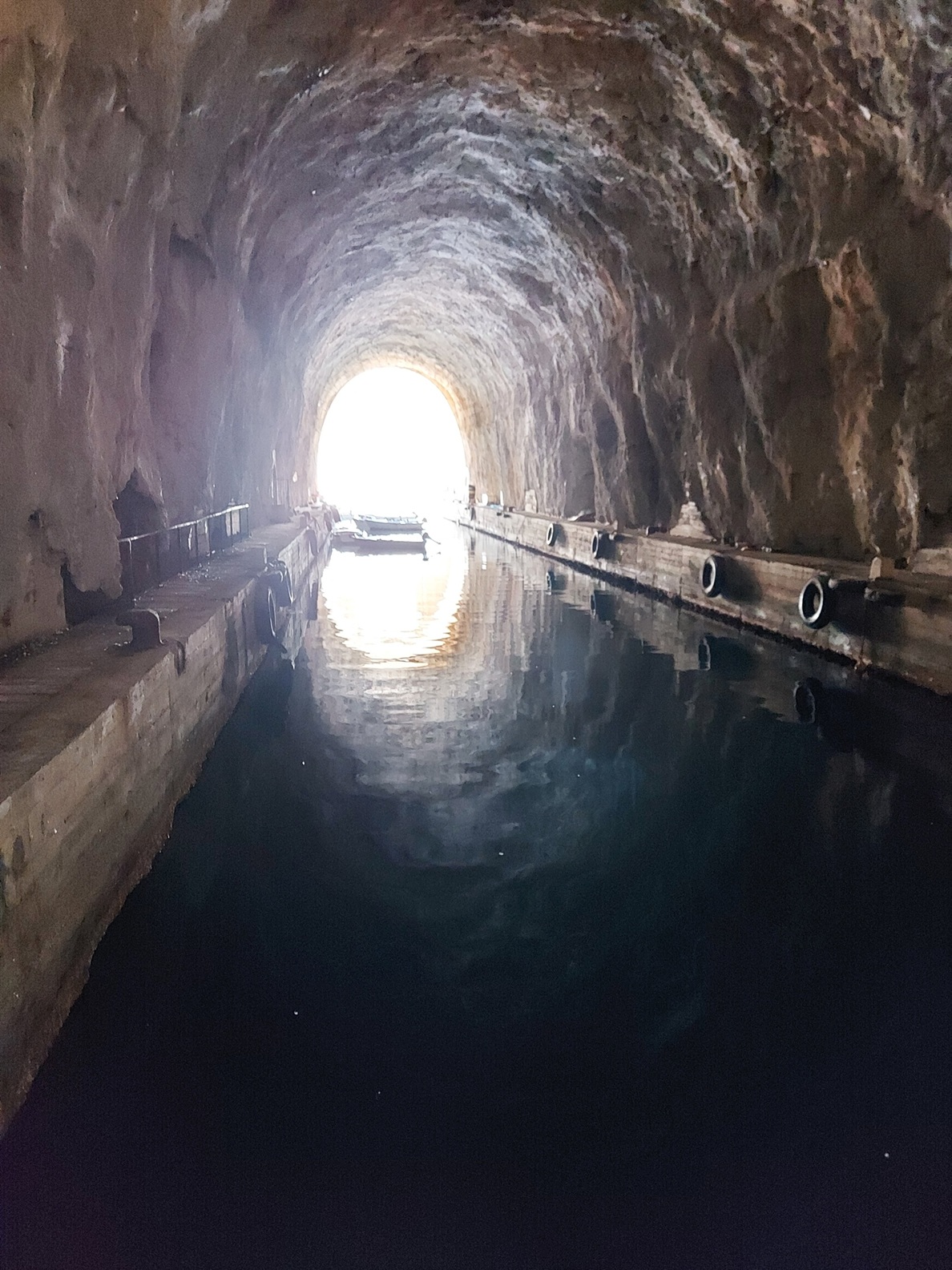
Smrka (Brač)
A striking place — visually impressive, nautically ambivalent. Smrka is defined by its former military bunker, carved deep into the rock — a surreal, almost cathedral-like structure that invites exploration more than it offers shelter.
We used the spot primarily for mooring practice alongside the bunker and to explore the surroundings. For that purpose, it is excellent: calm water, dramatic scenery, and plenty of room to experiment — at least outside peak activity.
Despite being marked as an anchorage in pilot books, the reality is less inviting: depths of up to 10 m extend far into the bay, making it difficult to find suitable holding ground for a typical cruising yacht. Additionally, charts indicate fishing installations and even nets at around 20 m depth, which further complicate anchor placement.
Staying alongside the bunker overnight is, realistically, not a great idea. Local fishing activity appears to use the structure, and occupying the space with a yacht risks unwanted friction — something best avoided in small, working bays.
If one were to stay overnight at all, a stern-to with anchor and landline might be the only defensible setup. Free anchoring, however, cannot be recommended for a sailing yacht.
- Shelter: visually enclosed, but functionally limited
- Bottom: unclear; depth and obstacles reduce usability
- Depth impression: deep (≈10 m far into the bay)
- Nice to know: impressive submarine bunker; ideal for maneuver training and short visits
- Watch out for: fishing nets (~20 m), local boat traffic, limited anchoring options, potential conflict when mooring at bunker
Come for the curiosity, stay for the practice — but don’t mistake it for a comfortable anchorage.
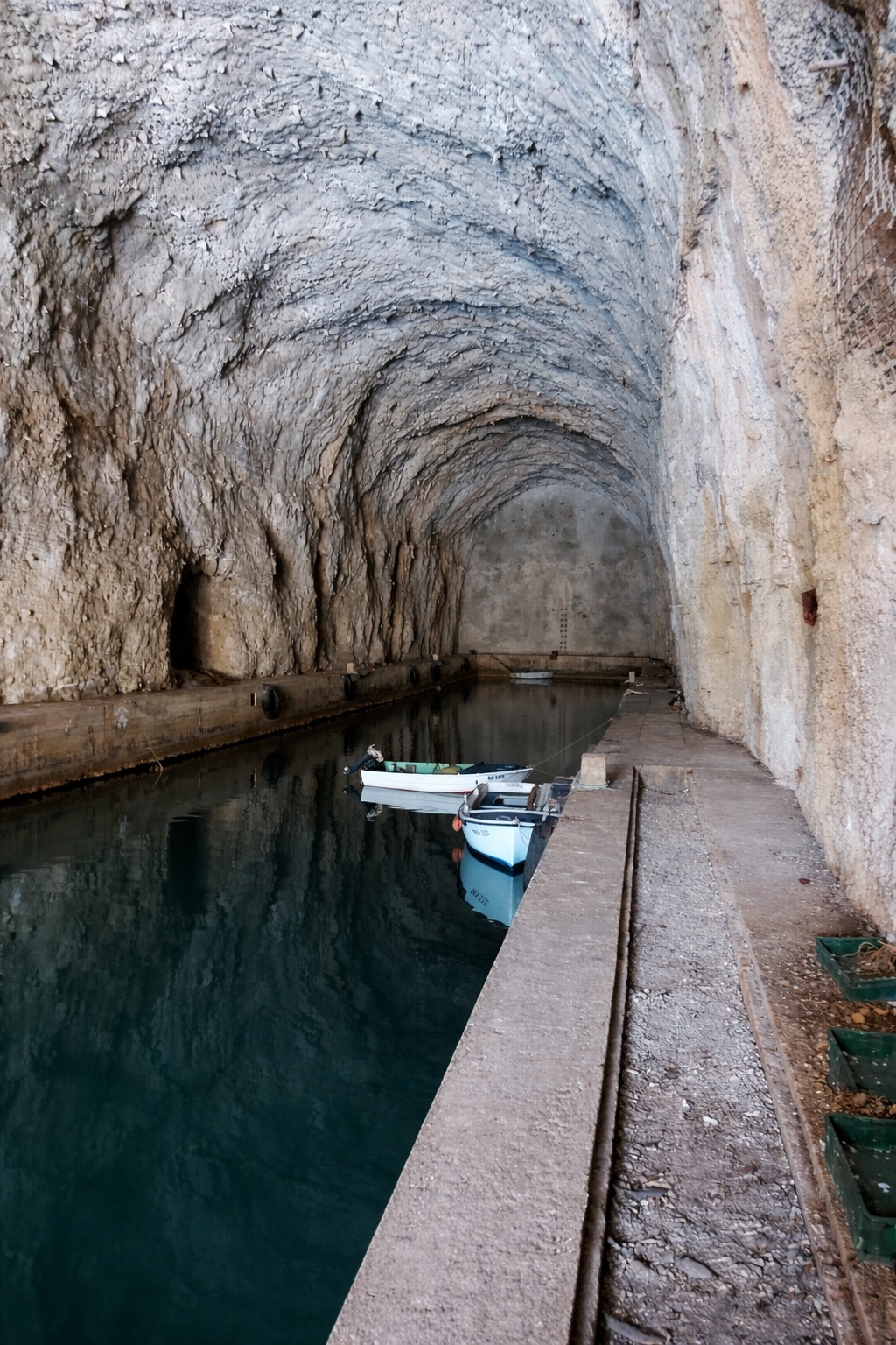
Sobra (Mljet)
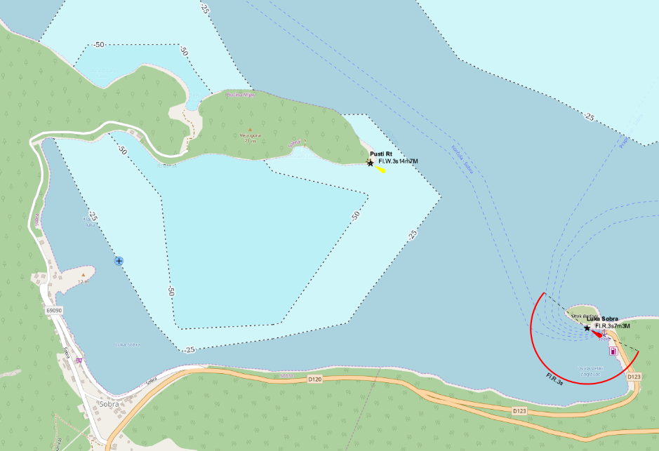
A grand natural harbor — less an anchorage than a piece of landscape. Sobra stretches deep into the island of Mljet, surrounded by steep, green slopes that make the entire bay feel enclosed, almost fjord-like.
We stayed at the ferry pier in the far western end, moored alongside in a small raft. The night was calm, unhurried — even a quiet breakfast was possible before the first ferries announced the return of reality.
This is not a classical anchorage experience: we did not anchor, and given the visual impression and charted depths, it seems unlikely that the bay is particularly suitable for it. Deep water extends far into the bay, limiting practical anchoring options for cruising yachts.
The bay itself offers excellent shelter in virtually all conditions, but that safety comes at a price: infrastructure and traffic — especially ferry movements — define how and where you can realistically stay.
In the eastern part near the village of Sobra, there are additional berthing options, though we did not use them.
- Shelter: excellent; enclosed bay with protection from all directions
- Bottom: unknown; anchoring not attempted
- Depth impression: deep throughout large parts of the bay
- Nice to know: ferry pier usable off-season; dramatic, fjord-like scenery
- Watch out for: ferry traffic; limited anchoring feasibility; infrastructure-dependent stay
Beautiful to behold, easy to stay — as long as you play by the rhythm of the ferries.
Soline (Pašman)
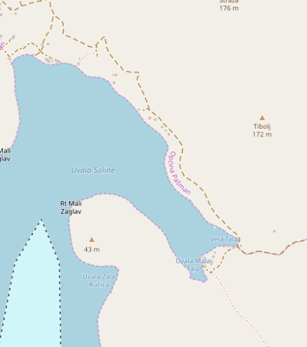
A well-organized bay — and that is both its strength and its limitation. Soline offers a wide, gently opening basin with calm water and a reassuring sense of enclosure. On paper, it looks like a textbook anchorage. In reality, it is firmly in the hands of buoy fields.
We picked up a mooring buoy in the northwestern corner, where things felt slightly more relaxed than in the central parts. A small but welcome bonus: waste disposal was included when paying the buoy fee — a detail one appreciates more than one admits.
Ashore, a konoba delivers exactly what you hope for: honest food, solid choice, no unnecessary theatrics.
The bay is very well protected in almost all directions. However, a gap in the northwest acts like a funnel: under certain conditions, wind can accelerate and push straight into the anchorage. Not dangerous per se — but noticeable, and worth respecting.
Depths would be ideal for anchoring, but that option is effectively off the table: anchoring is not permitted within the buoy fields, which cover most usable areas. If you insist on dropping the hook, you’ll need to move further into the adjacent bay to the northwest — about which we have no firsthand knowledge beyond its existence.
Expect company. Lots of it. Both the northern and southern buoy areas fill up reliably, and the overall atmosphere leans more toward orderly marina overflow than secluded anchorage.
- Shelter: very good overall; vulnerable to NW through valley effect
- Bottom: sand; anchoring theoretically good but practically restricted
- Depth impression: moderate, well-suited for anchoring (where allowed)
- Nice to know: waste disposal with buoy fee; good konoba ashore
- Watch out for: heavy use in season; anchoring prohibited; gusts from NW gap
If you accept the buoys, Soline works beautifully — if you seek solitude, it will politely disappoint you.
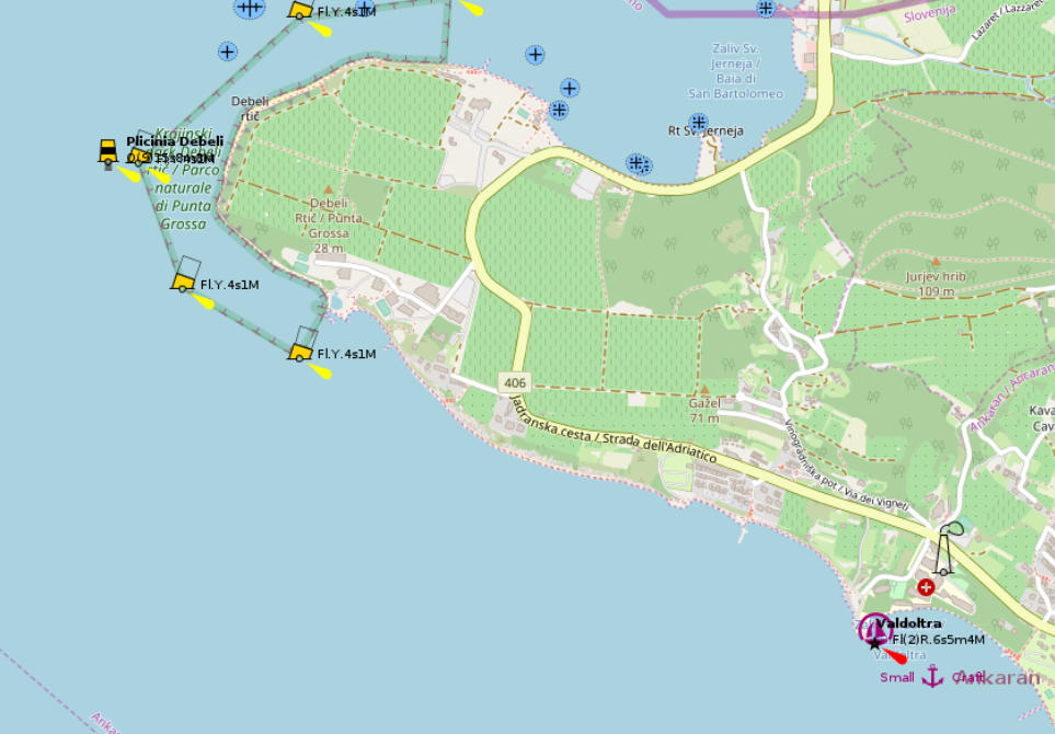
Strunjan (Slovenia)
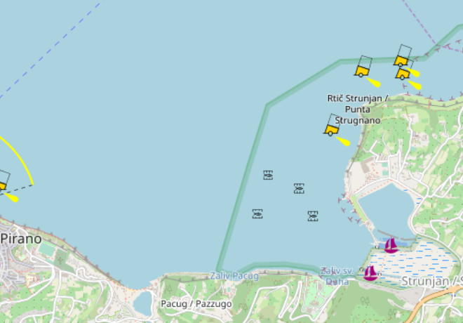
A wide, forgiving bay — with a few quiet traps for the inattentive. Strunjan opens broadly and remains very shallow across large areas, creating an anchorage that feels spacious, almost generous.
We entered at night, which adds a layer of complexity not immediately obvious by day: the bay is scattered with fish farms and special markers, some of which are poorly visible after dark. This is not the place for blind confidence on arrival.
Once settled, however, things simplify considerably. The holding is excellent, and the gently shelving depths provide a wide band of anchor-friendly water along much of the الساحline.
Protection is selective rather than absolute: the bay offers good shelter from southerly through easterly winds, but remains exposed to anything with a northern or western component.
Despite that, the sheer space and forgiving depth profile make this a remarkably beginner-friendly anchorage — provided one respects the chart and keeps a proper lookout.
- Shelter: good from S–E; exposed to N–W
- Bottom: mud / sand; very good holding
- Depth impression: shallow over wide areas; gradual slope
- Nice to know: large anchoring zone; easy setup even for less experienced crews
- Watch out for: fish farms and markers; limited visibility at night; very shallow patches
Spacious, simple, and slightly deceptive — Strunjan rewards attention more than experience.
Sunfarni (Lošinj)
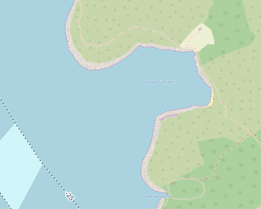
A practical refuge — not planned, but precisely what was needed. Sunfarni lies tucked under the lee of Lošinj, offering remarkably solid protection against Bora.
We arrived after a rather demanding maneuver training in strong Bora conditions, which had done its didactic duty — and its physiological one: one crew member surrendered to seasickness, making this an unplanned but necessary stop.
The bay delivers where it matters: excellent holding and generous depths, though not without variation. Even close to shore, the chart indicates around 7 meters, with deeper patches further out. In short: plenty of water — occasionally more than you might wish for.
Shelter is the defining feature here. The bay is well protected from NW through E to SW, making it a reliable option in unsettled conditions, particularly when the Bora is still setting the tone outside.
We did not stay overnight, but as a temporary anchorage or recovery stop, this place performs exceptionally well.
- Shelter: very good from NW–E–SW; excellent in Bora
- Bottom: sand / mud; very reliable holding
- Depth impression: moderate to deep; ~7 m even near shore in parts
- Nice to know: calm water even in strong offshore winds; good emergency stop
- Watch out for: varying depths; anchoring space can tighten if busy
Not a destination in itself — but a thoroughly dependable pause when the sea reminds you who is in charge.
Supetarska Draga (Rab)
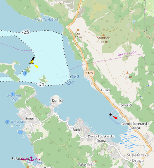
If there is such a thing as a perfect anchorage, this comes dangerously close. Supetarska Draga offers an exceptionally wide belt of ideal anchoring depths, stretching across a vast area of the bay.
Depths of roughly 3–6 meters dominate large parts, paired with a sand and fine gravel seabed where the anchor sets almost instantly — the kind of holding that inspires quiet confidence rather than constant checking.
The surrounding forested hills provide excellent protection in nearly all directions, with the notable exception of northwesterly winds, to which the main bay remains open. Conveniently, several smaller side bays offer refuge precisely in those conditions.
Infrastructure is equally forgiving: an ACI marina and numerous private jetties and moorings provide fallback options if anchoring space becomes scarce — which, given the size of the bay, is rarely a pressing concern.
One caveat, however, deserves respect: winds from southerly directions can be significantly accelerated by local terrain, creating a noticeable funneling effect. The sea may stay relatively flat, but the wind itself can turn unexpectedly forceful — uncomfortable rather than dangerous, but worth anticipating.
- Shelter: very good in most directions; exposed to NW; strong S winds possible (funneling)
- Bottom: sand / gravel; excellent holding
- Depth impression: large areas with 3–6 m; very anchor-friendly profile
- Nice to know: huge anchoring area; alternatives via marina and private jetties; protected side bays
- Watch out for: NW exposure in main bay; gusty southerlies due to terrain effects
Few places combine space, holding, and shelter this effortlessly — a rare, almost unfair advantage.
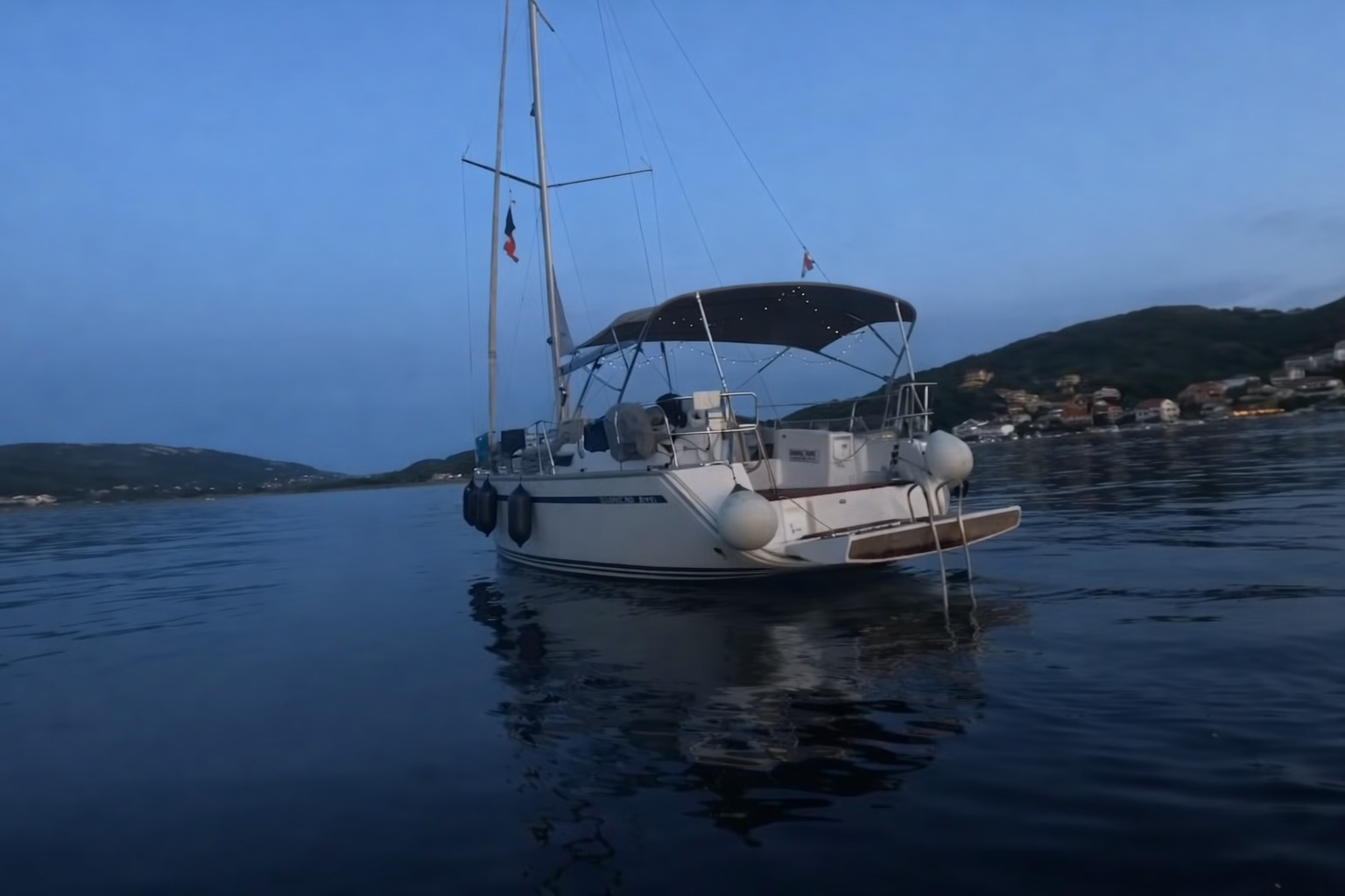
Sveti Grgur (Main Bay)
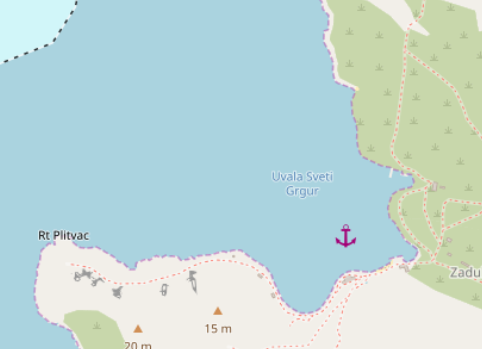
A wide, quiet bay with an atmosphere that is hard to place — somewhere between calm refuge and open-air relic. The approach is straightforward, the space generous, and the depths are ideal for anchoring across large parts of the bay.
The anchor set immediately on first attempt, suggesting a reliable seabed of sand and gravel. There is ample room to swing, and even with multiple boats, the bay rarely feels constrained.
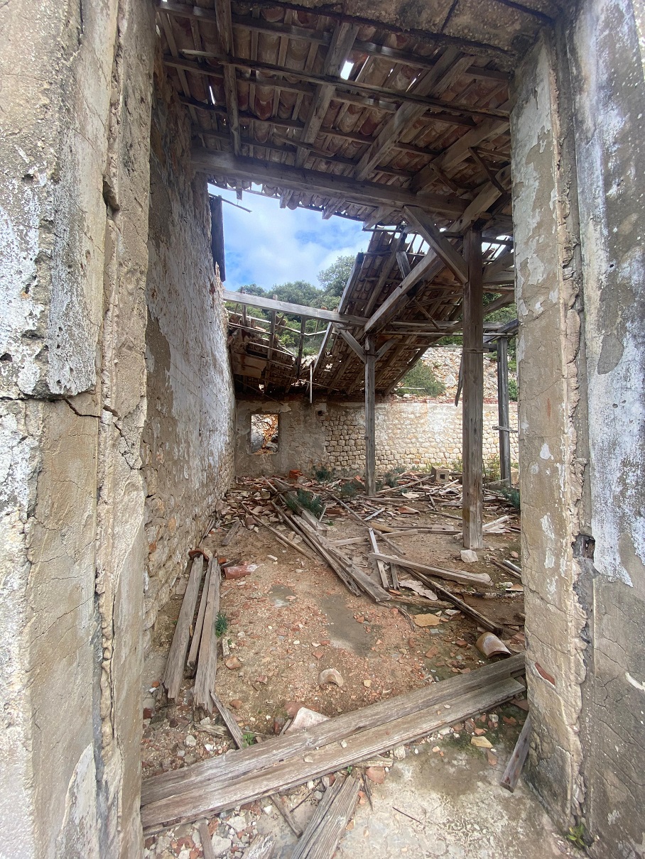
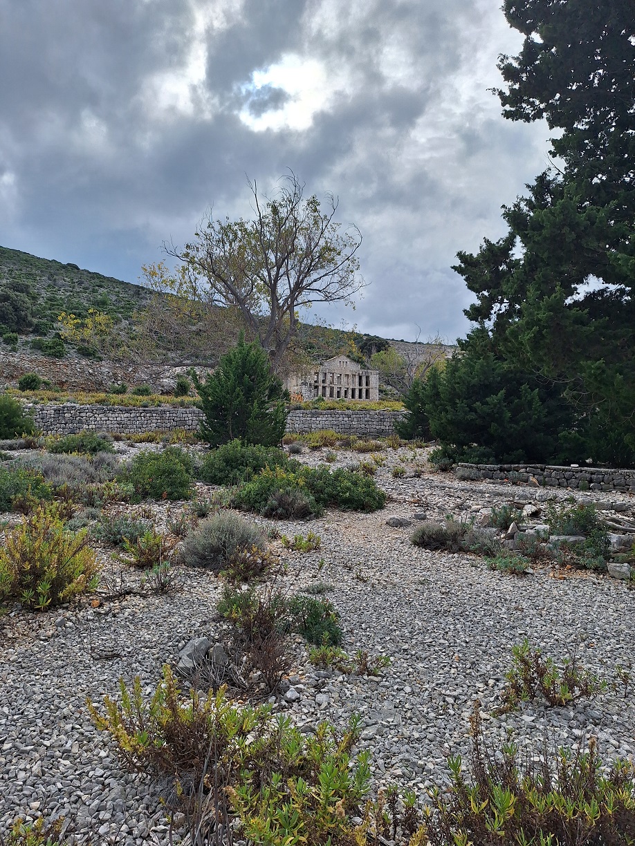
What defines this place, however, is not seamanship but history: Sveti Grgur once served as a women’s political prison during Yugoslav times, closely linked to the infamous camp on nearby Goli Otok. Today, the remains are abandoned and slowly decaying — roofs collapsed, walls open to the sky, nature reclaiming what ideology once imposed.
Walking ashore feels almost intrusive: scattered ruins, overgrown paths, and a silence that is not quite peaceful. And yet, the surrounding landscape — pine trees, low shrubs, and clear water — offers a stark, almost unsettling contrast.
- Shelter: generally good; open to certain directions depending on position in bay
- Bottom: sand / gravel; very reliable holding
- Depth impression: well-suited for anchoring across a wide area
- Nice to know: direct access to historic ruins; quiet, rarely crowded
- Watch out for: exposed feel in stronger winds; no infrastructure; uneven remains ashore
A place that holds your anchor without question — and your thoughts a little longer than expected.
Impressions
Impressions (inland exploration)
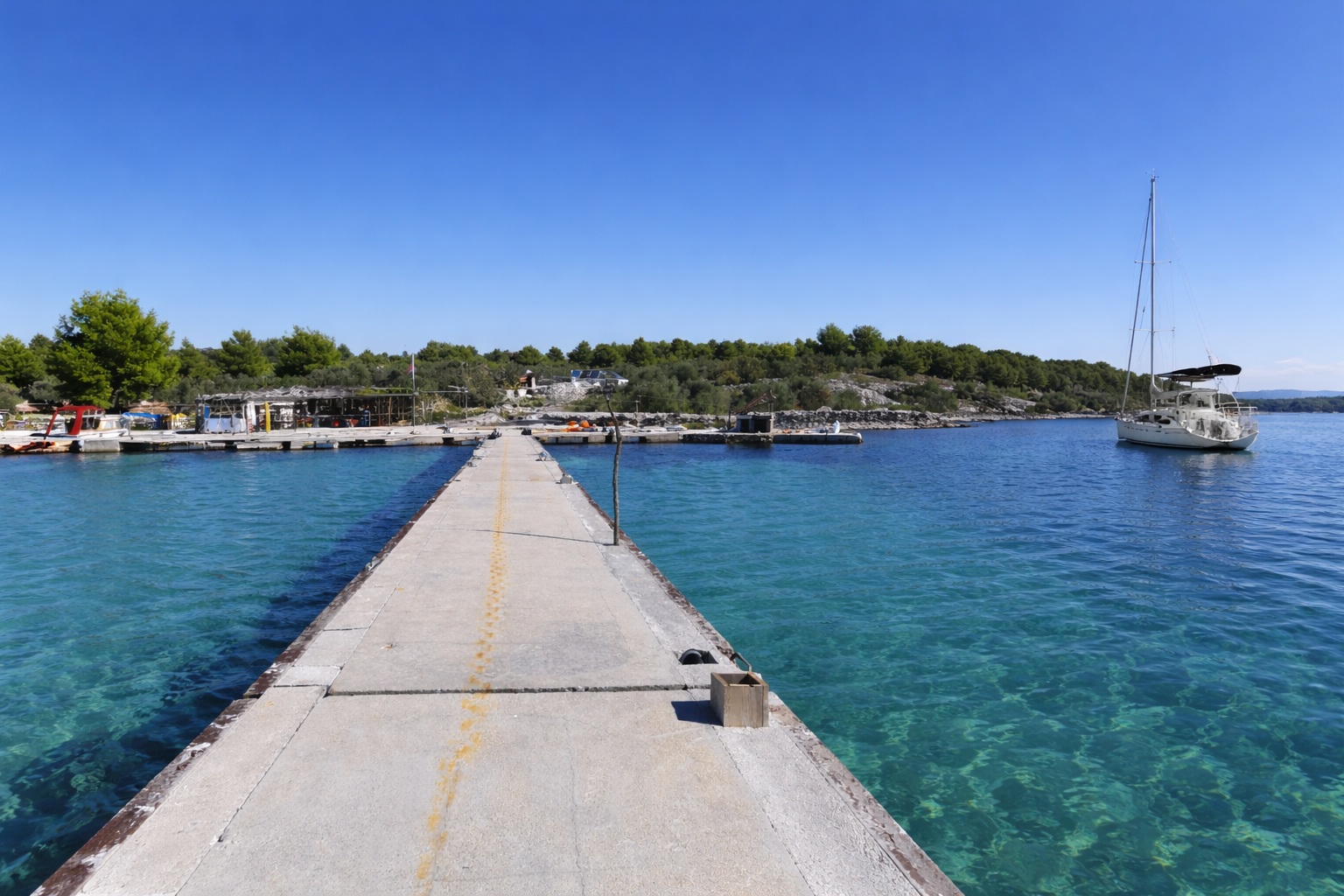
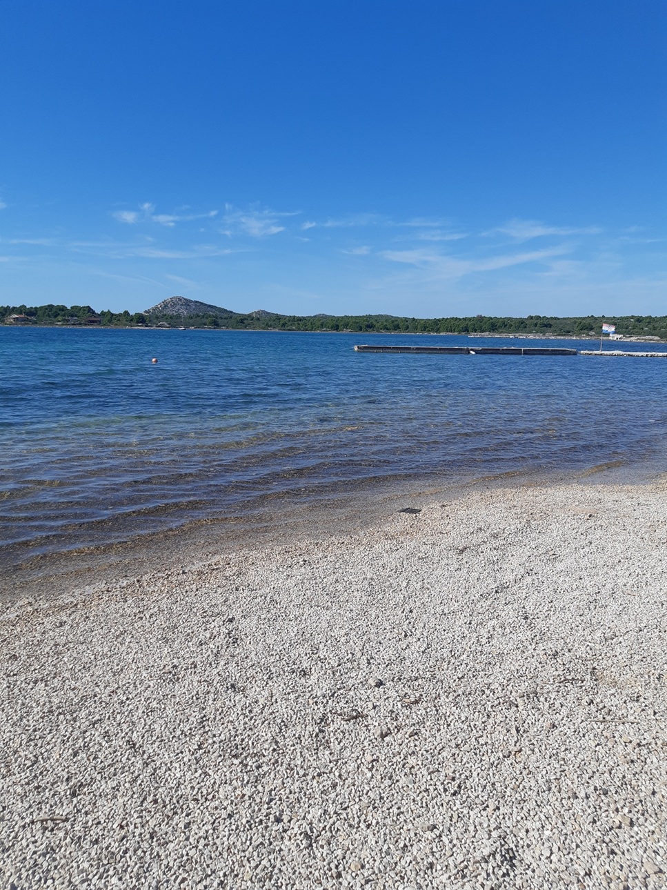
Vela Luka
Vela Luka / Mala Luka is a broad, very shallow anchoring area that feels open, easy to read, and forgiving — at least in calm weather. We used it as a short daytime stop for anchoring practice and lunch ashore, not as an overnight anchorage.
The bay offers a large belt of anchorable depths, with plenty of room and a generally uncomplicated layout. One thing does stand out, though: a shoal in the middle of the bay, marked in the pilot at around 1.9 m. That is not catastrophic, but for a sailing yacht it is quite enough to ruin an otherwise relaxed approach.
According to the pilot, the seabed consists of rock slabs with a thin layer of sand. Holding may therefore be less straightforward than the open shape of the bay suggests, even if the shallow water and excellent visibility make it easier to judge what is happening below. Unmarked fishing gear or traps may also be present from time to time, though in clear water they should usually be spotted in time.
There is also a small pier, but with reported depths of only about 2 m maximum, I would not assume it is suitable for a typical cruising yacht without very careful checking.
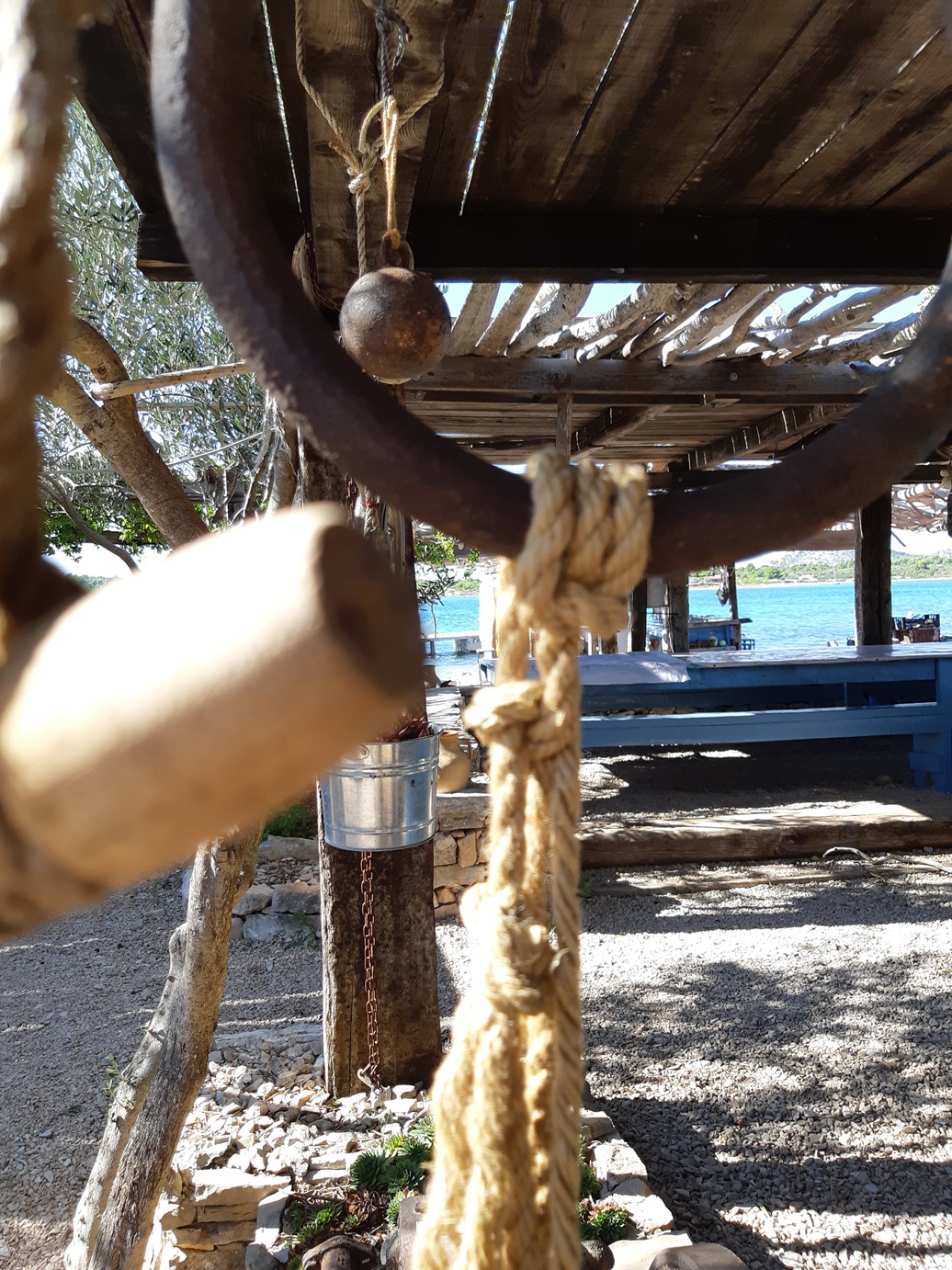
Ashore, the place has a distinctly rustic charm: a konoba with handmade maritime decoration, sun-bleached timber, nets, horns, driftwood and stone. The food during our visit in the absolute off-season was perfectly decent, though not exactly legendary.
- Shelter: probably limited; the bay is low, open and very shallow
- Bottom: rock slabs with a thin sand layer
- Depth impression: very shallow over a wide area; generally easy to anchor in daylight
- Nice to know: charming konoba ashore; clear water helps with reading the bottom
- Watch out for: 1.9 m shoal in the bay; possible unmarked fishing gear; uncertain depth at the pier
A pleasant lunch stop and training bay — broad, shallow, readable, but probably not a place I would trust for serious wind.
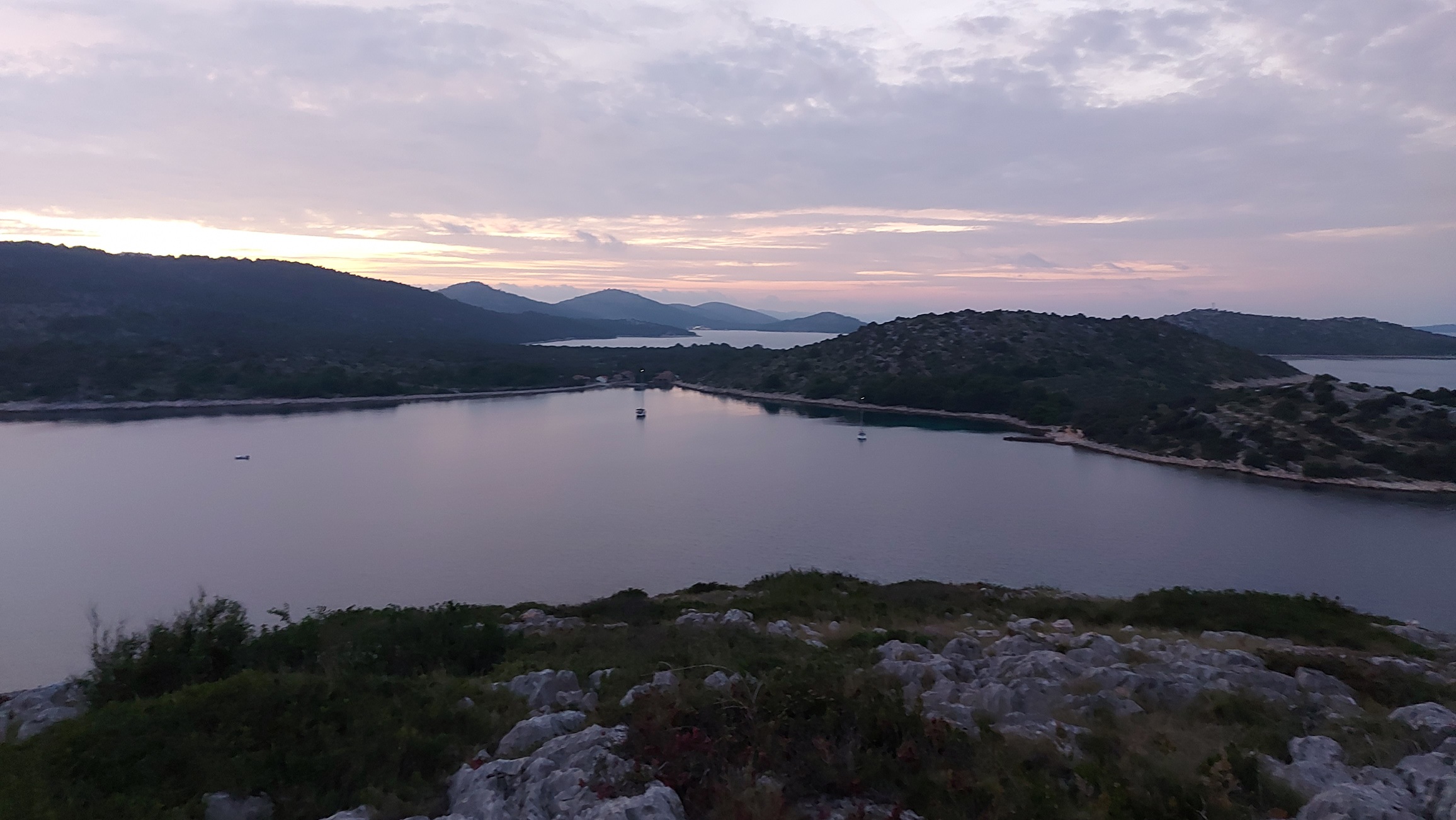
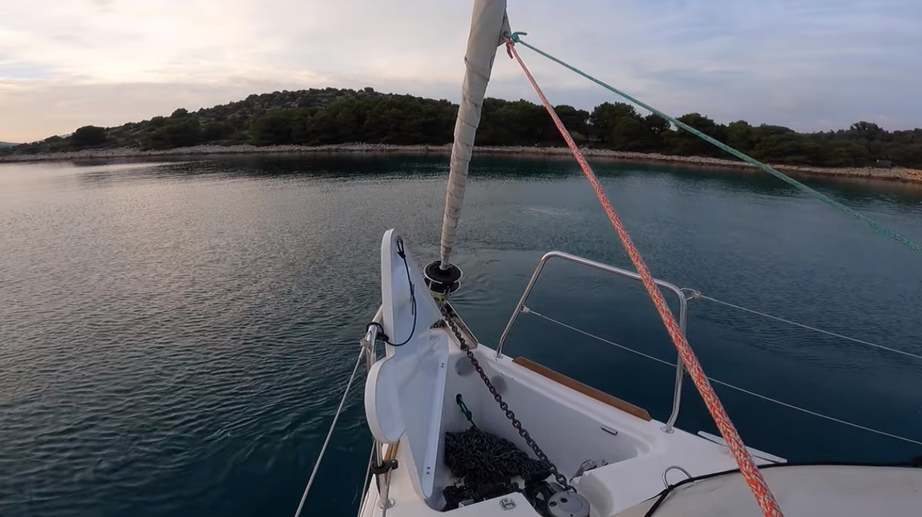
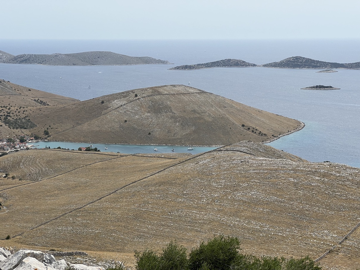
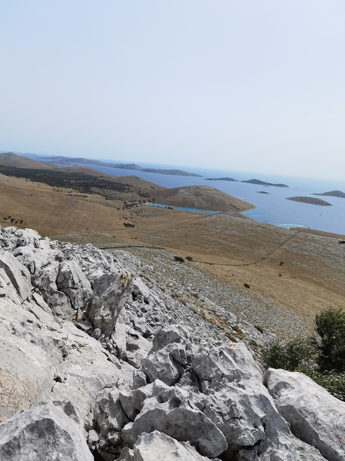
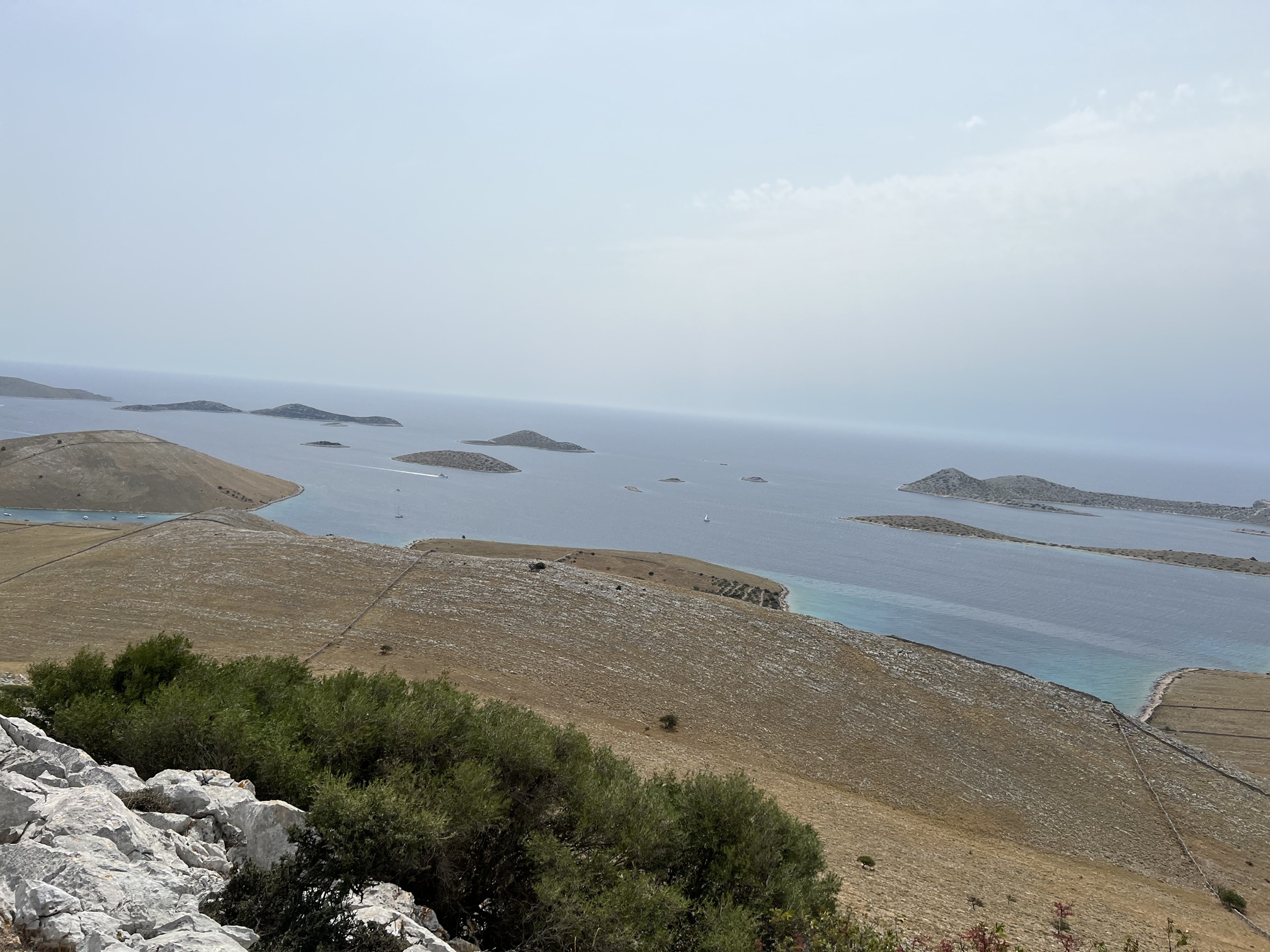
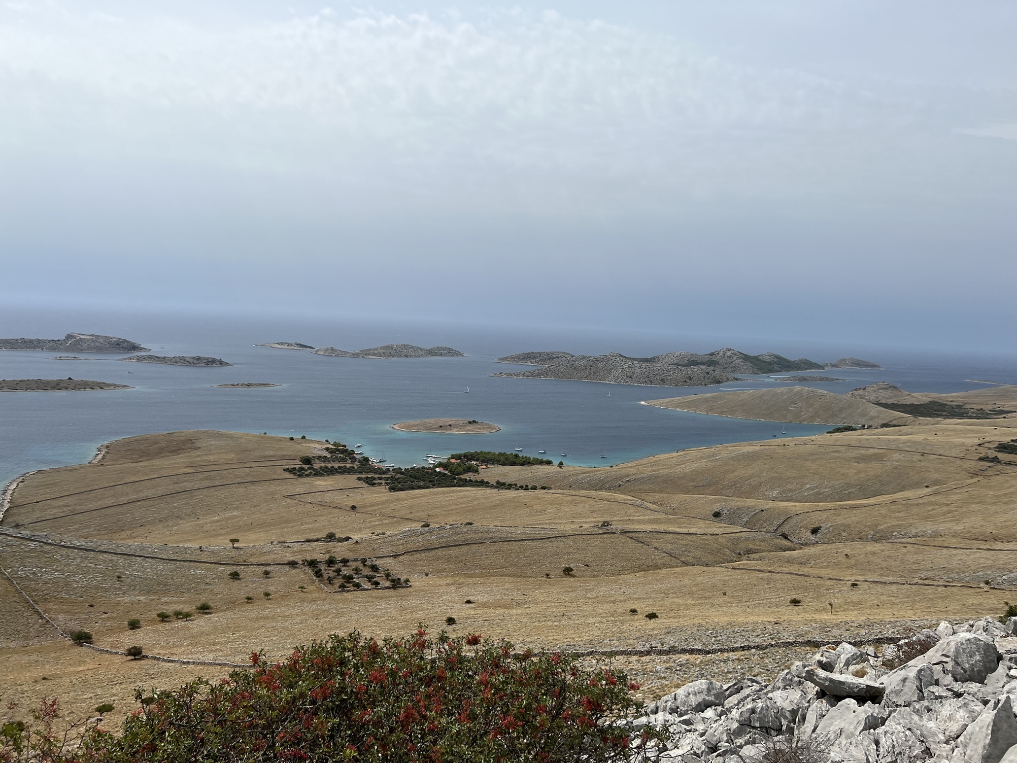
Vrulje (Kornat)

The bay itself is not especially wide; it stretches inland like a narrow tube, and much of the inner section is occupied by mooring buoys. When we arrived, no buoy was left for us, so we had to anchor outside the laid field.
That part of the bay felt more technical than comfortable: the bottom drops away fairly quickly, the holding ground is mixed, and the first attempt did not inspire confidence. There seems to be a blend of rock, sand, and gravel, with some weed in areas that are usually irrelevant for anchoring anyway. In our chosen spot, a few shallows even broke the surface, which made the whole scene feel rather less relaxed than postcard-pretty.
As one of my first more self-responsible anchorages, this place absolutely succeeded in one category: teaching paranoia. I slept badly, checked the anchor app far too often, and kept the compass practically next to my pillow. Entirely unnecessary, as it turned out: the anchor held, and there was barely any wind, wind shift, or swell to speak of.
Along the settlement there are reportedly some berths at piers, though we did not try them ourselves. A curious detail: even near the buoyed area, some boats anchored stern-to with a landline despite the obvious restriction around mooring fields — and apparently without consequences.
- Shelter: generally calm in settled weather; little swell during our stay
- Bottom: mixed rock / sand / gravel; some weed in non-anchoring areas
- Depth impression: drops off relatively quickly outside the buoy field
- Nice to know: excellent hike to the nearby hill with spectacular views
- Watch out for: crowded buoy field, visible shallows, awkward holding on first attempt, limited free anchoring room
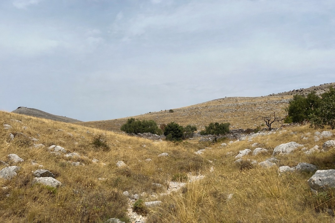
The real reward came the next day: a hike to a nearby summit of around 211 m, with a view so grand and severe that it almost made the restless night feel like good planning.
Impressions (bay)
Impressions (hike)
Zmajan
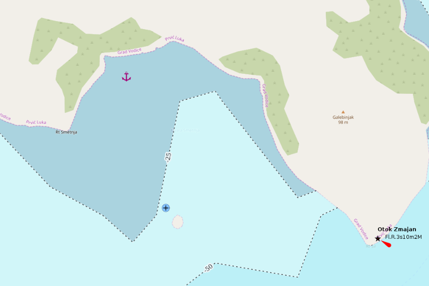
Zmajan is one of those anchorages that make immediate sense for a daytime stop: wide enough to feel open, clear enough to invite the water, and simple enough to reward a short pause without demanding much ceremony.
We stopped here for a swim break, and for that purpose the bay was excellent. The anchor set immediately in about 6 meters, and the water was exactly what one hopes for in midsummer: clear, cool, and deeply refreshing.
The seabed appears to be mostly sand with scattered rocky patches, but the more decisive feature is the underwater profile: depth increases rather quickly beyond the usable zone, and good anchoring depths are mainly found in the more open western part of the bay. That is convenient for a short stop, but less reassuring for a quiet night.
In terms of shelter, the bay works best against northerly to westerly winds. Yet precisely there, the anchoring geometry is not ideal enough to inspire deep overnight confidence. With very calm and stable weather, perhaps — possibly even with a stern line ashore — but once stronger winds or shifting directions enter the forecast, this place quickly loses its innocence.
- Shelter: mainly from north to west; limited confidence for changing conditions
- Bottom: sand with isolated rock; good holding in the right spot
- Depth impression: usable shallow zone, then rapidly dropping beyond 10 m
- Nice to know: excellent swim stop; clear and inviting water
- Watch out for: narrow band of practical anchoring depth; not ideal for unstable or shifting weather
In short: a very fine place to stop, dive in, reset the mind, and move on. For an overnight stay, however, I would trust it only under genuinely quiet skies.
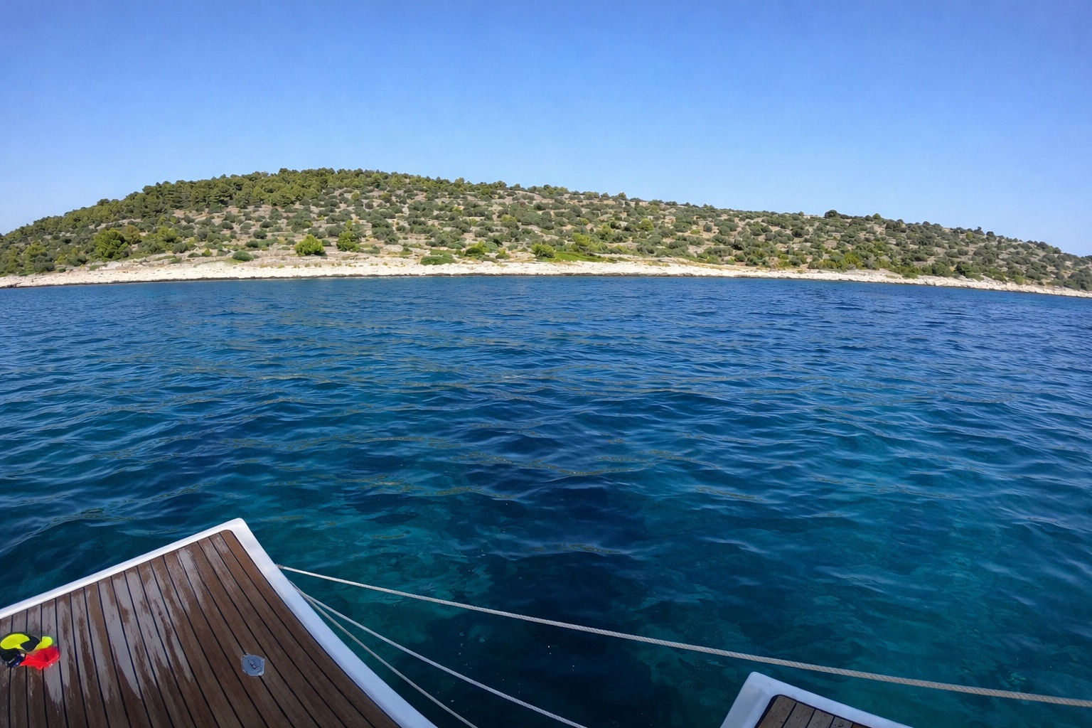
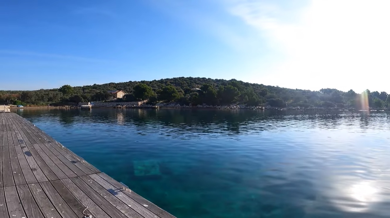
Zminjak (Murter)
Zminjak is less a single anchorage than a small system: two very different places, facing each other across a narrow stretch of water — each with its own logic, its own comfort, and its own limits.
North side — structured calm
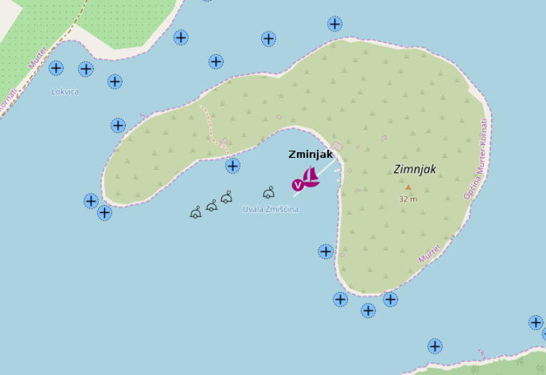
The northern side is, in essence, a managed anchorage. A konoba operates a buoy field here, which defines both the layout and the character of the place.
When we visited in October 2024, no buoys were laid, and anchoring was straightforward. The holding was excellent — whether on clean sand or, perhaps, unintentionally secured to one of the underlying mooring blocks.
Shelter is convincing: north-west through north to north-east are well covered, and depending on your exact position, even some westerly or easterly components lose their edge.
- Shelter: very good from NW–N–NE; partial cover from W and E depending on position
- Bottom: sand / mooring blocks; excellent holding
- Nice to know: konoba with buoy field in season; quiet off-season anchoring
- Highlight: short hike with an outstanding view over the bay
Impressions
Impressions (hike)
South side — improvised refuge
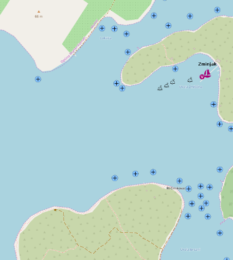
The southern side is a different creature altogether — less a bay than a wide, shallow roadstead, exposed and pragmatic in equal measure.
We ended up here as a temporary refuge from a strengthening Jugo. The area is very shallow over a broad stretch, which makes anchoring easy in principle — and indeed, the anchor set immediately in good holding sand.
In practice, however, the maneuver was less elegant: strong headwinds pushed the bow off repeatedly during deployment, turning a simple drop into a slightly untidy affair. Once set, though, the anchor held without complaint.
Protection is strictly conditional: only winds from south to south-east are reasonably blocked. From any other direction, this place is open and quickly uncomfortable.
- Shelter: limited; usable only in S–SE (Jugo) conditions
- Bottom: sand; reliable holding
- Depth impression: very shallow over a wide area
- Nice to know: easy anchoring in calm moments; good for a quick pause
- Watch out for: exposure; windage during anchoring; unsuitable for overnight stays
This is a place of necessity, not indulgence — perfectly serviceable when conditions demand it, but rarely a destination in its own right.
Impressions